Bundesautobahn 48
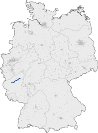
Bundesautobahn 48 (translates from German as Federal Motorway 48, short form Autobahn 48, abbreviated as BAB 48 or A 48) is an autobahn in western Germany. From the junction with the A 1 it connects to the A 3 and A 61 near Koblenz and is fully part of European route E 44.
| ||||
|---|---|---|---|---|
| Bundesautobahn 48 | ||||
 | ||||
| Route information | ||||
| Length | 79 km (49 mi) | |||
| Major junctions | ||||
| West end | ||||
| East end | ||||
| Location | ||||
| States | Rhineland-Palatinate | |||
| Highway system | ||||
| ||||
Exit list
| (1) | Vulkaneifel 3-way interchange | |
| Steininger Höhe/Bierscheid parking area | ||
| (2) | Ulmen | |
| Uersfeld parking area | ||
| Höchstberg parking area | ||
| (3) | Laubach | |
| Martental/Good viewpoint parking area | ||
| (4) | Kaisersesch | |
| Belzweide/Herberkaul parking area | ||
| (5) | Kaifenheim | |
| Elz Viaduct 380 m | ||
| Services Elztal | ||
| (6) | Mayen | |
| Rotendall parking area | ||
| (7) | Polch | |
| Mammutgrube parking area | ||
| Schnackenborn/Münsterer Höhe parking area | ||
| (8) | Ochtendung | |
| Goloring/Karmelenberg parking area | ||
| (9) | Koblenz 4-way interchange | |
| Schießer Weg/Erdkaul parking area | ||
| (10) | Koblenz-Nord | |
| Bendorf Bridge 1029 m | ||
| (11) | Bendorf/Neuwied | |
| Auf der Zeg parking area | ||
| Nonnenberg parking area | ||
| Services Grenzau | ||
| (12) | Höhr-Grenzhausen | |
| Brexbach Viaduct 260 m | ||
| Seelbachwiese/Mühlholz parking area | ||
| Kannebäckerland parking area | ||
| (13) | Dernbach 3-way interchange |
gollark: in docker or something if you must.
gollark: <@!330678593904443393> run the not-virus program.
gollark: ELECT~~R~~ION TIME!
gollark: Even smaller hello world program.
gollark: compressed version.
This article is issued from Wikipedia. The text is licensed under Creative Commons - Attribution - Sharealike. Additional terms may apply for the media files.

