Bruges-Capbis-Mifaget
Bruges-Capbis-Mifaget is a commune in the Pyrénées-Atlantiques department in southwestern France.
Bruges-Capbis-Mifaget | |
|---|---|
.jpg) Town hall | |
Location of Bruges-Capbis-Mifaget 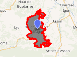
| |
 Bruges-Capbis-Mifaget  Bruges-Capbis-Mifaget | |
| Coordinates: 43°07′42″N 0°18′07″W | |
| Country | France |
| Region | Nouvelle-Aquitaine |
| Department | Pyrénées-Atlantiques |
| Arrondissement | Pau |
| Canton | Ouzom, Gave et Rives du Neez |
| Intercommunality | Vath Vielha |
| Government | |
| • Mayor (2016-2020) | François Lescloupé |
| Area 1 | 16.55 km2 (6.39 sq mi) |
| Population (2017-01-01)[1] | 887 |
| • Density | 54/km2 (140/sq mi) |
| Time zone | UTC+01:00 (CET) |
| • Summer (DST) | UTC+02:00 (CEST) |
| INSEE/Postal code | 64148 /64800 |
| Elevation | 277–473 m (909–1,552 ft) (avg. 316 m or 1,037 ft) |
| 1 French Land Register data, which excludes lakes, ponds, glaciers > 1 km2 (0.386 sq mi or 247 acres) and river estuaries. | |
People from the commune are called "brugeois"'.[2]
Geography
Bruges-Capbis-Mifaget is situated on 16.55 square kilometres (6.39 sq mi) of rolling hills in the far foothills of the Pyrenees.
Location
The commune is located on the east side of the department, 25 kilometres (16 mi) southeast of Pau.
Road Access
Bruges-Capbis-Mifaget is accessible by departmental routes 35, 232, 287, and 335.
Bordering communes
- Haut-de-Bosdarros to the north
- Arros-de-Nay to the northeast
- Lys to the northwest
- Asson to the south and east
- Arthez-d'Asson to the southeast
- Louvie-Juzon to the southwest
gollark: I don't mean just that stuff like global climate change mitigation hasn't happened, I mean that every product ever involves incredibly complex supply chains and can't really not have that.
gollark: The unfortunate situation of our time is that we need giant large-scale coordination to do anything, but all large-scale coordination inevitably fails in some way or another.
gollark: I'm also not a fan of the socialism side, but I dislike world governments separately.
gollark: As previously happened with America.
gollark: This is probably an unstable situation and people will demand the world government does more things.
References
- Source
- Notes
- "Populations légales 2017". INSEE. Retrieved 6 January 2020.
- Gentilé sur habitants.fr
| Wikimedia Commons has media related to Bruges-Capbis-Mifaget. |
| Authority control |
|
|---|
This article is issued from Wikipedia. The text is licensed under Creative Commons - Attribution - Sharealike. Additional terms may apply for the media files.