Aibonito, Puerto Rico
Aibonito (Spanish pronunciation: [ajβoˈnito]) is a small mountain municipality in Puerto Rico located in the Mountain range of Cayey, north of Salinas; south of Barranquitas and Comerio; east of Coamo; and west of Cidra, and Cayey. Aibonito is spread over 8 wards and Aibonito Pueblo (the downtown area and the administrative center of the city). It is part of the San Juan-Caguas-Guaynabo Metropolitan Statistical Area.
Aibonito | |
|---|---|
Town and Municipality | |
.jpg) | |
 Flag | |
| Nicknames: "La Ciudad de las Flores", "La Ciudad Fría", "El Jardín de Puerto Rico", "La Nevera De Puerto Rico" | |
| Anthem: "Aibonito" | |
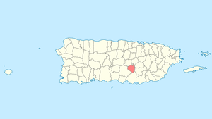
 Map of Puerto Rico highlighting Aibonito Municipality | |
| Coordinates: 18°08′24″N 66°15′58″W | |
| Commonwealth | |
| Founded | March 13, 1824 |
| Wards | |
| Government | |
| • Mayor | William Alicea Pérez (PNP) |
| • Senatorial dist. | 6 – Guayama |
| • Representative dist. | 27 |
| Area | |
| • Total | 82 km2 (31.5 sq mi) |
| • Land | 82 km2 (31.5 sq mi) |
| • Water | 0.01 km2 (0.0 sq mi) |
| Elevation | 731 m (2,401 ft) |
| Population (2010) | |
| • Total | 26,493 |
| Demonym(s) | Aiboniteños |
| Time zone | UTC−4 (AST) |
| ZIP Codes | 00705, 00786 |
| Area code(s) | 787/939 |
| Major routes | |
| Website | www |
Aibonito is located at a relatively high elevation (its main plaza is the highest in the island at 2,401 ft [731 m] above sea level), which makes its climate cooler than most of Puerto Rico's towns. It holds the record for the lowest temperature ever recorded in Puerto Rico; because of this, the municipality's nicknames include "The Cold City" and "The Fridge of Puerto Rico."
History
Before the Spanish colonization of the Americas, it is believed that there were Taíno settlements in the region that belonged to Cacique Orocobix domain.
After the Spanish arrived, it is believed that a ranch was established in the region by Pedro Zorascoechea in 1630, which led the development of a hamlet. However, it wasn't until 1822 when Don Manuel Veléz presented himself before the government, representing the inhabitants of the area, to ask for Aibonito to be officially declared a town. This was authorized on March 13, 1824, by Governor Don Miguel de la Torre. The first Catholic church in Aibonito was built in 1825. The building was replaced by the current church, which was started in 1887 and completed in 1897. After the town was officially constituted, wards started developing in the area.
On the Spanish–American War of 1898, around 800 Spanish and Puerto Rican soldiers were able to defeat the invading American troops due to their strategic placement in the Asomante mountain. This scrimmage came to an end when the Spanish government surrendered on August 12, 1898. The Spanish and Puerto Rican forces at Asomante never surrendered and would have held their position indefinitely if not for the buckling of the Spanish government in Madrid.
Hurricane Maria
Hurricane Maria on September 20, 2017 triggered numerous landslides in Aibonito with the significant amount of rainfall.[1][2][3]
Name
There are several stories regarding the name of the town. Some people say that it is derived from the Taíno word "Jatibonicu", which was the name of a Cacique (leader) of the area. This name was also used to refer to a river in the area and was also the name used by the tribe of Orocobix, Taíno chief of the area. Finally, there's a legend that tells of a Spanish soldier called Diego Alvarez who on May 17, 1615, reached one of the highest peaks in the area and upon watching the view, exclaimed "Ay, que bonito!" ("Oh, how pretty!") which eventually was turned into the name of the region.
Geography
Aibonito is located in the Cayey mountain range ("Sierra de Cayey"), part of the Cordillera Central in Puerto Rico. Aibonito is the town with the highest elevation in Puerto Rico, located at 2,401 feet above sea level. Some of its mountains are La Sierra (2,394 ft), Asomante (2,042 ft) and Buena Vista (2,042 ft).[4]
Barrios

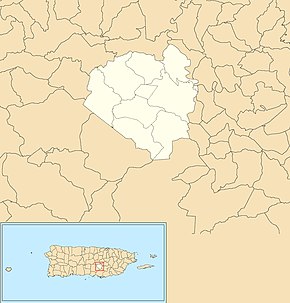
Like all municipalities of Puerto Rico, Aibonito is subdivided into barrios. The municipal buildings, central square and large Catholic church are located in a small barrio referred to as "el pueblo", near the center of the municipality.[5][6][7][8]
Sectors
Barrios (which are like minor civil divisions)[9] in turn are further subdivided into smaller local populated place areas/units called sectores (sectors in English). The types of sectores may vary, from normally sector to urbanización to reparto to barriada to residencial, among others.[10][11][12]
Special Communities
Of the 742 places on the list of Comunidades Especiales de Puerto Rico, the following barrios, communities, sectors, or neighborhoods are in Aibonito: the Municipal neighborhood, Algarrobo barrio, Amoldadero and Los Muros in La Plata barrio, El Campito, El Coquí, El Fresal, La Españolita, La Represa, Las Bambúas, Los Cuadritos, Parcelas Nuevas in Pasto barrio, Parcelas Rabanal, Parcelas Viejas in Pasto, San Luis, Sector El Nueve, and Sector Gallera.[13]
Water features
Some of the rivers that flow through Aibonito are the Río de Aibonito, Río Cuyón, Río de la Plata and Río Usabón.
Climate
Aibonito holds the record for the lowest temperature in Puerto Rico. That is 38 °F (3 °C) on March 9, 1911.[14] The highest temperature record is 98 °F (37 °C) recorded on September 29, 1920.[14] Aibonito is among Puerto Rico's coolest towns.
| Month | Jan | Feb | Mar | Apr | May | Jun | Jul | Aug | Sep | Oct | Nov | Dec | Year |
|---|---|---|---|---|---|---|---|---|---|---|---|---|---|
| Record high °F (°C) | 84 (29) |
88 (31) |
92 (33) |
92 (33) |
90 (32) |
93 (34) |
95 (35) |
94 (34) |
98 (37) |
92 (33) |
90 (32) |
89 (32) |
98 (37) |
| Average high °F (°C) | 74.3 (23.5) |
74.9 (23.8) |
76.3 (24.6) |
78.0 (25.6) |
79.4 (26.3) |
80.5 (26.9) |
80.7 (27.1) |
81.0 (27.2) |
81.0 (27.2) |
80.0 (26.7) |
77.4 (25.2) |
74.8 (23.8) |
78.2 (25.7) |
| Daily mean °F (°C) | 67.9 (19.9) |
68.0 (20.0) |
68.9 (20.5) |
70.5 (21.4) |
72.1 (22.3) |
73.4 (23.0) |
73.7 (23.2) |
74.0 (23.3) |
73.8 (23.2) |
73.1 (22.8) |
71.1 (21.7) |
68.9 (20.5) |
71.3 (21.8) |
| Average low °F (°C) | 61.5 (16.4) |
61.0 (16.1) |
61.2 (16.2) |
62.9 (17.2) |
64.8 (18.2) |
66.4 (19.1) |
66.7 (19.3) |
67.0 (19.4) |
66.7 (19.3) |
66.2 (19.0) |
64.4 (18.0) |
62.8 (17.1) |
64.3 (17.9) |
| Record low °F (°C) | 43 (6) |
40 (4) |
38 (3) |
49 (9) |
52 (11) |
55 (13) |
57 (14) |
60 (16) |
58 (14) |
56 (13) |
43 (6) |
45 (7) |
38 (3) |
| Average rainfall inches (mm) | 3.05 (77) |
2.68 (68) |
2.39 (61) |
4.32 (110) |
4.46 (113) |
3.22 (82) |
3.46 (88) |
5.03 (128) |
7.74 (197) |
7.12 (181) |
5.87 (149) |
4.20 (107) |
53.52 (1,359) |
| Average rainy days (≥ 0.10) | 9 | 7 | 6 | 8 | 8 | 7 | 8 | 15 | 24 | 18 | 19 | 16 | 145 |
| Source: Southeast Regional Climate Center [15] | |||||||||||||
Demographics
The United States took control of Puerto Rico from Spain in the aftermath of the Spanish-American War under the terms of the Treaty of Paris of 1898 and conducted its first census of Puerto Rico, finding that the population of Aibonito was 8,596.
| Historical population | |||
|---|---|---|---|
| Census | Pop. | %± | |
| 1900 | 8,596 | — | |
| 1910 | 10,815 | 25.8% | |
| 1920 | 13,264 | 22.6% | |
| 1930 | 16,361 | 23.3% | |
| 1940 | 16,819 | 2.8% | |
| 1950 | 18,191 | 8.2% | |
| 1960 | 18,360 | 0.9% | |
| 1970 | 20,044 | 9.2% | |
| 1980 | 22,167 | 10.6% | |
| 1990 | 24,971 | 12.6% | |
| 2000 | 26,493 | 6.1% | |
| 2010 | 25,900 | −2.2% | |
| U.S. Decennial Census[16] 1899 (shown as 1900)[17] 1910-1930[18] 1930-1950[19] 1960-2000[20] 2010[7] | |||
Tourism

Landmarks and places of interest
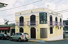
Two of the older landmarks of Aibonito are the Old Encanto Theater, and Moscoso Pharmacy. Their building facades reflect early 20th century architecture. The Mirador Overlook allows for panoramic views of the Plata Valley. The Degetau Stone (in Spanish: La Piedra de Degetau) was where Federico Degetau, a writer, found his inspiration. Casa Museo Federico Degetau is the restored, house museum of the writer. The San José Catholic Church which was designed by architect Pedro Cobreros between 1887 and 1897, was built in 1898 is located in the central plaza. There is a plaque commemoration the 100th anniversary of the Spanish-American War at Asomante Memorial, a place with a view of the Central Mountain Range. The Asomante Trench in Spanish: La Trinchera de Asomante is where part of the Spanish-American war took place. The Central Plaza is named after Segundo Ruíz Belvis, a national abolitionist hero. The San Cristóbal Canyon, a nine-kilometers-long canyon with waterfalls, is the only canyon in Puerto Rico is located between Aibonito and Barranquitas. In Robles barrio there is an iron bridge with PR-176 and was built in 1892. The annual Festival of Flowers is celebrated each June in Aibonito.[4]
Culture
Sports
Aibonito had a BSN basketball franchise called the Polluelos de Aibonito.[21] In 1986 they beat the defending champions, Atléticos de San Germán, in seven games to win their only championship. In 1987, the Polluelos reached the finals once again, but that time, they lost in seven games to the Titanes de Morovis. Recently, the Polluelos have not been able to see action on the BSN's tournaments because of economic and team ownership problems. Also Aibonito had a Double AA baseball. The franchise is also Polluelos de Aibonito. In 1966 they won the only baseball championship.
Festivals and events
Aibonito celebrates its patron saint festival in late July or early August. The Fiestas Patronales de Santiago Apostol is a religious and cultural celebration that generally features parades, games, artisans, amusement rides, regional food, and live entertainment.[4]
Aibonito celebrates a Flower Festival between late June and early July.[4] During this event, many visitors from other towns and countries come to Aibonito to see a huge display of various flowers and others. Aibonito also celebrates a Festival de la Montaña in November.
Economy
Agriculture
Aibonito has several plantations of tobacco and coffee. They are also known for their flower plantations. Also, a popular chicken producer in the island, To-Ricos, operates from Aibonito.[4]
Business
Baxter International has one of its factories located in Aibonito. They produce medical tools for the hospitals and other medical uses.
Current projects
In 2014, William Alicea Pérez, the mayor of Aibonito stressed that many improvements had been made to the town and municipality of Aibonito and to its urban center. Several infrastructure projects were completed in 2014, including the inauguration of an assisted living center, and a stadium and he announced future plans for a gym, progress on another stadium and other projects that were under way for the benefit of Aibonito. Pérez indicated that its urban center had been transformed and would continue to be improved upon. The construction of a gym for boxing and martial arts is underway with the help of Miguel Cotto, a Puerto Rican boxing champion.[22]
Government
All municipalities in Puerto Rico are administered by a mayor, elected every four years. On November 4, 2008, William Alicea Pérez (of the New Progressive Party), won the elections, beating former mayor Jose Alberto Diaz (PPD) by 3,658 votes.
The city belongs to the Puerto Rico Senatorial district VI, which is represented by two Senators. In 2012, Miguel Pereira Castillo and Angel M. Rodríguez were elected as District Senators.[23]
Transportation
There are 15 bridges in Aibonito.[24]
Symbols
Flag
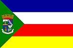
The flag of Aibonito features four equal horizontal bands of blue, white, red, and yellow; a green isosceles triangle based on the hoist side bears the town's coat of arms.
Coat of arms
The coat of arms features a four-paneled shield. The upper left corner features the Asomante mountain with a sword in front, representing the last battles of the Spanish–American War that took place there. The upper right corner features a white band on a blue field, symbolizing the fog that covers the region in winter. To each side of the band, a purple color flower and a golden lily. The lower left corner features the gold tower of Casa Manresa, to symbolize the spiritual value of the institution. In the lower right corner a divided green mountain which represents the Cañon San Cristóbal with a seashell above it that symbolizes Apostle James.
Notable people
- Obie Bermudez, artist
- Rubén Berrios Martínez, politician[25]
- Rafael Pont Flores, journalist[25]
- Eliu Rivera, New Jersey politician
- Ramón Vázquez, baseball player and coach
- Orlando Rosa, 1996 Olympian Freestyle Wrestling
References
- "Preliminary Locations of Landslide Impacts from Hurricane Maria, Puerto Rico". USGS Landslide Hazards Program. USGS. Archived from the original on 3 March 2019. Retrieved 3 March 2019.
- "Preliminary Locations of Landslide Impacts from Hurricane Maria, Puerto Rico" (PDF). USGS Landslide Hazards Program. USGS. Archived (PDF) from the original on 3 March 2019. Retrieved 3 March 2019.
- "With Bottles And Buckets, Puerto Ricans Seek The Water To Survive". NPR.org.
- "Aibonito Municipality". enciclopediapr.org. Fundación Puertorriqueña de las Humanidades (FPH). Archived from the original on 14 February 2019. Retrieved 14 February 2019.
- Picó, Rafael; Buitrago de Santiago, Zayda; Berrios, Hector H. Nueva geografía de Puerto Rico: física, económica, y social, por Rafael Picó. Con la colaboración de Zayda Buitrago de Santiago y Héctor H. Berrios. San Juan Editorial Universitaria, Universidad de Puerto Rico,1969. Archived from the original on 26 December 2018. Retrieved 30 December 2018.
- Gwillim Law (20 May 2015). Administrative Subdivisions of Countries: A Comprehensive World Reference, 1900 through 1998. McFarland. p. 300. ISBN 978-1-4766-0447-3. Retrieved 25 December 2018.
- Puerto Rico 2010 - population and housing unit counts (PDF). U.S. Dept. of Commerce, Economics and Statistics Administration, U.S. Census Bureau. 2010. Archived (PDF) from the original on 20 February 2017. Retrieved 30 December 2018.
- "Map of Aibonito at the Wayback Machine" (PDF). Archived from the original (PDF) on 24 March 2018. Retrieved 29 December 2018.
- "US Census Barrio-Pueblo definition". factfinder.com. US Census. Archived from the original on 13 May 2017. Retrieved 5 January 2019.
- "Agencia: Oficina del Coordinador General para el Financiamiento Socioeconómico y la Autogestión (Proposed 2016 Budget)". Puerto Rico Budgets (in Spanish). Retrieved 28 June 2019.
- Rivera Quintero, Marcia (2014), El vuelo de la esperanza: Proyecto de las Comunidades Especiales Puerto Rico, 1997-2004 (first ed.), San Juan, Puerto Rico Fundación Sila M. Calderón, ISBN 978-0-9820806-1-0
- "Leyes del 2001". Lex Juris Puerto Rico (in Spanish). Retrieved 24 June 2020.
- Rivera Quintero, Marcia (2014), El vuelo de la esperanza:Proyecto de las Comunidades Especiales Puerto Rico, 1997-2004 (Primera edición ed.), San Juan, Puerto Rico Fundación Sila M. Calderón, p. 273, ISBN 978-0-9820806-1-0
- National Oceanic and Atmospheric Administration Archived August 9, 2013, at the Wayback Machine
- "AIBONITO, PUERTO RICO". The University of North Carolina (Chapel Hill campus). March 2012. Archived from the original on August 8, 2013. Retrieved October 26, 2011.
- "U.S. Decennial Census". United States Census Bureau. Archived from the original on 13 February 2020. Retrieved 21 September 2017.
- "Report of the Census of Porto Rico 1899". War Department, Office Director Census of Porto Rico. Archived from the original on 16 July 2017. Retrieved 21 September 2017.
- "Table 3-Population of Municipalities: 1930, 1920, and 1910" (PDF). United States Census Bureau. Archived (PDF) from the original on 17 August 2017. Retrieved 21 September 2017.
- "Table 4-Area and Population of Municipalities, Urban and Rural: 1930 to 1950" (PDF). United States Census Bureau. Archived (PDF) from the original on 30 August 2015. Retrieved 21 September 2014.
- "Table 2 Population and Housing Units: 1960 to 2000" (PDF). United States Census Bureau. Archived (PDF) from the original on 24 July 2017. Retrieved 21 September 2017.
- "El Béisbol Recuerda A Héctor Ferrer". Isla News PR (in Spanish). 6 November 2018. Archived from the original on 2 February 2019. Retrieved 1 February 2019.
- "Rinde cuentas el Alcalde de Aibonito". La Cordillera. Retrieved 24 June 2019.
- Elecciones Generales 2012: Escrutinio General Archived January 15, 2013, at the Wayback Machine on CEEPUR
- "Aibonito Bridges". National Bridge Inventory Data. US Dept. of Transportation. Archived from the original on 20 February 2019. Retrieved 19 February 2019.
- "Aibonito". Archived from the original on 17 July 2010. Retrieved 9 July 2010.
External links
- "Aibonito from the heights behind the city, Porto Rico". The Library of Congress. Retrieved 9 November 2019.