Agur, Israel
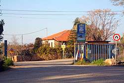
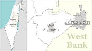
Agur (Hebrew: עָגוּר, lit. Crane), pronounced ʻA[g]oor, is a moshav in central Israel. Located near Beit Shemesh, it falls under the jurisdiction of Mateh Yehuda Regional Council. In 2018 it had a population of 525.[1]
Agur עגור | |
|---|---|
 | |
 Agur | |
| Coordinates: 31°41′54.83″N 34°54′38.71″E | |
| Country | Israel |
| District | Jerusalem |
| Council | Mateh Yehuda |
| Affiliation | Moshavim Movement |
| Founded | 1950 |
| Founded by | Kurdish Jews |
| Population (2018)[1] | 525 |
| Name meaning | Crane |
History
The village was established in 1950 by immigrants from Yemen on land that had belonged to the Palestinian village of Ajjur, which was occupied and depopulated in October 1948 by the Fourth Battalion of the Giv'ati Brigade as part of Operation Yoav.[2][3] In 1953 the founders left to establish another moshav, Nahala; Agur was repopulated by immigrants from the Kurdish areas of Turkey.[2]
Economy
Today Agur operates its own winery, producing wine from four blends – blanca, rose, kessem, and special reserve. Grapes from each vineyard in the Judean Mountains are fermented separately before being blended.[4] The owner and founder of the winery is Shuki Yashuv.[5]
See also
References
- "Population in the Localities 2018" (XLS). Israel Central Bureau of Statistics. 25 August 2019. Retrieved 26 August 2019.
- Agur Homee
- Khalidi, W. (1992). All That Remains: The Palestinian Villages Occupied and Depopulated by Israel in 1948. Washington D.C.: Institute for Palestine Studies. p. 207. ISBN 0-88728-224-5.
- L'Chaim - To Life
- The Judean Hills' secret Jewel, The Jerusalem Post