Ramat Raziel
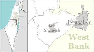
Ramat Raziel (Hebrew: רָמַת רָזִיאֵל, lit. Raziel Heights) is a moshav in central Israel. Located in the centre of the Jerusalem corridor, it falls under the jurisdiction of Mateh Yehuda Regional Council. In 2019 it had a population of 660.[1]
Ramat Raziel | |
|---|---|
 | |
 Ramat Raziel | |
| Coordinates: 31°46′25.68″N 35°4′22.43″E | |
| Country | Israel |
| District | Jerusalem |
| Council | Mateh Yehuda |
| Affiliation | Mishkei Herut Beitar |
| Founded | 1948 |
| Population (2019)[1] | 660 |
History
The village was established in 1948, and was named after David Raziel, a commander of the Irgun.
It is located on land belonging to the depopulated Palestinian village of Kasla, Jerusalem.[2]
gollark: 🇦🇨 🇦🇨🇦🇨 🇦🇨🇦🇨 🇦🇨🇦🇨 🇦🇨🇦🇨 🇦🇨🇦🇨 🇦🇨🇦🇨 🇦🇨🇦🇨 🇦🇨🇦🇨 🇦🇨🇦🇨 🇦🇨🇦🇨 🇦🇨🇦🇨 🇦🇨🇦🇨 🇦🇨🇦🇨 🇦🇨🇦🇨 🇦🇨🇦🇨 🇦🇨🇦🇨 🇦🇨🇦🇨 🇦🇨🇦🇨 🇦🇨🇦🇨 🇦🇨🇦🇨 🇦🇨🇦🇨 🇦🇨🇦🇨 🇦🇨🇦🇨 🇦🇨🇦🇨 🇦🇨🇦🇨 🇦🇨🇦🇨 🇦🇨🇦🇨 🇦🇨🇦🇨 🇦🇨🇦🇨 🇦🇨🇦🇨 🇦🇨🇦🇨 🇦🇨🇦🇨 🇦🇨🇦🇨 🇦🇨🇦🇨 🇦🇨🇦🇨 🇦🇨🇦🇨 🇦🇨🇦🇨 🇦🇨🇦🇨 🇦🇨🇦🇨 🇦🇨🇦🇨 🇦🇨🇦🇨 🇦🇨🇦🇨 🇦🇨🇦🇨 🇦🇨🇦🇨 🇦🇨🇦🇨 🇦🇨🇦🇨 🇦🇨🇦🇨 🇦🇨🇦🇨 🇦🇨🇦🇨 🇦🇨🇦🇨 🇦🇨🇦🇨 🇦🇨🇦🇨 🇦🇨🇦🇨 🇦🇨🇦🇨 🇦🇨🇦🇨 🇦🇨🇦🇨 🇦🇨🇦🇨 🇦🇨🇦🇨 🇦🇨🇦🇨 🇦🇨🇦🇨 🇦🇨🇦🇨 🇦🇨🇦🇨 🇦🇨🇦🇨 🇦🇨🇦🇨 🇦🇨🇦🇨 🇦🇨🇦🇨 🇦🇨🇦🇨 🇦🇨🇦🇨 🇦🇨🇦🇨 🇦🇨🇦🇨 🇦🇨🇦🇨 🇦🇨
gollark: He left ingame too.
gollark: Also, it must know exactly what the user wants to do, and do it, even if they don't ask it to.
gollark: Also, anyone or anything in all possible universes must be able to use it.
gollark: It must be compatible with 76+9D universes.
References
- "Population in the Localities 2019" (XLS). Israel Central Bureau of Statistics. Retrieved 16 August 2020.
- Khalidi, Walid (1992). All That Remains: The Palestinian Villages Occupied and Depopulated by Israel in 1948. Washington D.C.: Institute for Palestine Studies. p. 299. ISBN 0-88728-224-5.
This article is issued from Wikipedia. The text is licensed under Creative Commons - Attribution - Sharealike. Additional terms may apply for the media files.