68th parallel north

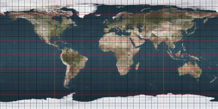
The 68th parallel north is a circle of latitude that is 68 degrees north of the Earth's equatorial plane, in the Arctic. It crosses the Atlantic Ocean, Europe, Asia and North America.

68°
68th parallel north

At this latitude the sun is visible for 24 hours, 0 minutes during the summer solstice and Civil Twilight during the winter solstice.

Around the world

Starting at the Prime Meridian and heading eastwards, the parallel 68° north passes through:

Co-ordinates Country, territory or ocean Notes
68°0′N 0°0′E Atlantic Ocean Norwegian Sea
68°0′N 13°0′E  Norway Moskenesøya, Lofoten, Nordland
68°0′N 13°17′E Atlantic Ocean Vestfjorden, Norwegian Sea
68°0′N 15°4′E  Norway Engeløya, Nordland
68°0′N 15°7′E Atlantic Ocean Skagstadsundet, Norwegian Sea
68°0′N 15°4′E  Norway Lundøya and Finnøya, and the mainland Nordland
68°0′N 13°17′E Atlantic Ocean Vestfjorden, Norwegian Sea
68°0′N 15°4′E  Norway Engeløya, Lundøya and Finnøya, and the mainland Nordland
68°0′N 13°17′E Atlantic Ocean Vestfjorden, Norwegian Sea
68°0′N 15°6′E  Norway Islands of Engeløya, Lundøya and Finnøya, and the mainland Nordland
68°0′N 17°1′E  Sweden Norrbottens län
68°0′N 17°48′E  Norway Nordland, for about 5,8 km
68°0′N 17°56′E  Sweden Norrbottens län
68°0′N 23°33′E  Finland Lapland
68°0′N 29°25′E  Russia Kola Peninsula, Murmansk Oblast
68°0′N 39°58′E Arctic Ocean White Sea
68°0′N 44°14′E  Russia Kanin Peninsula, Nenets Autonomous Okrug
68°0′N 46°33′E Arctic Ocean Barents Sea
68°0′N 49°43′E  Russia Nenets Autonomous Okrug
Komi Republic
Yamalo-Nenets Autonomous Okrug
68°0′N 73°6′E Arctic Ocean Gulf of Ob, Kara Sea
68°0′N 74°48′E  Russia Yamalo-Nenets Autonomous Okrug
68°0′N 77°12′E Arctic Ocean Taz Estuary, Kara Sea
68°0′N 77°30′E  Russia Yamalo-Nenets Autonomous Okrug
Krasnoyarsk Krai
Yakutia
Chukotka Autonomous Okrug
68°0′N 176°31′W Arctic Ocean Chukchi Sea
68°0′N 165°15′W  United States Alaska
68°0′N 141°0′W  Canada Yukon
Northwest Territories
Nunavut
68°0′N 115°7′W Arctic Ocean Coronation Gulf
Passing just north of the Couper, Berens and Lawford Islands
Passing just north of Hepburn Island
Passing just south of the Jameson Islands
68°0′N 110°9′W  Canada Nunavut
68°0′N 110°0′W Arctic Ocean Bathurst Inlet
68°0′N 109°26′W  Canada Nunavut - Chapman Islands
68°0′N 109°0′W Arctic Ocean Bathurst Inlet
Passing just north of Lewes Island
Fishers Island
68°0′N 107°53′W  Canada Nunavut
68°0′N 103°17′W Arctic Ocean Queen Maud Gulf
68°0′N 98°59′W  Canada Nunavut - O'Reilly Island, Klutschak Peninsula and Adelaide Peninsula
68°0′N 96°6′W Arctic Ocean Chantrey Inlet
68°0′N 95°25′W  Canada Nunavut
68°0′N 88°20′W Arctic Ocean Committee Bay
68°0′N 86°48′W  Canada Nunavut - Wales Island and Melville Peninsula
68°0′N 82°9′W Arctic Ocean Foxe Basin
68°0′N 77°2′W  Canada Nunavut - Prince Charles Island, Air Force Island and Baffin Island
68°0′N 64°46′W Arctic Ocean Davis Strait
68°0′N 50°20′W  Greenland Avannaata
Sermersooq
68°0′N 31°49′W Atlantic Ocean Greenland Sea
Norwegian Sea
gollark: _ponders the necessity of folders other than `~/Programming` and `~/.factorio`_
gollark: Plus the important stuff, like factorio saves.
gollark: I want to copy my `~/Programming` folder off the disk before formatting it, obviously.
gollark: I mean, yes, most things are probably better than on this live CD, given that I'm copying 20GB of files onto an external disk while the OS runs from RAM, but you know.
gollark: ... in what way?

See also

This article is issued from Wikipedia. The text is licensed under Creative Commons - Attribution - Sharealike. Additional terms may apply for the media files.