2017 Pacific hurricane season
The 2017 Pacific hurricane season was significantly less active than the previous three Pacific hurricane seasons, featuring eighteen named storms, nine hurricanes, and four major hurricanes. Despite the considerable amount of activity, most of the storms were weak and short-lived. The season officially started on May 15 in the eastern Pacific, and on June 1 in the central Pacific; they both ended on November 30. These dates conventionally delimit the period of each year when most tropical cyclones form in the basin. However, the formation of tropical cyclones is possible at any time of the year. This was demonstrated when the first storm, Tropical Storm Adrian, was named on May 10, and became the earliest-known tropical storm in the East Pacific since the advent of satellite imagery. The season saw near-average activity in terms of Accumulated Cyclone Energy (ACE), in stark contrast to the extremely active seasons in 2014, 2015, and 2016; and for the first time since 2012, no tropical cyclones formed in the Central Pacific basin. However, for the third year in a row, the season featured above-average activity in July, with the ACE value being the fifth highest for the month. Damage across the basin reached $375.28 million (2017 USD), while 45 people were killed by the various storms.
| 2017 Pacific hurricane season | |
|---|---|
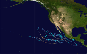 Season summary map | |
| Seasonal boundaries | |
| First system formed | May 9, 2017 |
| Last system dissipated | October 28, 2017 |
| Strongest storm | |
| Name | Fernanda |
| • Maximum winds | 145 mph (230 km/h) (1-minute sustained) |
| • Lowest pressure | 948 mbar (hPa; 27.99 inHg) |
| Seasonal statistics | |
| Total depressions | 20 |
| Total storms | 18 |
| Hurricanes | 9 |
| Major hurricanes (Cat. 3+) | 4 |
| Total fatalities | 45 total |
| Total damage | $375.28 million (2017 USD) |
| Related articles | |
Beginning in 2017, the National Hurricane Center has the option to issue advisories, and thus allow watches and warnings to be issued, on disturbances that are not yet tropical cyclones but have a high chance to become one, and are expected to bring tropical storm or hurricane conditions to landmasses within 48 hours. Such systems are classified as "Potential Tropical Cyclones".[1] This was first demonstrated in the East Pacific basin on August 29, with the designation of Potential Tropical Cyclone Fourteen-E—which later developed into Tropical Storm Lidia—south-southeast of the Baja California Peninsula.
Seasonal forecasts
| Record | Named storms |
Hurricanes | Major hurricanes |
Ref | |
|---|---|---|---|---|---|
| Average (1981–2010): | 15.4 | 7.6 | 3.2 | [2] | |
| Record high activity: | 1992: 27 | 2015: 16 | 2015: 11 | [3] | |
| Record low activity: | 2010: 8 | 2010: 3 | 2003: 0 | [3] | |
| Date | Source | Named storms |
Hurricanes | Major hurricanes |
Ref |
| May 25, 2017 | NOAA | 14–20 | 6–11 | 3–7 | [4] |
| May 29, 2017 | SMN | 16 | 10 | 6 | [5] |
| Area | Named storms | Hurricanes | Major hurricanes | Ref | |
| Actual activity: | EPAC | 18 | 9 | 4 | |
| Actual activity: | CPAC | 0 | 0 | 0 | |
| Actual activity: | 18 | 9 | 4 | ||
On May 25, 2017, the National Oceanic and Atmospheric Administration released its annual forecast, predicting an 80% chance of a near- to above-average season in both the Eastern and Central Pacific basins, with a total of 14–20 named storms, 6–11 hurricanes, and 3–7 major hurricanes.[nb 1][4] During May 28, the Servicio Meteorológico Nacional (SMN) issued its first forecast for the season, predicting a total of 16 named storms, 10 hurricanes, and 6 major hurricanes to develop.[5]
Seasonal summary


The Accumulated Cyclone Energy (ACE) for the 2017 Pacific hurricane season was 100.12 units (99.065 units from the East Pacific and 1.055 units from the Central Pacific).[nb 2]
Although hurricane season in the eastern Pacific does not officially begin until May 15, and on June 1 in the central Pacific,[6] activity began several days prior with the formation of a tropical depression on May 9. This marked the earliest formation of a tropical cyclone in the basin, surpassing 1990's Hurricane Alma.[7] It intensified into Tropical Storm Adrian a few hours later, marking the earliest formation of a named storm on record.[8] Near normal activity occurred in June, with Tropical Storm Calvin formed on June 11, and Hurricane Dora on June 25.[9] For the third year in a row, July featured above average activity, with the fifth highest ACE value for that month on record.[10] This total was due to long-lived hurricanes Eugene, Fernanda, Hilary, and Irwin. August saw significantly less activity, with only three storms forming in the month; however it featured Hurricane Kenneth, the third major hurricane of the season. September featured four storms, including Hurricane Otis, which became the fourth major hurricane of the season. Only two storms formed after October 1, Ramon and Selma. Both did not attain hurricane status, though Selma became the first and last storm to make landfall in El Salvador. No systems were active in November for the first time since the 2010 season.
Systems
Tropical Storm Adrian
| Tropical storm (SSHWS) | |
  | |
| Duration | May 9 – May 10 |
|---|---|
| Peak intensity | 45 mph (75 km/h) (1-min) 1004 mbar (hPa) |
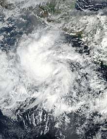
On May 5, the National Hurricane Center (NHC) indicated that an area of low pressure was forecast to form south of Mexico over subsequent days, with the possibility of tropical cyclone development thereafter.[11] A broad cyclonic circulation began to develop as expected late on May 7,[12] gradually organizing into the season's first tropical depression by 21:00 UTC on May 9.[13] Upon formation, at which point it was located about 545 mi (875 km) south-southeast of Salina Cruz, Mexico, the depression became the earliest-forming East Pacific tropical cyclone (east of 140°W) on record at the time, before being overtaken by Tropical Depression One-E in 2020. The previous record was held by 1990's Hurricane Alma, which formed on May 12.[7] The depression intensified into Tropical Storm Adrian six hours later, the earliest-known formation of a named storm in eastern Pacific proper since the advent of the satellite era.[14] Initially, forecasts expected the small storm to intensify into a powerful hurricane. Shortly after reaching peak intensity early on May 10, an unexpected increase in mid-level wind shear caused Adrian to quickly weaken and degenerate to a remnant low by 00:00 UTC on May 11.[15] Adrian's remnant low persisted for another day, before dissipating on May 12.[15]
Additionally, unrelated to Adrian, Tropical Storm Arlene in the North Atlantic basin also formed before the corresponding hurricane season was set to officially begin, being the most intense storm in the month of April in the North Atlantic since Ana in 2003. This makes the second consecutive year after 2016 where the first storms in both basins were pre-season storms.[16]
Tropical Storm Beatriz
| Tropical storm (SSHWS) | |
  | |
| Duration | May 31 – June 2 |
|---|---|
| Peak intensity | 45 mph (75 km/h) (1-min) 1001 mbar (hPa) |
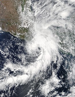
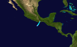
A tropical wave emerged off the western coast of Africa on May 18 and entered the East Pacific about a week later, where steady organization led to the formation of a tropical depression around 12:00 UTC on May 31. Embedded within southwesterly flow around a large upper-level trough across northern Mexico, the depression moved steadily northeast in a favorable environment, and it intensified into Tropical Storm Beatriz by 06:00 UTC on June 1. After attaining peak winds of 45 mph (75 km/h), the system made landfall around 00:00 UTC on June 2 about 25 miles (40 km) west of Puerto Ángel before the mountainous terrain of Mexico quickly made Beatriz dissipate inland twelve hours later.[17]
In the state of Oaxaca, flights out of Bahías de Huatulco International Airport were cancelled and schools were closed until June 3. Dozens of roads were impassable due to mudslides and flooding; numerous locales received over 4 in (102 mm) of rain, with rainfall at a maximum of 19.07 in (484.4 mm) in Huatulco.[17] Numerous landslides caused significant disruption across the state; the storm blocked large areas of Federal Highway 200 in Oaxaca. A landslide in San Marcial Ozolotepec killed two girls and buried several houses, while another in San Carlos Yautepec killed a woman.[18] As of June 4, a total of six people have been killed—five in Oaxaca and two in Tehuantepec.[19] Damage in Oaxaca reached MXN$3.2 billion (US$172 million).[20]
Tropical Storm Calvin
| Tropical storm (SSHWS) | |
  | |
| Duration | June 11 – June 13 |
|---|---|
| Peak intensity | 45 mph (75 km/h) (1-min) 1004 mbar (hPa) |
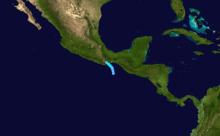
In the second week of June, the NHC forecast the development of a broad area of low pressure a few hundred miles south of Mexico over the next several days.[21] This prediction came to fruition on June 9,[22] and the fledgling disturbance steadily organized into a tropical depression by 12:00 UTC on June 11 while located about 150 mi (240 km) south-southeast of Salina Cruz.[23] It was slow to organize initially due to moderate easterly wind shear as it drifted northwestwards;[24] by 18:00 UTC on June 12, however, the tropical depression intensified into Tropical Storm Calvin.[23] Intensifying slightly to reach winds of 45 mph (75 km/h),[23] Calvin made landfall halfway between Salina Cruz and Puerto Ángel, near Paja Blanca, around 00:00 UTC on June 13.[25] Just 12 hours later, Calvin dissipated into a remnant low.[23] The remnants of the storm caused heavy rainfall and some flooding in the area,[26] however no fatalities were reported.[23] Less than two weeks after Tropical Storm Beatriz, Calvin affected similar areas of Mexico and inflicted additional damage which resulted in at least 70 million pesos (US$3.88 million) in Oaxaca.[27]
Hurricane Dora
| Category 2 hurricane (SSHWS) | |
  | |
| Duration | June 24 – June 28 |
|---|---|
| Peak intensity | 105 mph (165 km/h) (1-min) 974 mbar (hPa) |
A large gyre developed over Central America around June 15. A trough detached from the gyre and drifted across just south of the Gulf of Tehuantepec between June 21 and June 23. By June 23, a tropical wave associated with the remnants of Tropical Storm Bret in the Atlantic began merging with the trough. A surface low formed early on the next day, followed by the development of a tropical depression at 18:00 UTC. Initially located about 230 mi (370 km) south-southeast of Acapulco, the depression moved west-northwestward due to a mid-tropospheric ridge, which stretched from northern Mexico westward into nearby Pacific waters. At 06:00 UTC on June 25, the depression intensified into Tropical Storm Dora. Thereafter, favorable conditions including low wind shear and warm sea surface temperatures allowed Dora to undergo rapid intensification, becoming a hurricane at 06:00 UTC on June 26 and a Category 2 hurricane about six hours later.[28]
With impressive outflow and an eye apparent on satellite imagery,[29] the storm peaked with maximum sustained winds of 105 mph (165 km/h) and a minimum barometric pressure of 974 mbar (28.8 inHg) by 18:00 UTC June 26. Dora remained a Category 2 hurricane for about 12 more hours before beginning to rapidly weaken over cooler sea surface temperatures and in an environment of drier air, falling to Category 1 intensity at 06:00 UTC on June 27 and deteriorating to a tropical storm around 18:00 UTC. The storm later degenerated into a remnant low near Socorro Island early on June 28, after all of the storm's convection had been diminished. The remnant low moved slowly over the eastern Pacific before dissipating early on July 1.[28] The outer bands of Dora brought heavy rains to Guerrero, resulting in flash floods that inundated 20 homes. Overall damage was minor, however.[30]
Hurricane Eugene
| Category 3 hurricane (SSHWS) | |
  | |
| Duration | July 7 – July 12 |
|---|---|
| Peak intensity | 115 mph (185 km/h) (1-min) 966 mbar (hPa) |
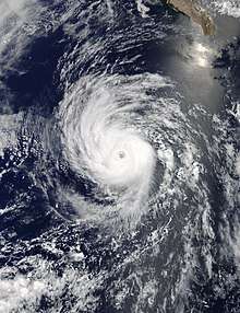
Hurricane Eugene developed from a disturbance located 765 mi (1,230 km) south of the southern tip of the Baja California Peninsula on July 7.[31] On the following day, Eugene underwent a period of rapid intensification; in an 18-hour period starting at 21:00 UTC on July 8, Eugene intensified from a tropical storm with 70 mph (110 km/h) winds to a Category 3 hurricane with 115 mph (185 km/h) winds, making it the first major hurricane of the season.[32][33] However, by 12 hours later, the entrainment of dry air caused Eugene to weaken to a Category 2 hurricane,[34] and due to traveling over cooler waters, Eugene weakened to a tropical storm on the following day.[35] As the coverage of deep convection steadily dwindled, Eugene fell to tropical depression intensity around 15:00 UTC on July 12, and degenerated to a remnant low six hours later.[36][37]
Dangerous rip currents combined with swells of 4 to 8 ft (1.2 to 2.4 m) across southern California resulted in hundreds of rescues. On July 10 alone, lifeguards in Huntington Beach made 200 rescues while 600 were made in Los Angeles County; lifeguards also responded to 700 medical emergencies.[38]
Hurricane Fernanda
| Category 4 hurricane (SSHWS) | |
  | |
| Duration | July 12 – July 22 |
|---|---|
| Peak intensity | 145 mph (230 km/h) (1-min) 948 mbar (hPa) |
Late on July 10, the NHC began monitoring a broad area of low pressure several hundred miles southwest of Manzanillo. Contrary to predictions of gradual development,[39] the disturbance rapidly organized into a tropical depression by 03:00 UTC on July 12,[40] and further strengthened to become Tropical Storm Fernanda around 15:00 UTC that day.[41] The nascent cyclone initially battled moderate northeasterly wind shear, with its low-level circulation displaced to the northeastern edge of the deep convection.[42] This period of unfavorable upper-level winds was short-lived, and soon afterwards Fernanda commenced a period of rapid intensification, intensifying into a hurricane at 21:00 UTC on July 13.[43] A well-defined eye formed within a growing central dense overcast, and Fernanda further intensified into a major hurricane early on July 14.[44] Only six hours later, the system was upgraded to a Category 4 hurricane.[45] At 10.9°N, Fernanda became the second strongest hurricane to occur at such a low latitude in the Eastern Pacific, only behind 2015's Hurricane Olaf.[46]
With expansive upper-level outflow and spiral bands, a distinct eye, and a symmetric central dense overcast, Fernanda attained peak winds of 145 mph (230 km/h) around 03:00 UTC on July 15.[47] A series of microwave passes around that time began to indicate the formation of a secondary eyewall that halted the cyclone's development as it tracked west-northwest to northwest.[48] The eyewall replacement cycle concluded early on July 16, allowing Fernanda to remain a powerful hurricane amid favorable environmental conditions.[49] By late on July 18, however, cooler ocean temperatures and a more stable environment prompted the storm's weakening trend.[50] Fernanda fell below hurricane intensity shortly before entering the Central Pacific as it succumbed to stronger southwesterly wind shear,[51] becoming a tropical depression at 03:00 UTC on July 21,[52] and after failing to produce sustained deep convection, degenerated to a remnant low about 500 miles (805 km) east of Hilo, Hawaii, by 21:00 UTC on July 22.[53]
Tropical Depression Eight-E
| Tropical depression (SSHWS) | |
  | |
| Duration | July 17 – July 20 |
|---|---|
| Peak intensity | 35 mph (55 km/h) (1-min) 1007 mbar (hPa) |
A low-pressure trough began producing disorganized convection over the waters of the Pacific Ocean, well to the south of Baja California Peninsula, on July 14.[54] Despite only marginally conducive environmental conditions, the disturbance began to show signs of organization two days later,[55] and it attained tropical depression status by 06:00 UTC on July 17.[56] Strong west-northwesterly wind shear confined the storm's intermittent bursts of convection well to the southwest of its low-level circulation, and the depression consequently failed to produce winds above 35 mph (55 km/h).[57] The system's center later degenerated into a low-pressure trough within the Intertropical Convergence Zone, prompting the NHC to discontinue advisories at 21:00 UTC on July 20.[58]
Tropical Storm Greg
| Tropical storm (SSHWS) | |
  | |
| Duration | July 17 – July 26 |
|---|---|
| Peak intensity | 60 mph (95 km/h) (1-min) 1000 mbar (hPa) |
On July 12, the NHC forecast the formation of a broad area of low pressure south of Mexico over subsequent days.[59] The disturbance formed two days later and slowly organized into a tropical depression by 15:00 UTC on July 17.[60][61] The tropical cyclone battled strong west-northwesterly wind shear after formation, intensifying into Tropical Storm Greg by 09:00 UTC on July 18, as deep convection burst near the center. However, the storm remained in a steady state for several days thereafter, despite continued predictions of intensification.[62][63] Ultimately, given global models' poor handling of the environment, NHC lowered their intensity forecast for Greg.[64] The cyclone continued west for the remainder of its life and maintained a similar convective structure, with intermittent bursts of deep convection near the center.[65] Approaching the Central Pacific, Greg's low-level circulation became increasingly difficult to locate as it moved into a cooler, drier environment intertwined by increasing southerly wind shear, and the system weakened to a tropical depression around 21:00 UTC on July 25.[66] It degenerated to a remnant low 24 hours later.[67]
Hurricane Hilary
| Category 2 hurricane (SSHWS) | |
  | |
| Duration | July 21 – July 30 |
|---|---|
| Peak intensity | 110 mph (175 km/h) (1-min) 969 mbar (hPa) |
Part of an exceptionally active July, the NHC began highlighting the far eastern reaches of the Pacific basin on July 19 for tropical development in later days.[68] A large area of disturbed weather progressed westward across Costa Rica later that day,[69] steadily organizing into a tropical depression by 15:00 UTC on July 21.[70] The cyclone failed to organize immediately after formation, and its low-level center migrated to the southern extent of associated convection.[71] By 03:00 UTC on July 23, though, better defined banding features and a more organized convective structure led the NHC to designate the system as Tropical Storm Hilary.[72] Over the coming hours, the cyclone's convective structure evolved into a small central dense overcast while hints of an eye became apparent;[73] in accordance with satellite estimates, Hilary was upgraded to a hurricane at 09:00 UTC on July 24.[74] A moist environment and warm ocean waters propelled Hilary to its peak as a Category 2 hurricane with winds of 110 mph (175 km/h) 24 hours later, at which time its core was most symmetric.[75] After maintaining its intensity, the hurricane began to weaken late on July 26 as northerly wind shear increased.[76] It fell back to tropical storm intensity around 03:00 UTC on July 27, and ultimately degenerated to a remnant low four days later.[77][78]
Hurricane Irwin
| Category 1 hurricane (SSHWS) | |
  | |
| Duration | July 22 – August 1 |
|---|---|
| Peak intensity | 90 mph (150 km/h) (1-min) 979 mbar (hPa) |
On July 16, the NHC highlighted the expected formation of an area of low pressure south of Mexico later that week.[79] A tropical wave began producing disorganized cloudiness three days later,[68] and the broad system slowly organized into a tropical depression by 15:00 UTC on July 22.[80] Its structure changed little after formation, impinged by strong wind shear; despite this, satellite wind data indicated the cyclone intensified into Tropical Storm Irwin by 09:00 UTC on July 23.[81] Over the next 24 hours, deep convection began to wrap around the center and a mid-level eye formed as environmental conditions improved;[82] by 09:00 UTC on July 25, Irwin intensified into a hurricane.[83] Although coolest cloudtops were located in the western semicircle of the system, a well-defined eye and convection in the eyewall propelled Irwin to its peak with winds of 90 mph (150 km/h) late on July 25.[84] Almost immediately, outflow from nearby Hurricane Hilary increased wind shear over the system and caused it to begin weakening;[85] Irwin rapidly fell to tropical storm strength around 15:00 UTC on July 26.[86] Contrary to projections of continued weakening, however, the storm's cloud pattern maintained or even improved over subsequent days as it passed over marginal ocean temperatures.[87] Finally, after losing its deep convection and being reduced to a swirl of low-level clouds, Irwin was declared a remnant low around 21:00 UTC on August 1.[88]
Tropical Depression Eleven-E
| Tropical depression (SSHWS) | |
  | |
| Duration | August 4 – August 5 |
|---|---|
| Peak intensity | 35 mph (55 km/h) (1-min) 1006 mbar (hPa) |
On July 28, the NHC noted the possibility of an area of low pressure well south of Mexico developing over subsequent days.[89] An area of disorganized showers and thunderstorms associated with a tropical wave materialized three days later, but little change occurred thereafter.[90] Early on August 3, a surface circulation formed in association with concentrating convection,[91] and this process led to the formation of a tropical depression by 06:00 UTC the next day.[92] The newly formed cyclone did not intensify after designation, and its low- and mid-level circulations separated by over 265 mi (425 km) on August 5 due strong easterly wind shear.[93] Falling short of the tropical storm criteria, the short-lived depression was declared a remnant low at 18:00 UTC that day.[92] The lingering vortex slowed its northwestward motion and executed a counter-clockwise loop, before dissipating completely 205 miles (335 km) southwest of the Baja California Peninsula on August 8.[92]
Tropical Storm Jova
| Tropical storm (SSHWS) | |
  | |
| Duration | August 11 – August 13 |
|---|---|
| Peak intensity | 40 mph (65 km/h) (1-min) 1003 mbar (hPa) |
The NHC began monitoring a strong tropical wave over the eastern Caribbean on August 3.[94] The feature pushed westward, developing into Hurricane Franklin before making landfall on the Yucatán,[95] and attaining its peak as a Category 1 hurricane before making landfall near Vega de Alatorre, Veracruz on August 10.[96] Although its low-level circulation dissipated, the NHC in days prior noted the potential for Franklin's mid-level remnants to reform in the East Pacific.[97] The remnants of Franklin induced a surface low off the coast of southwestern Mexico on August 11, and steady organization led to the formation of Tropical Storm Jova by 03:00 UTC the next day.[98] On a westward course, Jova was plagued by strong wind shear from an area of high pressure over northwestern Mexico, with a very disorganized appearance on satellite.[99] After lacking sufficient organization to be declared a tropical cyclone, the storm was declared a remnant low around 03:00 UTC on August 14.[100]
Hurricane Kenneth
| Category 4 hurricane (SSHWS) | |
  | |
| Duration | August 18 – August 23 |
|---|---|
| Peak intensity | 130 mph (215 km/h) (1-min) 951 mbar (hPa) |
On August 12, the NHC noted the potential for an area of low pressure to form well south of Baja California Peninsula during the following days.[101] A large area of disturbed weather developed two days later as predicted;[102] however, organization was slow to occur, and a tropical depression only formed four days later, around 15:00 UTC on August 18.[103] The newly formed cyclone embarked on a west to west-northwest course, intensifying into Tropical Storm Kenneth early on August 19 and further into a hurricane by 15:00 UTC on August 20.[104] Despite forecasts of only slight additional intensification,[105] Kenneth rapidly intensified, with the eye feature warming dramatically and the surrounding cloud tops cooling. The cyclone attained major hurricane strength around 03:00 UTC on August 21,[106] and six hours later reached its peak as a Category 4 hurricane with sustained winds of 130 mph (215 km/h).[107] Progressively cooler sea surface temperatures and increasing wind shear caused Kenneth to steadily weaken following the intensification trend, with its inner core eroding and low-level circulation becoming displaced.[108] By 21:00 UTC on August 22, the storm weakened below hurricane strength.[109] On the following day, at 21:00 UTC, Kenneth was declared to be post-tropical.
Tropical Storm Lidia
| Tropical storm (SSHWS) | |
  | |
| Duration | August 30 – September 3 |
|---|---|
| Peak intensity | 65 mph (100 km/h) (1-min) 986 mbar (hPa) |
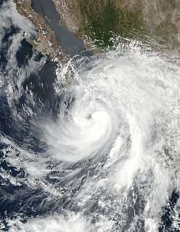
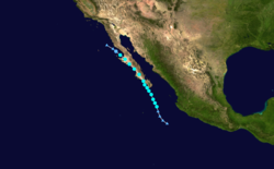
A vigorous tropical wave emerged off the western coast of Africa on August 16; it crossed Central America into the East Pacific on August 25. Part of a large cyclonic gyre, the disturbance failed to organize for several days—despite already producing tropical storm-force winds—amid high wind shear from Hurricane Harvey in the Gulf of Mexico. After Harvey weakened, however, an increase in the system's organization led to the formation of Tropical Storm Lidia around 18:00 UTC on August 30. Flow between a subtropical high and upper-level trough directed Lidia on a north-northwest track, and the cyclone strengthened to a peak of 65 mph (100 km/h) later on August 31. Lidia passed very close to Cabo San Lucas early the next morning, and interaction with the high terrain of Baja California Sur caused the storm to weaken slightly; it made its first landfall near Punta Marquez with winds of 60 mph (95 km/h) around 12:00 UTC, and its second landfall near Punta Abreojos early on September 2 with winds of 45 mph (75 km/h). Lidia continued to weaken as it moved northwest, degenerating to a remnant low around 06:00 UTC on September 3 and dissipating twelve hours later.[110]
Hurricane Otis
| Category 3 hurricane (SSHWS) | |
  | |
| Duration | September 11 – September 19 |
|---|---|
| Peak intensity | 115 mph (185 km/h) (1-min) 965 mbar (hPa) |
On September 8, Atlantic Hurricane Katia made landfall in Mexico, dissipating on September 9. However, its mid-level circulation survived, and eventually spawned an area of low pressure off the coast of Mexico. On September 11, the system organized into Tropical Depression Fifteen-E.[111] During the next several days the depression slowly drifted westward. Situated within a dry environment, it struggled to intensify for nearly a week, and some models even predicted the depression would dissipate without ever reaching tropical storm strength.[112] However, by 15:00 UTC on September 16, the system unexpectedly started to organize with a small area of deep convection developing near its low-level center, which allowed it to finally strengthen into Tropical Storm Otis later on the same day.[113] While only marginal strengthening was forecast, Otis unexpectedly rapidly intensified into a Category 2 hurricane by 15:00 UTC on September 17, despite low ocean temperatures, dry air, and increased wind shear.[114] Otis continued to intensify into a Category 3 major hurricane by 03:00 UTC on September 18, developing a well-defined eye with a diameter of 12 mi (19 km).[115] Then by 21:00 UTC on the same day, Otis had rapidly degenerated back into a tropical storm with maximum sustained winds of 45 mph (70 km/h).[116] Twelve hours after developing a well-defined eye, Otis started weakening at a remarkable rate,[117] losing most of its deep convection due to low ocean surface temperatures, until it weakened into a remnant low on September 19.[118]
Hurricane Max
| Category 1 hurricane (SSHWS) | |
  | |
| Duration | September 13 – September 15 |
|---|---|
| Peak intensity | 90 mph (150 km/h) (1-min) 980 mbar (hPa) |
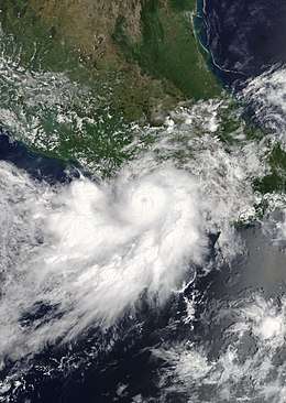
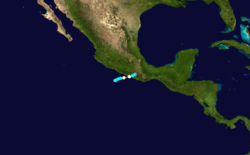
On September 9, the NHC mentioned the possibility for an area of low pressure to form south of Mexico over later days.[119] A trough of low pressure materialized the next day,[120] steadily organizing into a tropical depression near the southwestern coast of Mexico around 15:00 UTC on September 13. Despite forecasts of little or no intensification,[121] the newly formed cyclone intensified into Tropical Storm Max six hours later.[122] Quick intensification ensued as the storm improved in structure and developed a well-defined eye, prompting the NHC to upgrade Max to a hurricane around 12:00 UTC on September 14.[123] Max attained peak winds of 90 mph (150 km/h),[124] while making landfall on the coastline of Guerrero. The mountainous terrain of inland Mexico severely disrupted Max's circulation, causing it to degenerate by 09:00 UTC on September 15.[125]
In preparation for Max, about 788 people evacuated to temporary shelters.[126] Throughout Guerrero, over 1,500 homes were inundated by floodwaters or damaged by strong winds that ripped off roofs. Over 100 trees were downed, mudslides and sinkholes closed several roads (including Mexican Federal Highway 200), and telephone service was cut. At the height of the storm, 126,503 Comisión Federal de Electricidad customers lost electricity. A bridge between Cruz Grande and Copala was severely damaged, and access to Juchitán de Zaragoza was severed due to a flooded highway. One of 17 rapidly-rising rivers swept away a residence and two neighbors who attempted to rescue the homeowner; one of the neighbors died, constituting one of two deaths attributed to the storm. At least 3,000 residents across five municipalities in Guerrero were stranded.[126][127] Waves of 10–16 ft (3–5 m) battered the coastline, where six ships were sunk.[128] Damage from the hurricane was estimated to be around US$13 million.[129]
Hurricane Norma
| Category 1 hurricane (SSHWS) | |
  | |
| Duration | September 14 – September 20 |
|---|---|
| Peak intensity | 75 mph (120 km/h) (1-min) 985 mbar (hPa) |
On September 10, the NHC started to monitor an area of low pressure — associated with the tropical wave that spawned Hurricane Irma in the Atlantic basin — well south of Manzanillo, Mexico.[130][131] The disturbance gradually organized during the following days and by 09:00 UTC on September 14 the system was noted to develop a well-defined center and spiral banding.[132] This led to the formation of Tropical Storm Norma, operationally skipping tropical depression status.[133] In post-season analysis, it was determined that Norma had formed as a tropical depression three hours earlier, and that it did not strengthen into a tropical storm until 12:00 UTC.[131] The newly formed tropical storm continued to intensify at a steady pace while it moved slowly northward, becoming a Category 1 hurricane by 00:00 UTC on September 16 and reaching winds of 75 mph (120 km/h).[131] At this time warnings were being issued for the southern portions of the Baja California Peninsula as Norma was forecast to become a significant hurricane and make landfall in the area.[134] However, its broad circulation and the entrainment of dry air quickly became an impediment in doing so.[135] Norma then weakened back to a tropical storm at 12:00 UTC later that day while becoming stationary, though a developing ridge over Mexico began to move the storm slowly towards the north.[131] Norma maintained its intensity the next day and continued being slowly steered by the ridge towards a northwesterly to west-northwesterly path, all tropical storm warnings were discontinued as Norma started to shift its track more to the west.[136] The cyclone continued weakening for several days as it slowly drifted to the west, until finally degenerating into a remnant low at 03:00 UTC on September 20.[131] The remnants of Norma persisted for a little over 2 days before they completely dissipated.[131]
Tropical Storm Pilar
| Tropical storm (SSHWS) | |
  | |
| Duration | September 23 – September 25 |
|---|---|
| Peak intensity | 50 mph (85 km/h) (1-min) 1000 mbar (hPa) |
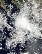
During the week of September 18, the NHC began monitoring a tropical wave,[137] as it spawned a broad area of low pressure located offshore of the southwestern coast of Mexico.[138] The disturbance lacked any significant organization until September 23 at around 21:00 UTC when the system was noted to developed surface winds of over 35 mph (55 km/h) becoming Tropical Depression Eighteen-E.[139] The depression organized into a tropical storm six hours later and was given the name Pilar, the sixteenth named storm of the annual Pacific hurricane season.[140] Thereafter, despite having a disorganized appearance on satellite, Pilar's winds increased in strength, and it reached its peak with sustained winds of 50 mph (85 km/h).[141] By 09:00 UTC on September 24, Pilar continued to track north along the coast, with warnings being issued for the southwestern coast of Mexico.[142] However, early on September 25, these warnings were discontinued,[143] as Tropical Storm Pilar showed signs of weakening mainly due to land interaction, and was reduced to a tropical depression before ultimately dissipating at around 21:00 UTC later that same day.[144] Although Pilar did not make landfall as a tropical cyclone, heavy rainfall was reported in Puerto Vallarta, Mexico, to the northeast of Islas Marías, and in other areas along the Mexican coastline.[145]
Tropical Storm Ramon
| Tropical storm (SSHWS) | |
  | |
| Duration | October 3 – October 4 |
|---|---|
| Peak intensity | 45 mph (75 km/h) (1-min) 1002 mbar (hPa) |
On October 3, the NHC noted a high chance of tropical development in an area of low pressure, to the south of Mexico.[146] The system increased in intensity and became Tropical Storm Ramon later on the same day, skipping tropical depression status.[147] Due to wind shear from a large anticyclone to its north, the storm did not intensify much further.[148] Although Ramon was forecast to linger over open waters as it moved westward, this did not occur and the system quickly grew disorganized.[149] Ramon weakened into a tropical depression on October 4, having lasted as a tropical storm only for 18 hours.[150] As it moved westward, Ramon continued to weaken, until it finally degenerated into a trough of low pressure by 00:00 UTC the following day.[151] The National Hurricane Center issued its last advisory on the degenerated system at 09:00 UTC, on October 5.[152]
Tropical Storm Selma
| Tropical storm (SSHWS) | |
  | |
| Duration | October 27 – October 28 |
|---|---|
| Peak intensity | 40 mph (65 km/h) (1-min) 1004 mbar (hPa) |
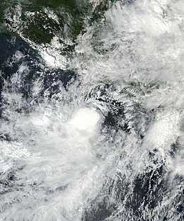
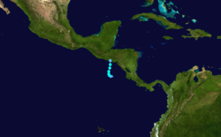
Late on October 24, the NHC began to monitor the formation of an area of low pressure located south of eastern Central America.[153] The system quickly gained organization as it moved northwestwards,[154] and was declared Tropical Storm Selma at 09:00 UTC on October 27.[155] This marked only the second time that an Eastern Pacific tropical cyclone became a tropical storm east of 90°W, the other being Alma of 2008.[155] With the environment thought to be generally conducive to intensification, Selma was forecast to gain some strength before moving northwards into Central America. However, with wind shear stronger than expected,[156] this did not materialize, and Selma never strengthened beyond minimal tropical storm status.[157] Eventually, at 12:00 UTC on October 28, Selma made landfall just southeast of San Salvador, El Salvador,[158] becoming the first Eastern Pacific tropical cyclone to make landfall anywhere in El Salvador.[159] Once over land, Selma weakened quickly, and degenerated into a post-tropical cyclone by 21:00 UTC on October 28. Selma's remnant dissipated overland within the next several hours.[160]
Heavy rains produced by Selma and a cold front resulted in flooding that killed seven people in Honduras. Dozens of landslides damaged homes and blocked roadways while 13 rivers topped their banks. Approximately 38,000 people required evacuation and more than 3,000 homes were flooded as 13 rivers topped their banks.[161] Rainfall extended into Nicaragua, causing floods that claimed another 10 lives in areas recovering from Tropical Storm Nate.[162]
Storm names
The following names were used for named storms that formed in the northeastern Pacific Ocean during 2017. No names were retired, so this list will be used again in the 2023 season.[163] This same list was used in the 2011 season.
|
|
For storms that form in the Central Pacific Hurricane Center's area of responsibility, encompassing the area between 140 degrees west and the International Date Line, all names are used in a series of four rotating lists.[164] The next four names that were slated for use in 2017 are shown below; however, none of them were used.
|
|
|
|
The usage of the name "Hilary" in July garnered some negative attention relating to former U.S. Presidential candidate Hillary Clinton. People also took to Twitter to poke fun at the name and at Clinton with political jokes.[165]
Season effects
This is a table of all the storms that formed in the 2017 Pacific hurricane season. It includes their duration, names, landfall(s), denoted in parentheses, damages, and death totals. Deaths in parentheses are additional and indirect (an example of an indirect death would be a traffic accident), but were still related to that storm. Damage and deaths include totals while the storm was extratropical, a tropical wave, or a low, and all the damage figures are in 2017 USD.
| Saffir–Simpson scale | ||||||
| TD | TS | C1 | C2 | C3 | C4 | C5 |
| Storm name |
Dates active | Storm category
at peak intensity |
Max 1-min wind mph (km/h) |
Min. press. (mbar) |
Areas affected | Damage (USD) |
Deaths | Refs | ||
|---|---|---|---|---|---|---|---|---|---|---|
| Adrian | May 9 – 10 | Tropical storm | 45 (75) | 1004 | None | None | None | |||
| Beatriz | May 31 – June 2 | Tropical storm | 45 (75) | 1001 | Southwestern Mexico | $172 million | 7 | |||
| Calvin | June 11 – 13 | Tropical storm | 45 (75) | 1004 | Southwestern Mexico, Guatemala | $3.88 million | None | |||
| Dora | June 25 – 28 | Category 2 hurricane | 105 (165) | 974 | Southwestern Mexico | Minimal | None | |||
| Eugene | July 7 – 12 | Category 3 hurricane | 115 (185) | 966 | Baja California Peninsula, California | None | None | |||
| Fernanda | July 12 – 22 | Category 4 hurricane | 145 (230) | 948 | Hawaii | None | None | |||
| Eight-E | July 17 – 20 | Tropical depression | 35 (55) | 1007 | None | None | None | |||
| Greg | July 17 – 26 | Tropical storm | 60 (95) | 1000 | None | None | None | |||
| Hilary | July 21 – 30 | Category 2 hurricane | 110 (175) | 969 | Southwestern Mexico | None | None | |||
| Irwin | July 22 – August 1 | Category 1 hurricane | 90 (150) | 979 | None | None | None | |||
| Eleven-E | August 4 – 5 | Tropical depression | 35 (55) | 1006 | None | None | None | |||
| Jova | August 11 – 13 | Tropical storm | 40 (65) | 1003 | Western Mexico | None | None | |||
| Kenneth | August 18 – 23 | Category 4 hurricane | 130 (215) | 951 | None | None | None | |||
| Lidia | August 31 – September 3 | Tropical storm | 65 (100) | 986 | Western Mexico, Baja California Peninsula, Arizona, California | $123 million | 18 (2) | |||
| Otis | September 11 – 19 | Category 3 hurricane | 115 (185) | 965 | None | None | None | |||
| Max | September 13 – 15 | Category 1 hurricane | 90 (150) | 980 | Southern Mexico | $76.4 million | 1 | |||
| Norma | September 14 – 20 | Category 1 hurricane | 75 (120) | 985 | Baja California Peninsula | None | None | |||
| Pilar | September 23 – 25 | Tropical storm | 50 (85) | 1000 | Western Mexico | Minimal | None | |||
| Ramon | October 3 – 4 | Tropical storm | 45 (75) | 1002 | Southern Mexico | None | None | |||
| Selma | October 27 – 28 | Tropical storm | 40 (65) | 1004 | Nicaragua, Costa Rica, El Salvador, Guatemala, Honduras | Unknown | 17 | |||
| Season aggregates | ||||||||||
| 20 systems | May 9 – October 28 |
145 (230) | 948 | $375 million | 43 (2) | |||||
See also
- List of Pacific hurricanes
- Pacific hurricane season
- Tropical cyclones in 2017
- 2017 Atlantic hurricane season
- 2017 Pacific typhoon season
- 2017 North Indian Ocean cyclone season
- South-West Indian Ocean cyclone seasons: 2016–17, 2017–18
- Australian region cyclone seasons: 2016–17, 2017–18
- South Pacific cyclone seasons: 2016–17, 2017–18
- South Atlantic tropical cyclone
Footnotes
- A major hurricane is a storm that ranks as Category 3 or higher on the Saffir–Simpson scale.
- The totals represent the sum of the squares for every (sub)tropical storm's intensity of over 33 knots (38 mph, 61 km/h), divided by 10,000. Calculations are provided at Talk:2017 Pacific hurricane season/ACE calcs.
References
- "Update on National Hurricane Center Products and Services for 2017" (PDF). National Hurricane Center. Retrieved March 12, 2017.
- "Background Information: East Pacific Hurricane Season". Climate Prediction Center. College Park, Maryland: National Oceanic and Atmospheric Administration. May 22, 2014. Retrieved May 29, 2014.
- National Hurricane Center; Hurricane Research Division; Central Pacific Hurricane Center. "The Northeast and North Central Pacific hurricane database 1949–2019". United States National Oceanic and Atmospheric Administration's National Weather Service. A guide on how to read the database is available here.
- "Above-normal Atlantic hurricane season is most likely this year". National Oceanic and Atmospheric Administration. May 25, 2017.
- http://smn.cna.gob.mx/tools/DATA/Ciclones%20Tropicales/Proyecci%C3%B3n/2017.pdf
- Dorst Neal. When is hurricane season? (Report). Atlantic Oceanographic and Meteorological Laboratory. Archived from the original on 6 December 2010. Retrieved November 25, 2010.
- Doyle Rice (May 9, 2017). "Earliest Pacific tropical depression on record forms". USA Today. Retrieved May 9, 2017.
- Hurricane Specialist Unit (June 1, 2017). Monthly Tropical Weather Summary: May (Report). Miami, Florida: National Hurricane Center. Retrieved August 22, 2017.
- Hurricane Specialist Unit (July 1, 2017). Monthly Tropical Weather Summary: June (Report). Miami, Florida: National Hurricane Center. Retrieved August 22, 2017.
- Hurricane Specialist Unit (August 1, 2017). Monthly Tropical Weather Summary: July (Report). Miami, Florida: National Hurricane Center. Retrieved August 22, 2017.
- Stacy R. Stewart (May 5, 2017). "Special Tropical Weather Outlook". Miami, Florida: National Hurricane Center. Retrieved May 9, 2017.
- Scott Stripling (May 7, 2017). "Tropical Weather Discussion". Miami, Florida: National Hurricane Center. Retrieved May 9, 2017.
- Richard J. Pasch (May 9, 2017). Tropical Depression One-E Public Advisory Number 1 (Report). Miami, Florida: National Hurricane Center. Retrieved May 9, 2017.
- Stacy R. Stewart (May 9, 2017). Tropical Storm Adrian Public Advisory Number 2 (Report). Miami, Florida: National Hurricane Center. Retrieved May 9, 2017.
- Michael J. Brennan (November 22, 2017). Tropical Cyclone Report: Tropical Storm Adrian (PDF) (Report). Miami, Florida: National Hurricane Center. pp. 2, 5. Retrieved November 23, 2017.
- Bob Henson (May 11, 2017). "Adios, Adrian: Earliest Tropical Storm in East Pacific Annals Dissipates". Weather Underground. Retrieved May 11, 2017.
- Daniel P. Brown (July 13, 2017). Tropical Cyclone Report: Tropical Storm Beatriz (PDF) (Report). Miami, Florida: National Hurricane Center. pp. 2, 5. Retrieved July 21, 2017.
- "UPDATE 1-Tropical Storm Beatriz nears Mexico's Pacific coast, kills 3". Thomson Reuters. June 2, 2017. Retrieved June 2, 2017.
- "Suman 7 muertos tras paso de tormenta tropical "Beatriz" en Oaxaca". Intolerancia. June 4, 2017. Retrieved June 11, 2017.
- Sánchez, Virgilio (11 July 2017). "Dejó Beatriz daños por 3 mil 200 mdp en Oaxaca; falta costo de Calvin" (in Spanish). Noticias Voz e Imagen. Retrieved 30 January 2018.
- Lixion A. Avila (June 8, 2017). "Tropical Weather Outlook". Miami, Florida: National Hurricane Center. Retrieved June 11, 2017.
- John L. Beven II (June 9, 2017). "Tropical Weather Outlook". Miami, Florida: National Hurricane Center. Retrieved June 11, 2017.
- John P. Cangialosi (August 31, 2017). Tropical Cyclone Report: Tropical Storm Calvin (PDF) (Report). Miami, Florida: National Hurricane Center. pp. 2, 3, 5. Retrieved September 4, 2017.
- Richard J. Pasch (June 12, 2017). Tropical Depression Three-E Discussion Number 4 (Report). Miami, Florida: National Hurricane Center. Retrieved June 12, 2017.
- Stacy R. Stewart (June 12, 2017). Tropical Storm Calvin Intermediate Advisory Number 5A (Report). Miami, Florida: National Hurricane Center. Retrieved June 12, 2017.
- Cangialosi (June 13, 2017). Remnants Of Calvin Advisory Number 8 (Report). Miami, Florida: National Hurricane Center. Retrieved June 14, 2017.
- Oscar Rodríguez (June 16, 2017). "Oaxaca necesita 70 mpd para reparar daños carreteros per lluvias" (in Spanish). Retrieved June 18, 2017.
- Robbie J. Berg (November 20, 2017). Tropical Cyclone Report: Hurricane Dora (PDF) (Report). Miami, Florida: National Hurricane Center. pp. 2, 5. Retrieved November 22, 2017.
- Stacy R. Stewart (June 26, 2017). Hurricane Dora Discussion Number 7 (Report). Miami, Florida: National Hurricane Center. Retrieved June 27, 2017.
- "'Dora' deja daños leves en Guerrero". Excelsior (in Spanish). June 26, 2017. Retrieved June 28, 2017.
- David P. Roberts (July 7, 2017). Tropical Storm Eugene Public Advisory Number 1 (Report). Miami, Florida: National Hurricane Center. Retrieved July 7, 2017.
- Lixion A. Avila (July 8, 2017). Tropical Storm Eugene Public Advisory Number 5 (Report). Miami, Florida: National Hurricane Center. Retrieved July 9, 2017.
- Christopher W. Landsea (July 9, 2017). Hurricane Eugene Public Advisory Number 8 (Report). Miami, Florida: National Hurricane Center. Retrieved July 9, 2017.
- John P. Cangialosi (July 9, 2017). Hurricane Eugene Discussion Number 10 (Report). Miami, Florida: National Hurricane Center. Retrieved July 10, 2017.
- Richard J. Pasch (July 10, 2017). Hurricane Eugene Discussion Number 14 (Report). Miami, Florida: National Hurricane Center. Retrieved July 10, 2017.
- Christopher W. Landsea (July 12, 2017). Tropical Depression Eugene Discussion Number 20 (Report). Miami, Florida: National Hurricane Center. Retrieved July 27, 2017.
- Christopher W. Landsea (July 12, 2017). Post-Tropical Cyclone Eugene Discussion Number 21 (Report). Miami, Florida: National Hurricane Center. Retrieved July 27, 2017.
- Darsha Philips and Jovana Lara (July 10, 2017). "More than 600 beachgoers rescued as strong rip currents hit SoCal beaches". KABC. Retrieved July 22, 2017.
- Daniel P. Brown (July 10, 2017). "Graphical Tropical Weather Outlook". Miami, Florida: National Hurricane Center. Retrieved July 11, 2017.
- Daniel P. Brown (July 12, 2017). Tropical Depression Six-E Public Advisory Number 1 (Report). Miami, Florida: National Hurricane Center. Retrieved July 12, 2017.
- John L. Beven II (July 12, 2017). Tropical Storm Fernanda Public Advisory Number 3 (Report). Miami, Florida: National Hurricane Center. Retrieved July 12, 2017.
- Daniel P. Brown (July 12, 2017). Tropical Storm Fernanda Discussion Number 5 (Report). Miami, Florida: National Hurricane Center. Retrieved July 13, 2017.
- John L. Beven II (July 13, 2017). Hurricane Fernanda Discussion Number 8 (Report). Miami, Florida: National Hurricane Center. Retrieved July 13, 2017.
- David A. Zelinsky (July 14, 2017). Hurricane Fernanda Public Advisory Number 11 (Report). Miami, Florida: National Hurricane Center. Retrieved July 14, 2017.
- Richard J. Pasch (July 14, 2017). Hurricane Fernanda Public Advisory Number 12 (Report). Miami, Florida: National Hurricane Center. Retrieved July 14, 2017.
- NHC E. Pacific Ops (July 14, 2017). "Fernanda is now a category 4 hurricane- the 2nd strongest storm so far south in the eastern Pacific". Twitter. Retrieved July 16, 2017.
- John L. Beven II (July 14, 2017). Hurricane Fernanda Discussion Number 13 (Report). Miami, Florida: National Hurricane Center. Retrieved July 23, 2017.
- David A. Zelinsky (July 22, 2017). Hurricane Fernanda Discussion Number 15 (Report). Miami, Florida: National Hurricane Center. Retrieved July 23, 2017.
- Daniel P. Brown (July 16, 2017). Hurricane Fernanda Discussion Number 19 (Report). Miami, Florida: National Hurricane Center. Retrieved July 23, 2017.
- David P. Roberts (July 18, 2017). Hurricane Fernanda Discussion Number 29 (Report). Miami, Florida: National Hurricane Center. Retrieved July 23, 2017.
- Stacy R. Stewart (July 20, 2017). Tropical Storm Fernanda Discussion Number 34 (Report). Miami, Florida: National Hurricane Center. Retrieved July 23, 2017.
- Forecaster Powell (July 21, 2017). Tropical Depression Fernanda Advisory Number 41 (Report). Honolulu, Hawaii: Central Pacific Hurricane Center. Retrieved October 20, 2018.
- Tom Birchard (July 22, 2017). Post-Tropical Cyclone Fernanda Discussion Number 44 (Report). Miami, Florida: Central Pacific Hurricane Center. Archived from the original on September 3, 2017. Retrieved July 23, 2017.
- Eric S. Blake (July 14, 2017). "Graphical Tropical Weather Outlook". Miami, Florida: National Hurricane Center. Retrieved July 21, 2017.
- Eric S. Blake (July 16, 2017). "Graphical Tropical Weather Outlook". Miami, Florida: National Hurricane Center. Retrieved July 21, 2017.
- Daniel P. Brown (July 18, 2017). Tropical Depression Eight-E Public Advisory Number 1 (Report). Miami, Florida: National Hurricane Center. Retrieved July 21, 2017.
- Robbie J. Berg (July 18, 2017). Tropical Depression Eight-E Discussion Number 3 (Report). Miami, Florida: National Hurricane Center. Retrieved July 21, 2017.
- John L. Beven II (July 20, 2017). Post-Tropical Cyclone Eight-E Discussion Number 10 (Report). Miami, Florida: National Hurricane Center. Retrieved July 21, 2017.
- Christopher W. Landsea (July 12, 2017). "Graphical Tropical Weather Outlook". Miami, Florida: National Hurricane Center. Retrieved July 21, 2017.
- Richard J. Pasch (July 14, 2017). "Graphical Tropical Weather Outlook". Miami, Florida: National Hurricane Center. Retrieved July 21, 2017.
- Daniel P. Brown (July 17, 2017). Tropical Depression Seven-E Public Advisory Number 1 (Report). Miami, Florida: National Hurricane Center. Retrieved July 21, 2017.
- Daniel P. Brown (July 18, 2017). Tropical Storm Greg Discussion Number 4 (Report). Miami, Florida: National Hurricane Center. Retrieved July 21, 2017.
- Robbie J. Berg (July 20, 2017). Tropical Storm Greg Discussion Number 15 (Report). Miami, Florida: National Hurricane Center. Retrieved July 21, 2017.
- Christopher W. Landsea; Nelsie A. Ramos (July 21, 2017). Tropical Storm Greg Discussion Number 19 (Report). Miami, Florida: National Hurricane Center. Retrieved July 21, 2017.
- Stacy R. Stewart (July 23, 2017). Tropical Storm Greg Discussion Number 27 (Report). Miami, Florida: National Hurricane Center. Retrieved July 27, 2017.
- Robbie J. Berg (July 25, 2017). Tropical Depression Greg Discussion Number 34 (Report). Miami, Florida: National Hurricane Center. Retrieved July 27, 2017.
- Richard Ballard (July 26, 2017). Post-Tropical Cyclone Greg Discussion Number 38 (Report). Honolulu, Hawaii: Central Pacific Hurricane Center. Retrieved July 27, 2017.
- Daniel P. Brown (July 19, 2017). "Graphical Tropical Weather Outlook". Miami, Florida: National Hurricane Center. Retrieved July 23, 2017.
- Robbie J. Berg (July 19, 2017). "Graphical Tropical Weather Outlook". Miami, Florida: National Hurricane Center. Retrieved July 23, 2017.
- Lixion A. Avila (July 21, 2017). Tropical Depression Nine-E Public Advisory Number 1 (Report). Miami, Florida: National Hurricane Center. Retrieved July 23, 2017.
- Lixion A. Avila (July 22, 2017). Tropical Depression Nine-E Discussion Number 5 (Report). Miami, Florida: National Hurricane Center. Retrieved July 23, 2017.
- John L. Beven II (July 22, 2017). Tropical Storm Hilary Public Advisory Number 7 (Report). Miami, Florida: National Hurricane Center. Retrieved July 23, 2017.
- Eric S. Blake (July 23, 2017). Tropical Storm Hilary Discussion Number 10 (Report). Miami, Florida: National Hurricane Center. Retrieved July 27, 2017.
- Richard J. Pasch (July 22, 2017). Hurricane Hilary Public Advisory Number 12 (Report). Miami, Florida: National Hurricane Center. Retrieved July 27, 2017.
- Richard J. Pasch (July 25, 2017). Hurricane Hilary Discussion Number 16 (Report). Miami, Florida: National Hurricane Center. Retrieved July 27, 2017.
- John P. Cangialosi (July 26, 2017). Hurricane Hilary Discussion Number 23 (Report). Miami, Florida: National Hurricane Center. Retrieved July 27, 2017.
- John P. Cangialosi (July 27, 2017). Tropical Storm Hilary Public Advisory Number 27 (Report). Miami, Florida: National Hurricane Center. Retrieved August 13, 2017.
- Eric S. Blake (July 30, 2017). Post-Tropical Cyclone Hilary Public Advisory Number 39 (Report). Miami, Florida: National Hurricane Center. Retrieved August 13, 2017.
- Eric S. Blake (July 16, 2017). "Graphical Tropical Weather Outlook". Miami, Florida: National Hurricane Center. Retrieved July 23, 2017.
- Lixion A. Avila (July 22, 2017). Tropical Depression Ten-E Public Advisory Number 1 (Report). Miami, Florida: National Hurricane Center. Retrieved July 23, 2017.
- David A. Zelinsky (July 23, 2017). Tropical Storm Irwin Discussion Advisory Number 4 (Report). Miami, Florida: National Hurricane Center. Retrieved July 27, 2017.
- David A. Zelinsky (July 24, 2017). Tropical Storm Irwin Discussion Advisory Number 8 (Report). Miami, Florida: National Hurricane Center. Retrieved July 27, 2017.
- John L. Beven II (July 25, 2017). Hurricane Irwin Public Advisory Advisory Number 12 (Report). Miami, Florida: National Hurricane Center. Retrieved July 27, 2017.
- John P. Cangialosi (July 25, 2017). Hurricane Irwin Discussion Advisory Number 15 (Report). Miami, Florida: National Hurricane Center. Retrieved July 27, 2017.
- David P. Roberts (July 26, 2017). Hurricane Irwin Discussion Advisory Number 16 (Report). Miami, Florida: National Hurricane Center. Retrieved July 27, 2017.
- Lixion A. Avila (July 26, 2017). Tropical Storm Irwin Public Advisory Advisory Number 17 (Report). Miami, Florida: National Hurricane Center. Retrieved August 13, 2017.
- Robbie J. Berg (July 30, 2017). Tropical Storm Irwin Discussion Advisory Number 35 (Report). Miami, Florida: National Hurricane Center. Retrieved August 13, 2017.
- Lixion A. Avila (August 1, 2017). Post-Tropical Cyclone Irwin Discussion Advisory Number 42 (Report). Miami, Florida: National Hurricane Center. Retrieved August 13, 2017.
- Robbie J. Berg (July 28, 2017). "Graphical Tropical Weather Outlook". Miami, Florida: National Hurricane Center. Retrieved August 13, 2017.
- John P. Cangialosi (July 30, 2017). "Graphical Tropical Weather Outlook". Miami, Florida: National Hurricane Center. Retrieved August 13, 2017.
- David A. Zelinsky (August 3, 2017). "Graphical Tropical Weather Outlook". Miami, Florida: National Hurricane Center. Retrieved August 13, 2017.
- Daniel P. Brown (November 21, 2017). Tropical Cyclone Report: Tropical Depression Eleven-E (PDF) (Report). Miami, Florida: National Hurricane Center. pp. 2, 5. Retrieved November 30, 2017.
- Lixion A. Avila (August 5, 2017). Tropical Depression Eleven-E Discussion Number 4 (Report). Miami, Florida: National Hurricane Center. Retrieved August 13, 2017.
- Stacy R. Stewart (August 3, 2017). "Graphical Tropical Weather Outlook". Miami, Florida: National Hurricane Center. Retrieved August 22, 2017.
- Daniel P. Brown (August 6, 2017). Tropical Storm Franklin Public Advisory Number 2 (Report). Miami, Florida: National Hurricane Center. Retrieved August 22, 2017.
- John L. Beven II (August 10, 2017). Hurricane Franklin Intermediate Advisory Number 14A (Report). Miami, Florida: National Hurricane Center. Retrieved August 22, 2017.
- Christopher W. Landsea; Nelsie Ramos (August 7, 2017). Graphical Tropical Weather Outlook (Report). Miami, Florida: National Hurricane Center. Retrieved August 22, 2017.
- Eric S. Blake (August 11, 2017). Tropical Storm Jova Discussion Number 1 (Report). Miami, Florida: National Hurricane Center. Retrieved August 22, 2017.
- David A. Zelinsky (August 12, 2017). Tropical Storm Jova Discussion Number 3 (Report). Miami, Florida: National Hurricane Center. Retrieved August 22, 2017.
- Richard J. Pasch (August 13, 2017). Post-Tropical Cyclone Jova Discussion Number 9 (Report). Miami, Florida: National Hurricane Center. Retrieved August 22, 2017.
- David A. Zelinsky (August 12, 2017). "Graphical Tropical Weather Outlook". Miami, Florida: National Hurricane Center. Retrieved August 22, 2017.
- Daniel P. Brown (August 14, 2017). "Graphical Tropical Weather Outlook". Miami, Florida: National Hurricane Center. Retrieved August 22, 2017.
- David A. Zelinsky (August 18, 2017). Tropical Depression Thirteen-E Public Advisory Number 1 (Report). Miami, Florida: National Hurricane Center. Retrieved August 22, 2017.
- David P. Roberts (August 18, 2017). Tropical Storm Kenneth Public Advisory Number 3 (Report). Miami, Florida: National Hurricane Center. Retrieved August 22, 2017.
- John P. Cangialosi (August 20, 2017). Hurricane Kenneth Public Advisory Number 9 (Report). Miami, Florida: National Hurricane Center. Retrieved August 22, 2017.
- Christopher W. Landsea (August 21, 2017). Hurricane Kenneth Public Advisory Number 11 (Report). Miami, Florida: National Hurricane Center. Retrieved August 22, 2017.
- Daniel P. Brown (August 21, 2017). Hurricane Kenneth Public Advisory Number 12 (Report). Miami, Florida: National Hurricane Center. Retrieved August 22, 2017.
- Daniel P. Brown (August 22, 2017). Hurricane Kenneth Public Advisory Number 16 (Report). Miami, Florida: National Hurricane Center. Retrieved August 22, 2017.
- Richard J. Pasch (August 22, 2017). Tropical Storm Kenneth Public Advisory Number 18 (Report). Miami, Florida: National Hurricane Center. Retrieved August 22, 2017.
- Lixion A. Avila (December 20, 2017). Tropical Cyclone Report: Tropical Storm Lidia (PDF) (Report). Miami, Florida: National Hurricane Center. Retrieved April 8, 2018.
- Christopher Landsea (September 11, 2017). "Tropical Depression Fifteen-E Discussion Number 1". Miami, Florida: National Hurricane Center. Retrieved December 8, 2017.
- David Zelinsky (September 16, 2017). "Tropical Depression Fifteen-E Discussion Number 19". Miami, Florida: National Hurricane Center. Retrieved December 8, 2017.
- John P. Cangialosi (September 16, 2017). "Tropical Storm Otis Discussion Number 21". Miami, Florida: National Hurricane Center. Retrieved December 8, 2017.
- John P. Cangialosi (September 17, 2017). "Hurricane Otis Discussion Number 24". Miami, Florida: National Hurricane Center. Retrieved December 8, 2017.
- Eric S. Blake (September 18, 2017). "Hurricane Otis Forecast/Advisory Number 26". Miami, Florida: National Hurricane Center. Retrieved December 8, 2017.
- Eric S. Blake (September 18, 2017). "Hurricane Otis Discussion Number 27". Miami, Florida: National Hurricane Center. Retrieved December 8, 2017.
- David Zelinsky (September 18, 2017). "Hurricane Otis Discussion Number 28". Miami, Florida: National Hurricane Center. Retrieved December 8, 2017.
- John P. Cangialosi (September 19, 2017). "Post-Tropical Cyclone Otis Discussion Number 32". Miami, Florida: National Hurricane Center. Retrieved December 8, 2017.
- Christopher W. Landsea; Nelsie Ramos (September 9, 2017). "Graphical Tropical Weather Outlook". Miami, Florida: National Hurricane Center. Retrieved September 16, 2017.
- David A. Zelinsky; Matthew Onderlinde (September 10, 2017). "Graphical Tropical Weather Outlook". Miami, Florida: National Hurricane Center. Retrieved September 16, 2017.
- Lixion A. Avila (September 13, 2017). Tropical Depression Sixteen-E Discussion Number 1 (Report). Miami, Florida: National Hurricane Center. Retrieved September 16, 2017.
- Lixion A. Avila (September 13, 2017). Tropical Storm Max Public Advisory Number 2 (Report). Miami, Florida: National Hurricane Center. Retrieved September 16, 2017.
- Lixion A. Avila (September 14, 2017). Hurricane Max Discussion Number 5 (Report). Miami, Florida: National Hurricane Center. Retrieved September 16, 2017.
- Robbie J. Berg (September 14, 2017). Hurricane Max Intermediate Advisory Number 6A (Report). Miami, Florida: National Hurricane Center. Retrieved September 16, 2017.
- Lixion A. Avila (September 15, 2017). Remnants of Max Discussion Number 9 (Report). Miami, Florida: National Hurricane Center. Retrieved September 16, 2017.
- "Se degrada huracán Max" (in Spanish). El Mañana. September 16, 2017. Retrieved September 16, 2017.
- "Wind and rain like they had never seen". Mexico News Daily. September 16, 2017. Retrieved September 16, 2017.
- "Huracán Max golpea a México: 2 desaparecidos y 600 casas inundadas" (in Spanish). La Gran Época. September 16, 2017. Retrieved September 16, 2017.
- Richard J. Pasch (March 29, 2018). Tropical Cyclone Report: Hurricane Maz (PDF) (Report). Miami, Florida: National Hurricane Center. Retrieved April 23, 2018.
- Christopher Landsea (September 10, 2017). Graphical Tropical Weather Outlook (Report). Miami, Florida: National Hurricane Center. Retrieved September 27, 2017.
- John L. Beven II; Christopher Landsea (March 12, 2018). HURRICANE NORMA (EP172017) (PDF) (Report). Tropical Cyclone Report. Miami, Florida: National Hurricane Center. Retrieved April 3, 2018.
- Robbie Berg (September 14, 2017). Tropical Storm Norma Discussion Number 1 (Report). Miami, Florida: National Hurricane Center. Retrieved September 27, 2017.
- Robbie Berg (September 14, 2017). Tropical Storm Norma Advisory Number 1 (Report). Miami, Florida: National Hurricane Center. Retrieved September 27, 2017.
- Lixion A. Avila (September 15, 2017). Hurricane Norma Advisory Number 4 (Report). Miami, Florida: National Hurricane Center. Retrieved September 27, 2017.
- Daniel P. Brown (September 16, 2017). Hurricane Norma Discussion Number 7 (Report). Miami, Florida: National Hurricane Center. Retrieved September 27, 2017.
- Christopher Landsea (September 18, 2017). Tropical Storm Norma Discussion Number 14 (Report). Miami, Florida: National Hurricane Center. Retrieved September 27, 2017.
- Lixion A. Avila (September 18, 2017). Graphical Tropical Weather Outlook (Report). Miami, Florida: National Hurricane Center. Retrieved September 27, 2017.
- Stacy Stewart (September 23, 2017). Tropical Depression Eighteen-E Advisory Number 1 (Report). Miami, Florida: National Hurricane Center. Retrieved September 27, 2017.
- Stacy Stewart (September 23, 2017). Tropical Depression Eighteen-E Discussion Number 1 (Report). Miami, Florida: National Hurricane Center. Retrieved September 25, 2017.
- David Zelinsky (September 23, 2017). Tropical Storm Pilar Discussion Number 2 (Report). Miami, Florida: National Hurricane Center. Retrieved September 25, 2017.
- David Zelinsky (September 24, 2017). Tropical Storm Pilar Discussion Number 3 (Report). Miami, Florida: National Hurricane Center. Retrieved September 25, 2017.
- John Cangialosi (September 24, 2017). Tropical Storm Pilar Advisory Number 6 (Report). Miami, Florida: National Hurricane Center. Retrieved September 25, 2017.
- John Cangialosi (September 24, 2017). Tropical Storm Pilar Discussion Number 7 (Report). Miami, Florida: National Hurricane Center. Retrieved September 27, 2017.
- Christopher Landsea (September 25, 2017). Remnants of Pilar Advisory Number 9 (Report). Miami, Florida: National Hurricane Center. Retrieved September 25, 2017.
- "Tormenta Pilar afecta con lluvia a Puerto Vallarta, México". El Nuevo Herald (in Spanish). Puerto Vallarta, Mexico. The Associated Press. September 25, 2017. Retrieved September 25, 2017.
- "Five-Day Graphical Tropical Weather Outlook". National Hurricane Center. October 3, 2017. Retrieved October 8, 2017.
- Daniel P. Brown (October 4, 2017). Tropical Storm Ramon Discussion Number 1 (Report). Miami, Florida: National Hurricane Center. Retrieved October 16, 2017.
- Richard J. Pasch (October 4, 2017). Tropical Storm Ramon Discussion Number 2 (Report). Miami, Florida: National Hurricane Center. Retrieved October 16, 2017.
- Richard J. Pasch (October 4, 2017). Tropical Storm Ramon Discussion Number 3 (Report). Miami, Florida: National Hurricane Center. Retrieved October 16, 2017.
- David Zelinsky (October 4, 2017). Tropical Storm Ramon Discussion Number 4 (Report). Miami, Florida: National Hurricane Center. Retrieved October 16, 2017.
- Daniel P. Brown (December 11, 2017). Tropical Storm Ramon (PDF) (Report). Tropical Cyclone Report. Miami, Florida: National Hurricane Center. Retrieved May 9, 2018.
- Lixion A. Avila (October 5, 2017). Remnants of Ramon Discussion Number 5 (Report). Miami, Florida: National Hurricane Center. Retrieved October 16, 2017.
- Jack L. Beven II (October 24, 2017). Five-Day Graphical Tropical Weather Outlook (Report). Miami, Florida: National Hurricane Center. Retrieved November 7, 2017.
- Jack L. Beven II (October 26, 2017). Five-Day Graphical Tropical Weather Outlook (Report). Miami, Florida: National Hurricane Center. Retrieved November 7, 2017.
- Eric S. Blake (October 27, 2017). Tropical Storm Selma Discussion Number 1 (Report). Miami, Florida: National Hurricane Center. Retrieved November 7, 2017.
- Daniel P. Brown (October 27, 2017). Tropical Storm Selma Discussion Number 2 (Report). Miami, Florida: National Hurricane Center. Retrieved November 7, 2017.
- Daniel P. Brown (October 27, 2017). Tropical Storm Selma Discussion Number 3 (Report). Miami, Florida: National Hurricane Center. Retrieved November 7, 2017.
- Dave P. Roberts (October 28, 2017). Tropical Storm Selma Intermediate Advisory Number 5A (Report). Miami, Florida: National Hurricane Center. Retrieved November 7, 2017.
- Philip Klotzbach [@philklotzbach] (October 28, 2017). "#Selma has made landfall in El Salvador - the 1st NE Pacific named storm to make landfall in El Salvador on record" (Tweet) – via Twitter.
- Dave P. Roberts (October 28, 2017). Post-Tropical Cyclone Selma Discussion Number 7 (Report). Miami, Florida: National Hurricane Center. Retrieved November 7, 2017.
- "Inundaciones y cientos de afectados en Honduras por Selma" (in Spanish). Critica. Agencia EFE. October 29, 2017. Retrieved November 14, 2017.
- Cinthya Tórrez, Melvin Rodríguez and Luis E. Martínez (October 28, 2017). "Nicaragua registra 25 muertos por las lluvias en menos de un mes". La Prensa (in Spanish). Retrieved November 14, 2017.
- "Tropical Cyclone Names 2016-2021". National Hurricane Center. National Oceanic and Atmospheric Administration. Archived from the original on December 30, 2016.
- "Pacific Tropical Cyclone Names 2016-2021". Central Pacific Hurricane Center. National Oceanic and Atmospheric Administration. May 12, 2016. Archived from the original (PHP) on December 30, 2016.
- "Tropical Storms 'Don' And 'Hilary' Bring Out Political Jokes On Twitter". WBZ-TV. July 19, 2017. Retrieved July 19, 2017.
External links
| Wikimedia Commons has media related to 2017 Pacific hurricane season. |
- National Hurricane Center Website
- National Hurricane Center's Eastern Pacific Tropical Weather Outlook
- Servicio Meteorológico Nacional Website (in Spanish)