Wrightsville, Arkansas
Wrightsville is a city in Pulaski County, Arkansas, United States. Its population was 2,114 at the 2010 census.[3] It is part of the Little Rock–North Little Rock–Conway Metropolitan Statistical Area.
Wrightsville, Arkansas | |
|---|---|
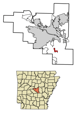 Location of Wrightsville in Pulaski County, Arkansas. | |
 Wrightsville, Arkansas Location in the United States | |
| Coordinates: 34°36′38″N 92°13′2″W | |
| Country | United States |
| State | Arkansas |
| County | Pulaski |
| Area | |
| • Total | 2.14 sq mi (5.53 km2) |
| • Land | 2.12 sq mi (5.48 km2) |
| • Water | 0.02 sq mi (0.05 km2) |
| Elevation | 256 ft (78 m) |
| Population (2010) | |
| • Total | 2,114 |
| • Estimate (2019)[2] | 2,131 |
| • Density | 1,007.09/sq mi (388.81/km2) |
| Time zone | UTC-6 (Central (CST)) |
| • Summer (DST) | UTC-5 (CDT) |
| ZIP code | 72183 |
| Area code(s) | 501 |
| FIPS code | 05-76970 |
| GNIS feature ID | 0056563 |
| Website | http://cityofwrightsville-ar.org/ |
Geography
Wrightsville is located at 34°36′38″N 92°13′2″W (34.610434, -92.217113).[4]
According to the United States Census Bureau, the city has a total area of 2.1 square miles (5.4 km2), of which 2.0 square miles (5.2 km2) is land and 0.49% is water.
Economy
Since 1981, Wrightsville has been home to the Arkansas Department of Correction Wrightsville Unit, which focuses on educational and rehabilitative services, aiding in workforce preparation, substance abuse recovery, and other aspects of re-entry into society for as many as 850 male and female inmates. A 212-inmate capacity boot camp program is also administered at the site for first-time non-violent inmates, along with a 50-inmate capacity female work release program, operated by the ADC since 1990. The Wrightsville Unit is a major employer in the community, with a staff of 169 employees in various fields.
Wrightsville also serves as the city of license for at least one Little Rock area radio station, KLAL-FM.
Government and infrastructure
The Arkansas Department of Correction Wrightsville Unit is in Wrightsville.[5] The land occupied by the unit formerly housed the Arkansas Negro Boys' Industrial School.[6]
The United States Postal Service operates the Wrightsville Post Office.[7]
Demographics
| Historical population | |||
|---|---|---|---|
| Census | Pop. | %± | |
| 1990 | 1,062 | — | |
| 2000 | 1,368 | 28.8% | |
| 2010 | 2,114 | 54.5% | |
| Est. 2019 | 2,131 | [2] | 0.8% |
| U.S. Decennial Census[8] | |||
As of the census[9] of 2000, there were 1,368 people, 262 households, and 193 families residing in the city. The population density was 667.6 people per square mile (257.7/km2). There were 291 housing units at an average density of 142.0/sq mi (54.8/km2). The racial makeup of the city was 24.12% White, 74.56% Black or African American, 0.07% Native American, 0.29% Asian, 0.29% from other races, and 0.66% from two or more races. 0.29% of the population were Hispanic or Latino of any race.
There were 262 households, out of which 32.4% had children under the age of 18 living with them, 42.4% were married couples living together, 24.8% had a female householder with no husband present, and 26.3% were non-families. 23.7% of all households were made up of individuals, and 8.0% had someone living alone who was 65 years of age or older. The average household size was 2.86 and the average family size was 3.37.
In the city, the population was spread out, with 16.5% under the age of 18, 13.7% from 18 to 24, 44.0% from 25 to 44, 18.6% from 45 to 64, and 7.1% who were 65 years of age or older. The median age was 34 years. For every 100 females, there were 250.8 males. For every 100 females age 18 and over, there were 299.3 males.
The median income for a household in the city was $28,036, and the median income for a family was $32,500. Males had a median income of $26,563 versus $20,000 for females. The per capita income for the city was $9,518. About 21.5% of families and 22.6% of the population were below the poverty line, including 27.4% of those under age 18 and 28.0% of those age 65 or over.
References
- "2019 U.S. Gazetteer Files". United States Census Bureau. Retrieved June 30, 2020.
- "Population and Housing Unit Estimates". United States Census Bureau. May 24, 2020. Retrieved May 27, 2020.
- "Profile of General Population and Housing Characteristics: 2010 Demographic Profile Data (DP-1): Wrightsville city, Arkansas". United States Census Bureau. Retrieved December 2, 2011.
- "US Gazetteer files: 2010, 2000, and 1990". United States Census Bureau. 2011-02-12. Retrieved 2011-04-23.
- Facilities 5. Arkansas Department of Corrections. Retrieved on March 8, 2011.
- "THV Extra: Arkansas' Secret Holocaust." THV. Retrieved on March 9, 2011.
- "Post Office™ Location - WRIGHTSVILLE." United States Postal Service. Retrieved on March 8, 2011.
- "Census of Population and Housing". Census.gov. Retrieved June 4, 2015.
- "U.S. Census website". United States Census Bureau. Retrieved 2008-01-31.
Municipalities and communities of Pulaski County, Arkansas, United States | ||
|---|---|---|
| Cities | 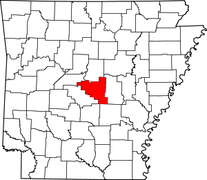 Map of Arkansas highlighting Pulaski County | |
| CDPs | ||
| Unincorporated communities | ||
| Footnotes | ‡This populated place also has portions in an adjacent county or counties | |