Hensley, Arkansas
Hensley is a census-designated place (CDP) in Pulaski County, Arkansas, United States. The population was 139 at the 2010 census.[3] It is part of the Little Rock–North Little Rock–Conway Metropolitan Statistical Area.
Hensley, Arkansas | |
|---|---|
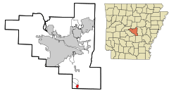 Location in Pulaski County and the state of Arkansas | |
 Hensley Location of Hensley in the US | |
| Coordinates: 34°30′16″N 92°12′15″W | |
| Country | United States |
| State | Arkansas |
| County | Pulaski |
| Area | |
| • Total | 1.02 sq mi (2.65 km2) |
| • Land | 1.02 sq mi (2.65 km2) |
| • Water | 0.00 sq mi (0.00 km2) |
| Elevation | 259 ft (79 m) |
| Population (2010) | |
| • Total | 12,282 |
| • Estimate (2016)[2] | N/A |
| Time zone | UTC-6 (Central (CST)) |
| • Summer (DST) | UTC-5 (CDT) |
| FIPS code | 05-31390 |
| GNIS feature ID | 0077164 |
| Highways | |
| Major airport | Clinton National (LIT) |
Geography
Hensley is located at 34°30′16″N 92°12′15″W (34.504317, -92.204253).[4]
According to the United States Census Bureau, the CDP has a total area of 1.0 square mile (2.6 km2), all land.
Demographics
| Historical population | |||
|---|---|---|---|
| Census | Pop. | %± | |
| 2000 | 150 | — | |
| 2010 | 139 | −7.3% | |
| U.S. Decennial Census[5] | |||
As of the census[6] of 2000, there were 150 people, 59 households, and 38 families residing in the CDP. The population density was 149.5 people per square mile (57.9/km2). There were 71 housing units at an average density of 70.8/sq mi (27.4/km2). The racial makeup of the CDP was 34.00% White, 64.67% Black or African American, and 1.33% from two or more races.
There were 59 households, out of which 23.7% had children under the age of 18 living with them, 39.0% were married couples living together, 20.3% had a female householder with no husband present, and 33.9% were non-families. 32.2% of all households were made up of individuals, and 15.3% had someone living alone who was 65 years of age or older. The average household size was 2.54 and the average family size was 3.21.
In the CDP, the population was spread out, with 20.0% under the age of 18, 8.7% from 18 to 24, 32.0% from 25 to 44, 22.7% from 45 to 64, and 16.7% who were 65 years of age or older. The median age was 40 years. For every 100 females, there were 87.5 males. For every 100 females age 18 and over, there were 87.5 males.
The median income for a household in the CDP was $26,607, and the median income for a family was $29,286. Males had a median income of $15,417 versus $21,875 for females. The per capita income for the CDP was $10,878. There were 21.4% of families and 21.2% of the population living below the poverty line, including no under eighteens and 29.0% of those over 64.
Notable people
- Andy Mayberry (born 1970), Republican former member of the Arkansas House of Representatives; author of the state law banning abortion after twenty weeks of gestation; resident of Hensley
- Julie Mayberry (born c. 1971), Andy Mayberry's wife and state House successor, effective January 2015
References
- "2016 U.S. Gazetteer Files". United States Census Bureau. Retrieved Jul 18, 2017.
- "Population and Housing Unit Estimates". Retrieved June 9, 2017.
- "U.S. Census website". U.S. Census Bureau. Retrieved 3 May 2011.
- "US Gazetteer files: 2010, 2000, and 1990". United States Census Bureau. 2011-02-12. Retrieved 2011-04-23.
- "Census of Population and Housing". Census.gov. Retrieved June 4, 2016.
- "U.S. Census website". United States Census Bureau. Retrieved 2008-01-31.
Municipalities and communities of Pulaski County, Arkansas, United States | ||
|---|---|---|
| Cities | 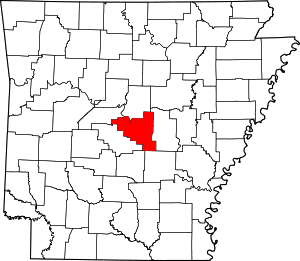 Map of Arkansas highlighting Pulaski County | |
| CDPs | ||
| Unincorporated communities | ||
| Footnotes | ‡This populated place also has portions in an adjacent county or counties | |