Washington Township, Lehigh County, Pennsylvania
Washington Township is a township in Lehigh County, Pennsylvania, in the United States. It is a suburb of Allentown, Pennsylvania, in the Lehigh Valley area of the state.
Washington Township | |
|---|---|
 Lehigh Gap Nature Center | |
 Location of Washington Township in Lehigh County | |
 Washington Township Pennsylvania | |
| Coordinates: 40°44′59″N 75°37′30″W | |
| Country | United States |
| State | Pennsylvania |
| County | Lehigh |
| Area | |
| • Total | 23.74 sq mi (61.48 km2) |
| • Land | 23.55 sq mi (61.01 km2) |
| • Water | 0.18 sq mi (0.48 km2) |
| Elevation | 518 ft (158 m) |
| Population (2010) | |
| • Total | 6,624 |
| • Estimate (2016)[2] | 6,761 |
| • Density | 287.04/sq mi (110.83/km2) |
| Time zone | UTC-5 (EST) |
| • Summer (DST) | UTC-4 (EDT) |
| ZIP codes | 18065, 18078, 18079, 18080 |
| Area code(s) | 610 |
The population of Washington Township was 6,588 at the 2000 census.
History
The Vigilant Fire Company Firemen's Monument was added to the National Register of Historic Places in 2004.[3]
Geography
According to the United States Census Bureau, the township has a total area of 23.8 square miles (61.6 km2), of which, 23.7 square miles (61.3 km2) of it is land and 0.1 square miles (0.3 km2) of it (0.46%) is water. It is drained by the Lehigh River, which separates it from Northampton County, and Blue Mountain separates it from Carbon County.
Its villages include Best Station, Emerald, Friedens, Lehigh Furnace, Lehigh Gap (also in Northampton County,) Neffs (also in North Whitehall Township,) Newhard, Newside, and Slatedale.
Adjacent municipalities
- North Whitehall Township (south)
- Heidelberg Township (west)
- East Penn Township, Carbon County (north)
- Lower Towamensing Township, Carbon County (tangent to the northeast)
- Lehigh Township, Northampton County (east)
- Slatington (east)
- Walnutport, Northampton County (east)
Climate
The township has a humid continental climate (Dfa/Dfb) and the hardiness zones are 6a and 6b. Average monthly temperatures in Friedens range from 27.9 °F in January to 72.3 °F in July.
Demographics
| Historical population | |||
|---|---|---|---|
| Census | Pop. | %± | |
| 2000 | 6,588 | — | |
| 2010 | 6,624 | 0.5% | |
| Est. 2016 | 6,761 | [2] | 2.1% |
| U.S. Decennial Census[4] | |||
As of the census[5] of 2000, there were 6,588 people, 2,512 households, and 1,929 families residing in the township. The population density was 278.4 people per square mile (107.5/km2). There were 2,594 housing units at an average density of 109.6/sq mi (42.3/km2). The racial makeup of the township was 98.71% White, 0.21% African American, 0.08% Native American, 0.41% Asian, 0.24% from other races, and 0.35% from two or more races. Hispanic or Latino of any race were 0.97% of the population.
There were 2,512 households, out of which 32.0% had children under the age of 18 living with them, 65.2% were married couples living together, 7.2% had a female householder with no husband present, and 23.2% were non-families. 18.0% of all households were made up of individuals, and 7.8% had someone living alone who was 65 years of age or older. The average household size was 2.62 and the average family size was 2.97.
In the township the population was spread out, with 22.7% under the age of 18, 6.9% from 18 to 24, 31.4% from 25 to 44, 27.3% from 45 to 64, and 11.7% who were 65 years of age or older. The median age was 40 years. For every 100 females, there were 103.0 males. For every 100 females age 18 and over, there were 101.8 males.
The median income for a household in the township was $50,587, and the median income for a family was $55,332. Males had a median income of $35,340 versus $26,967 for females. The per capita income for the township was $19,980. About 3.5% of families and 5.1% of the population were below the poverty line, including 3.0% of those under age 18 and 10.9% of those age 65 or over.
Education
The Township is served by the Northern Lehigh School District.
Transportation
Washington Township is served by Pennsylvania Route 873, which crosses north-to-south from Pennsylvania Route 248 in Lehigh Gap to PA 329 in Neffs and PA 309 in Schnecksville. An important east-to-west thoroughfare is Mountain Road, which proceeds west from PA 873 in Lehigh Gap to PA 309 north of New Tripoli. LANta serves the township with bus route 325.
References
- "2016 U.S. Gazetteer Files". United States Census Bureau. Retrieved Aug 14, 2017.
- "Population and Housing Unit Estimates". Retrieved June 9, 2017.
- "National Register Information System". National Register of Historic Places. National Park Service. July 9, 2010.
- "Census of Population and Housing". Census.gov. Retrieved June 4, 2016.
- "U.S. Census website". United States Census Bureau. Retrieved 2008-01-31.
Municipalities and communities of Lehigh County, Pennsylvania, United States | ||
|---|---|---|
| Cities | 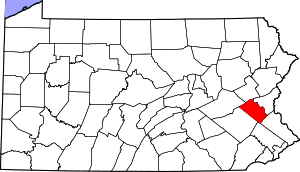 | |
| Boroughs | ||
| Townships |
| |
| CDPs | ||
| Unincorporated communities |
| |
| Footnotes | ‡This populated place also has portions in an adjacent county or counties | |