Lehigh Township, Northampton County, Pennsylvania
Lehigh Township is a township in Northampton County, Pennsylvania, United States. Lehigh Township is located in the Lehigh Valley region of the state.
Lehigh Township | |
|---|---|
 Corn growing in the township | |
.svg.png) Location of Pennsylvania in the United States | |
| Coordinates: 40°44′59″N 75°32′29″W | |
| Country | United States |
| State | Pennsylvania |
| County | Northampton |
| Area | |
| • Total | 29.84 sq mi (77.27 km2) |
| • Land | 29.34 sq mi (75.99 km2) |
| • Water | 0.49 sq mi (1.28 km2) |
| Elevation | 669 ft (204 m) |
| Population (2010) | |
| • Total | 10,526 |
| • Estimate (2016)[2] | 10,419 |
| • Density | 355.10/sq mi (137.11/km2) |
| Time zone | UTC-5 (EST) |
| • Summer (DST) | UTC-4 (EDT) |
| ZIP codes | 18035, 18038, 18067, 18086, 18088 |
| Area code(s) | 610 |
| FIPS code | 42-095-42424 |
| Website | http://www.lehightownship.com/ |
The population of Lehigh Township was 10,527 as of the 2010 census.
Geography
According to the United States Census Bureau, the township has a total area of 29.9 square miles (77 km2), of which, 29.7 square miles (77 km2) of it is land and 0.2 square miles (0.52 km2) of it (0.80%) is water. It is drained by the Lehigh River, which separates it from Lehigh County and Blue Mountain separates it from Carbon County to the north. Its villages include Berlinsville, Cherryville, Danielsville, Lehigh Gap (also in Lehigh County,) Pennsville, Rockville, and Treichlers.
The township's numbered roads include north-to-south Routes 145 and 873 and east-to-west Routes 248 and 946. 145 and 873 have their northern termini on 248 in Lehigh Gap and extend downriver via Treichlers to Allentown and south via Slatington to Schnecksville, respectively. 248 connects Carbon County with Bath, Nazareth, and Easton, while 946 extends east from 248 in Berlinsville to Klecknersville and Moorestown. Other local roads of note include Blue Mountain Drive, Cherryville Road, Indian Trail Road, and Mountain View Drive.
Adjacent municipalities
- Moore Township (east)
- Allen Township (south)
- North Whitehall Township, Lehigh County (south)
- Washington Township, Lehigh County (west)
- Walnutport (west)
- East Penn Township, Carbon County (tangent to the northwest)
- Lower Towamensing Township, Carbon County (north)
Climate
The township has a humid continental climate (Dfa/Dfb) and the hardiness zones are 6a and 6b. Average monthly temperatures in Cherryville range from 28.0 °F in January to 72.2 °F in July.
Demographics
| Historical population | |||
|---|---|---|---|
| Census | Pop. | %± | |
| 2000 | 9,728 | — | |
| 2010 | 10,526 | 8.2% | |
| Est. 2016 | 10,419 | [2] | −1.0% |
| U.S. Decennial Census[3] | |||
As of the census[4] of 2000, there were 9,728 people, 3,680 households, and 2,833 families residing in the township. The population density was 327.7 people per square mile (126.5/km2). There were 3,816 housing units at an average density of 128.6/sq mi (49.6/km2). The racial makeup of the township was 98.67% White, 0.36% African American, 0.20% Native American, 0.17% Asian, 0.16% from other races, and 0.43% from two or more races. Hispanic or Latino of any race were 0.74% of the population.
There were 3,680 households, out of which 31.7% had children under the age of 18 living with them, 67.0% were married couples living together, 6.9% had a female householder with no husband present, and 23.0% were non-families. 18.0% of all households were made up of individuals, and 8.2% had someone living alone who was 65 years of age or older. The average household size was 2.62 and the average family size was 2.98.
In the township the population was spread out, with 22.5% under the age of 18, 6.3% from 18 to 24, 29.5% from 25 to 44, 27.9% from 45 to 64, and 13.7% who were 65 years of age or older. The median age was 41 years. For every 100 females, there were 102.9 males. For every 100 females age 18 and over, there were 98.6 males.
The median income for a household in the township was $48,263, and the median income for a family was $55,216. Males had a median income of $37,307 versus $27,206 for females. The per capita income for the township was $21,400. About 2.3% of families and 2.9% of the population were below the poverty line, including 3.1% of those under age 18 and 4.1% of those age 65 or over.
Politics and government
The Township is governed by a five member board of supervisors. The chairman of the board is currently Darryl Snover. The township also elects the positions of solicitor, auditor, tax collector and appoints various other civil servants.
Legislators
- State Representative Zach Mako, Republican, 183rd district
- State Senator Mario Scavello, Republican, 40th district
- US Representative Susan Wild, Democrat, 7th district
Supervisors
- Darryl Snover, Chair
- Cynthia Miller, Vice-chair
- Phillip Gogel
- Keith Hantz
- Michael Jones
Public education
The Township is served by the Northampton Area School District, with one of its component elementary schools, Lehigh Elementary School, residing inside the Township.
References
- "2016 U.S. Gazetteer Files". United States Census Bureau. Retrieved Aug 14, 2017.
- "Population and Housing Unit Estimates". Retrieved June 9, 2017.
- "Census of Population and Housing". Census.gov. Retrieved June 4, 2016.
- "U.S. Census website". United States Census Bureau. Retrieved 2008-01-31.
External links
Municipalities and communities of Northampton County, Pennsylvania, United States | ||
|---|---|---|
| Cities | 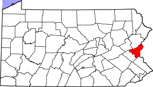 | |
| Boroughs | ||
| Townships | ||
| CDPs | ||
| Unincorporated communities | ||
| Footnotes | ‡This populated place also has portions in an adjacent county or counties | |