Vergennes Township, Michigan
Vergennes Township is a civil township of Kent County in the U.S. state of Michigan. As of the 2010 census, the township population was 4,189,[3] up from 3,611 at the 2000 census.
Vergennes Township, Michigan | |
|---|---|
 Vergennes Township Location within Michigan and the United States  Vergennes Township Vergennes Township (the United States) | |
| Coordinates: 42°59′6″N 85°22′3″W | |
| Country | United States |
| State | Michigan |
| County | Kent |
| Area | |
| • Total | 35.39 sq mi (91.65 km2) |
| • Land | 34.49 sq mi (89.32 km2) |
| • Water | 0.90 sq mi (2.34 km2) |
| Elevation | 791 ft (241 m) |
| Population (2010) | |
| • Total | 4,189 |
| • Density | 121/sq mi (46.9/km2) |
| Time zone | UTC-5 (Eastern (EST)) |
| • Summer (DST) | UTC-4 (EDT) |
| FIPS code | 26-081-81920[1] |
| GNIS feature ID | 1627193[2] |
| Website | www |
Geography
Vergennes Township is in eastern Kent County and is bordered to the east by Ionia County. The city of Lowell is along the township's southern border.
According to the United States Census Bureau, the township has a total area of 35.4 square miles (91.7 km2), of which 34.5 square miles (89.3 km2) are land and 0.89 square miles (2.3 km2), or 2.55%, are water.[3] The Flat River, a tributary of the Grand River, flows through the eastern side of the township.
Communities
- Fallasburg is an unincorporated community on the eastern side of the township. It began around a grist mill built by J. Wesley Fallas in 1839. It had a post office from 1851 until 1901.[4] Fallasburg Bridge over the Flat River is a notable covered bridge in the township.[5]
- Fox's Corner started around the home of James S. Fox in 1836. It had a schoolhouse beginning in 1870.[6]
Demographics
As of the census[1] of 2000, there were 3,611 people, 1,142 households, and 970 families residing in the township. The population density was 104.0 per square mile (40.2/km2). There were 1,209 housing units at an average density of 34.8 per square mile (13.4/km2). The racial makeup of the township was 97.48% White, 0.64% African American, 0.19% Native American, 0.78% Asian, 0.47% from other races, and 0.44% from two or more races. Hispanic or Latino of any race were 2.16% of the population.
There were 1,142 households out of which 48.1% had children under the age of 18 living with them, 76.7% were married couples living together, 5.1% had a female householder with no husband present, and 15.0% were non-families. 11.7% of all households were made up of individuals and 3.4% had someone living alone who was 65 years of age or older. The average household size was 3.13 and the average family size was 3.39.
In the township, the population was spread out with 33.5% under the age of 18, 5.2% from 18 to 24, 32.8% from 25 to 44, 21.7% from 45 to 64, and 6.9% who were 65 years of age or older. The median age was 34 years. For every 100 females, there were 103.6 males. For every 100 females age 18 and over, there were 99.8 males.
The median income for a household in the township was $61,500, and the median income for a family was $62,313. Males had a median income of $47,723 versus $31,754 for females. The per capita income for the township was $21,339. About 5.2% of families and 6.2% of the population were below the poverty line, including 5.7% of those under age 18 and 17.6% of those age 65 or over.
References
Notes
- "U.S. Census website". United States Census Bureau. Retrieved 2008-01-31.
- U.S. Geological Survey Geographic Names Information System: Vergennes Township, Michigan
- "Geographic Identifiers: 2010 Census Summary File 1 (G001), Vergennes township, Kent County, Michigan". American FactFinder. U.S. Census Bureau. Archived from the original on February 13, 2020. Retrieved March 28, 2019.
- Romig 1986, p. 191.
- hostmaster (2016-12-29). "Fallasburg Covered Bridge, Pioneer Village & School". Michigan. Retrieved 2017-07-30.
- Romig 1986, p. 208.
Sources
- Romig, Walter (October 1, 1986) [1973]. Michigan Place Names: The History of the Founding and the Naming of More Than Five Thousand Past and Present Michigan Communities. Great Lakes Books Series (Paperback). Detroit, Michigan: Wayne State University Press. ISBN 978-0-8143-1838-6.CS1 maint: ref=harv (link)
External links
Municipalities and communities of Kent County, Michigan, United States | ||
|---|---|---|
| Cities | 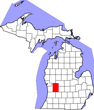 Map of Michigan highlighting Kent County | |
| Villages | ||
| Charter townships | ||
| General law townships | ||
| CDPs | ||
| Other unincorporated communities |
| |
| Footnotes | ‡This populated place also has portions in an adjacent county or counties | |