Cannon Township, Michigan
Cannon Township is a civil township of Kent County in the U.S. state of Michigan. As of the 2010 census, the population was 13,336,[4] up from 12,075 at the 2000 census.
Cannon Township, Michigan | |
|---|---|
| Motto(s): "A Historic Rural Community"[1] | |
 Cannon Township Location within Michigan and the United States  Cannon Township Cannon Township (the United States) | |
| Coordinates: 43°4′10″N 85°29′16″W | |
| Country | United States |
| State | Michigan |
| County | Kent |
| Area | |
| • Total | 37.0 sq mi (95.8 km2) |
| • Land | 35.3 sq mi (91.3 km2) |
| • Water | 1.7 sq mi (4.4 km2) |
| Elevation | 843 ft (257 m) |
| Population (2010) | |
| • Total | 13,336 |
| • Density | 378/sq mi (146.0/km2) |
| Time zone | UTC-5 (Eastern (EST)) |
| • Summer (DST) | UTC-4 (EDT) |
| FIPS code | 26-081-13080[2] |
| GNIS feature ID | 1626029[3] |
| Website | www |
History
The area that would become Cannon Township was originally attached to neighbouring Plainfield Township. In 1837 Andrew Watson brought his family to Cannon and built the first farm in the township. Over the next decade many other pioneers arrived and settled. In 1845 the township was split from Plainfield and took its present name. The state legislature organized Cannon Township as "Churchtown" in 1846. At the first town meeting, held in 1848, it was renamed "Cannon", after Cannonsburg, the largest village.[5]
The earliest land claims date from 1835. Families began settling permanently in 1839. Zebulon Rood purchased 240 acres (97 ha) of land in 1840 and built Cannon's first house, a log structure. He also cut the first road, making it possible to transport goods across Bear Creek. During the nineteenth and early twentieth centuries, the production of wheat, wool, corn, apples and other fruits supported the economy. This building served as the township hall from 1890 until 1987, when it became the Cannon Historical Museum.[6]
The township took its name from the small settlement of Cannonsburgh, which had been founded in 1842 at the direction of LeGrand Cannon, described as an eastern capitalist.[5] The hamlet had two mills and a store by 1845, and the town was platted to encourage residential growth. LeGrand Cannon was proud of his little town, and provided a fitting gift in appreciation: a small cannon inscribed with his name and date. The cannon was used by the townspeople to commemorate holidays, such as the 4th of July, until someone was hurt firing the ordnance. The cannon was then buried to prevent further injuries, but was later discovered and refitted for firing. Unfortunately, another person was subsequently injured while firing the cannon, and again it was buried, and has not been found again to this day.
Geography
According to the United States Census Bureau, the township has a total area of 37.0 square miles (95.8 km2), of which 35.3 square miles (91.3 km2) are land and 1.7 square miles (4.4 km2), or 4.63%, are water.[4] The water acreage comes from several small natural lakes in the township and an artificial one (Lake Bella Vista). The Grand River crosses the southwest corner of the township.
Communities
- Cannonsburg is an unincorporated community in the southeast part of the township.
- Chauncey (also known as Buena Vista and Imperial Mills) is an unincorporated, mostly historical settlement on the boundary between Cannon Township and Plainfield Township where Bear Creek enters the Grand River.
ZIP Codes:
- Rockford (49341) serves the northern half of the township.
- Belmont (49306) serves the southwestern part.
- Ada (49301) serves the southeastern part.
- ZIP Code 49317 serves a PO Box address in Cannonsburg.
Demographics
As of the census[2] of 2000, there were 12,075 people, 3,913 households, and 3,341 families residing in the township. The population density was 336.5 per sq mi (872 per km2). There were 4,174 housing units at an average density of 116.3 per sq mi (301 per km2). The racial makeup of the township was 97.67% White, 0.47% African American, 0.12% Native American, 0.34% Asian, 0.08% Pacific Islander, 0.40% from other races, and 0.91% from two or more races. Hispanic or Latino of any race were 1.01% of the population.
There were 3,913 households, out of which 51.2% had children under the age of 18 living with them, 78.3% were married couples living together, 5.1% had a female householder with no husband present, and 14.6% were non-families. 11.4% of all households were made up of individuals, and 3.1% had someone living alone who was 65 years of age or older. The average household size was 3.09 and the average family size was 3.38.
In the township the population was spread out, with 34.2% under the age of 18, 5.4% from 18 to 24, 30.7% from 25 to 44, 23.6% from 45 to 64, and 6.1% who were 65 years of age or older. The median age was 35 years. For every 100 females, there were 102.7 males. For every 100 females age 18 and over, there were 100.6 males.
The median income for a household in the township was $70,925, and the median income for a family was $76,805. Males had a median income of $55,696 versus $31,310 for females. The per capita income for the township was $27,383. About 1.8% of families and 2.5% of the population were below the poverty line, including 2.2% of those under age 18 and 2.4% of those age 65 or over.
Education
- Rockford Public Schools
- Lowell Area Schools
- Forest Hills Public Schools
References
- "Cannon Township, Michigan". Cannon Township, Michigan. Retrieved August 24, 2012.
- "U.S. Census website". United States Census Bureau. Retrieved 2008-01-31.
- U.S. Geological Survey Geographic Names Information System: Cannon Township, Michigan
- "Geographic Identifiers: 2010 Census Summary File 1 (G001), Cannon township, Kent County, Michigan". American FactFinder. U.S. Census Bureau. Archived from the original on February 13, 2020. Retrieved March 21, 2019.
- Dillenback & Leavitt, History and directory of Kent County, Michigan. Grand Rapids, Mich.: Daily Eagle Steam Printing House, 1870. pp. 43-46.
- "Canon Township Hall". Archived from the original on 2016-03-04. Retrieved 2013-07-29.
External links
- Official website
- Rockford Public Schools
- Lowell Public Schools
- Forest Hills Public Schools
- Pando Winter Sports Park
- Cannonsburg ski area
- Article on preservation of a local creek
Municipalities and communities of Kent County, Michigan, United States | ||
|---|---|---|
| Cities | 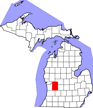 Map of Michigan highlighting Kent County | |
| Villages | ||
| Charter townships | ||
| General law townships | ||
| CDPs | ||
| Other unincorporated communities |
| |
| Footnotes | ‡This populated place also has portions in an adjacent county or counties | |