Twin Rivers, New Jersey
Twin Rivers is an unincorporated community and census-designated place (CDP) located within East Windsor Township, in Mercer County, New Jersey, United States.[6][7] As of the 2010 United States Census, the CDP's population was 7,443.[3] Twin Rivers was the first planned unit development in New Jersey.[8]
Twin Rivers, New Jersey | |
|---|---|
.jpg) Typical townhouse development in Twin Rivers | |
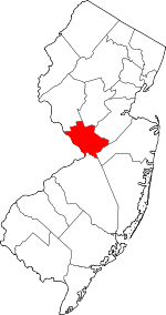
 Location in Mercer County and the state of New Jersey. | |
| Coordinates: 40.263194°N 74.487843°W | |
| Country | |
| State | |
| County | Mercer |
| Township | East Windsor |
| Area | |
| • Total | 1.319 sq mi (3.418 km2) |
| • Land | 1.280 sq mi (3.315 km2) |
| • Water | 0.039 sq mi (0.102 km2) 2.99% |
| Elevation | 108 ft (33 m) |
| Population | |
| • Total | 7,443 |
| • Density | 5,814.5/sq mi (2,245.0/km2) |
| Time zone | UTC-5 (Eastern (EST)) |
| • Summer (DST) | UTC-4 (Eastern (EDT)) |
| FIPS code | 3474330[4] |
| GNIS feature ID | 02390412[5] |
Geography
According to the United States Census Bureau, the CDP had a total area of 1.319 square miles (3.418 km2), including 1.280 square miles (3.315 km2) of land and 0.039 square miles (0.102 km2) of water (2.99%).[1][9]
Twin Rivers is bordered by two "twin" waterways: the Rocky Brook to the south, and the Millstone River to the north.
Community
Twin Rivers is a mainly a residential community located between Monroe Township and Hightstown. It contains two elementary schools; Ethel McKnight Elementary School (located on the south side) and Perry L. Drew Elementary School (located on the north), both part of the East Windsor Regional School District. Twin Rivers is divided into four sections, known as "quads", with quads 1 & 2 on the southern side of Route 33, and quads 3 & 4 located to the north. Twin Rivers contains a community room, a shopping center and a preschool, all located in quads 1 and 2. The shopping center has restaurants, a gym, a nail salon, and a laundromat. Additionally, each quad has its own swimming pool. Twin Rivers is located along Route 33 near exit 8 of the New Jersey Turnpike and Route 133; there are several large chain hotels within two miles (3.2 km) of the CDP.[10]
Demographics
| Historical population | |||
|---|---|---|---|
| Census | Pop. | %± | |
| 1980 | 7,742 | — | |
| 1990 | 7,715 | −0.3% | |
| 2000 | 7,422 | −3.8% | |
| 2010 | 7,443 | 0.3% | |
| Population sources: 1980[11] 1990-2010[6] 2000[12] 2010[3] | |||
Census 2010
The 2010 United States Census counted 7,443 people, 2,671 households, and 1,931.133 families in the CDP. The population density was 5,814.5 per square mile (2,245.0/km2). There were 2,808 housing units at an average density of 2,193.6 per square mile (847.0/km2). The racial makeup was 63.27% (4,709) White, 12.00% (893) Black or African American, 1.25% (93) Native American, 7.66% (570) Asian, 0.01% (1) Pacific Islander, 12.25% (912) from other races, and 3.56% (265) from two or more races. Hispanic or Latino of any race were 29.85% (2,222) of the population.[3]
Of the 2,671 households, 33.5% had children under the age of 18; 55.0% were married couples living together; 12.5% had a female householder with no husband present and 27.7% were non-families. Of all households, 23.0% were made up of individuals and 6.6% had someone living alone who was 65 years of age or older. The average household size was 2.79 and the average family size was 3.24.[3]
23.4% of the population were under the age of 18, 8.5% from 18 to 24, 30.2% from 25 to 44, 27.8% from 45 to 64, and 10.0% who were 65 years of age or older. The median age was 36.9 years. For every 100 females, the population had 99.1 males. For every 100 females ages 18 and older there were 96.2 males.[3]
Census 2000
As of the 2000 United States Census[4] there were 7,422 people, 2,748 households, and 2,033 families living in the CDP. The population density was 2,274.3/km2 (5,906.9/mi2). There were 2,818 housing units at an average density of 863.5/km2 (2,242.8/mi2). The racial makeup of the CDP was 76.25% White, 10.16% African American, 0.08% Native American, 6.25% Asian, 0.19% Pacific Islander, 4.61% from other races, and 2.47% from two or more races. Hispanic or Latino of any race were 14.63% of the population.[12]
There were 2,748 households, out of which 33.4% had children under the age of 18 living with them, 58.1% were married couples living together, 11.0% had a female householder with no husband present, and 26.0% were non-families. 21.2% of all households were made up of individuals, and 4.3% had someone living alone who was 65 years of age or older. The average household size was 2.70 and the average family size was 3.12.[12]
In the CDP the population was spread out, with 23.5% under the age of 18, 8.7% from 18 to 24, 30.6% from 25 to 44, 30.9% from 45 to 64, and 6.4% who were 65 years of age or older. The median age was 37 years. For every 100 females, there were 97.6 males. For every 100 females age 18 and over, there were 94.5 males.[12]
The median income for a household in the CDP was $62,760, and the median income for a family was $69,494. Males had a median income of $45,840 versus $33,393 for females. The per capita income for the CDP was $26,501. About 2.7% of families and 4.6% of the population were below the poverty line, including 4.7% of those under age 18 and 4.5% of those age 65 or over.[12]
References
- Gazetteer of New Jersey Places, United States Census Bureau. Accessed July 21, 2016.
- U.S. Geological Survey Geographic Names Information System: Twin Rivers Census Designated Place, Geographic Names Information System. Accessed November 20, 2012.
- DP-1 - Profile of General Population and Housing Characteristics: 2010 Demographic Profile Data for Twin Rivers CDP, New Jersey, United States Census Bureau. Accessed November 19, 2012.
- U.S. Census website, United States Census Bureau. Accessed September 4, 2014.
- US Board on Geographic Names, United States Geological Survey. Accessed September 4, 2014.
- New Jersey: 2010 - Population and Housing Unit Counts - 2010 Census of Population and Housing (CPH-2-32), United States Census Bureau, August 2012. Accessed November 15, 2012.
- Locality Search, State of New Jersey. Accessed April 19, 2015.
- Middleton, Kathleen M. "Twin Rivers" Archived 2011-03-01 at the Wayback Machine, in East Windsor Landmarks, East Windsor Township, New Jersey. Accessed November 20, 2012. "He created the idea of Twin Rivers, the first planned unit development (PUD) in New Jersey. Mr. Finn's idea earned him the 1968 National Builder of the Year Award."
- US Gazetteer files: 2010, 2000, and 1990, United States Census Bureau. Accessed September 4, 2014.
- Google (August 28, 2015). "Aerial view of Twin Rivers" (Map). Google Maps. Google. Retrieved August 28, 2015.
- Staff. 1980 Census of Population: Number of Inhabitants United States Summary, p. 1-141. United States Census Bureau, June 1983. Accessed January 12, 2012.
- DP-1 - Profile of General Demographic Characteristics: 2000 from the Census 2000 Summary File 1 (SF 1) 100-Percent Data for Twin Rivers CDP, New Jersey Archived 2020-02-12 at Archive.today, United States Census Bureau. Accessed November 19, 2012.
External links
| Wikimedia Commons has media related to Twin Rivers, New Jersey. |