Thornton Township, Cook County, Illinois
Thornton Township is one of 29 townships in Cook County, Illinois. As of the 2010 census, its population was 169,326.[2]
Thornton Township | |
|---|---|
 Location in Cook County | |
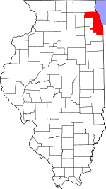 Cook County's location in Illinois | |
| Coordinates: 41°35′00″N 87°37′00″W | |
| Country | |
| State | |
| County | Cook |
| Established | 1850 |
| Government | |
| • Type | Township |
| • Body | Township Board |
| • Supervisor | Frank M. Zuccarelli |
| • Trustee | Joyce M. Washington |
| • Trustee | Stafford C. Owens |
| • Trustee | Gerald “Jerry” Jones |
| • Trustee | Norbert Cipowski |
| Area | |
| • Total | 47.42 sq mi (122.8 km2) |
| • Land | 46.93 sq mi (121.5 km2) |
| • Water | 0.49 sq mi (1.3 km2) |
| Elevation | 620 ft (189 m) |
| Population (2010) | |
| • Estimate (2016)[1] | 167,812 |
| • Density | 3,608/sq mi (1,393.2/km2) |
| Time zone | UTC-6 (CST) |
| • Summer (DST) | UTC-5 (CDT) |
| ZIP codes | 60406, 60409, 60419, 60425, 60426, 60429, 60430, 60438, 60469, 60473, 60476, 60633, 60827 |
| Area code | 708 |
| FIPS code | 17-031-75198 |
| GNIS feature ID | 0422238 |
| Website | thorntontownship |
Incorporated in 1850, it is located immediately south of the city of Chicago. It is the second most populous township in Illinois as of the 2010 census, after Rockford Township (pop. 178,527) in Winnebago County.[2]
The village of South Holland serves as the governmental seat of Thornton Township. The township is named after the village of Thornton, located in the south central portion of the township. Many parts of the township carry names inspired by the village's name, including the three high schools of Thornton Township District 205: Thornton Township High School in Harvey; Thornwood High School in South Holland; Thornridge High School in Dolton; Thornton Fractional South High School in Lansing; Thornton Fractional North High School in Calumet City and Thornton Fractional Center for Academics and Technology also in Calumet City. Supervisor Frank M. Zuccarelli was voted Supervisor of the Year in 2007 by the Township Officials of Illinois for his outstanding service to the residents of Thornton Township.
Geography
According to the United States Census Bureau, Thornton Township covers an area of 47.42 square miles (122.81 km2); of this, 46.93 square miles (121.54 km2) is land and 0.49 square miles (1.27 km2) (1.03 percent) is water.[2]
Boundaries
Thornton Township is bordered by Western Avenue on the west, 138th Street on the north, the Indiana state line on the east, and 183rd/186th Street on the south.
Cities and villages
- Blue Island (southern edge)
- Burnham
- Calumet City
- Dixmoor
- Dolton
- East Hazel Crest
- Glenwood (northern quarter)
- Harvey (vast majority)
- Hazel Crest (small portion)
- Homewood (northeast half)
- Lansing (northern half)
- Markham (eastern quarter)
- Phoenix
- Posen (eastern edge)
- Riverdale (southern half)
- South Holland
- Thornton
Adjacent townships
- North Township, Lake Co., Indiana (east)
- Bloom Township (south)
- Rich Township (southwest)
- Bremen Township (west)
- Calumet Township (northwest)
- Worth Township (northwest)
Cemeteries
The township contains these 11 cemeteries: Berger, First Reformed of Lansing, Glen Oak, Hazelwood, Holy Cross Catholic, Homewood Memorial Gardens, Mount Forest, Oak Lawn, Oak Ridge, Oakland and Washington Memory Gardens.
Major highways
Airports and landing strips
- Ingalls Memorial Hospital Heliport
Lakes
- Green Lake
- Homewood Lake
- Izaak Walton Lake
- Powder Horn Lake
- Swets Lake
- Wampum Lake
Forest Preserves
The following are all part of the Cook County Forest Preserves:
- Brownell Woods
- Burnham Woods
- Calumet Woods
- Green Lake Woods
- Kickapoo Meadows
- Shabbona Woods
- Wampum Lake Woods
- Wentworth Woods
Colleges
Political districts
- Illinois' 1st congressional district
- State House District 28
- State House District 29
- State House District 30
- State House District 34
- State House District 38
- State House District 80
- State Senate District 14
- State Senate District 15
- State Senate District 17
- State Senate District 19
- State Senate District 40
References
- "Thornton Township, Cook County, Illinois". Geographic Names Information System. United States Geological Survey. Retrieved 2010-01-10.
- United States Census Bureau 2007 TIGER/Line Shapefiles
- United States National Atlas
- "Population and Housing Unit Estimates". Retrieved June 9, 2017.
- "Geographic Identifiers: 2010 Demographic Profile Data (DP-1): Thornton township, Cook County, Illinois". U.S. Census Bureau, American Factfinder. Archived from the original on February 10, 2020. Retrieved March 21, 2013.
- "Census of Population and Housing". Census.gov. Retrieved June 4, 2016.
External links
- Thornton Township official website
- Township Officials of Illinois
- Cook County official site
- City-Data.com
- Illinois State Archives