Bremen Township, Cook County, Illinois
Bremen Township is one of 29 townships in Cook County, Illinois, USA. As of the 2010 census, its population was 110,118.[2] It was organized in 1850 and is located southwest of Chicago in southern Cook County. An administrative office for Bremen Township is located at 16361 South Kedzie Parkway, Markham, Illinois.
Bremen Township | |
|---|---|
 Seal | |
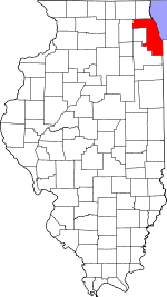
 Location in Cook County | |
 Cook County's location in Illinois | |
| Coordinates: 41°36′15″N 87°44′02″W | |
| Country | United States |
| State | Illinois |
| County | Cook |
| Area | |
| • Total | 37.8 sq mi (98.0 km2) |
| • Land | 37.7 sq mi (97.7 km2) |
| • Water | 0.1 sq mi (0.3 km2) 0.30% |
| Elevation | 640 ft (195 m) |
| Population (2010) | |
| • Estimate (2016)[1] | 109,672 |
| • Density | 2,919/sq mi (1,127.1/km2) |
| Time zone | UTC-6 (CST) |
| • Summer (DST) | UTC-5 (CDT) |
| ZIP codes | 60406, 60426, 60428, 60429, 60430, 60445, 60452, 60462, 60463, 60469, 60472, 60477, 60478 |
| FIPS code | 17-031-07939 |
| Website | brementownship |
This south suburban Cook County township includes the communities of:
As well as parts of:
- Posen (the remaining portion lies in Thornton Township)
- Blue Island (the remaining portion lies in Worth Township)
- Robbins (the remaining portion lies in Worth Township)
- Homewood (the remaining portion lies in both Thornton Township and Rich Township)
- Orland Park (the extreme eastern edge of Orland Park, the remaining 99% lies in mostly Orland Township with small portions in Palos Township and Frankfort Township)
- Tinley Park (which also has a large portion in Orland Township with smaller sections in Rich Township and Frankfort Township, Will County)
- Crestwood (the remaining portion lies in Worth Township)
- Hazel Crest (the remaining portion lies in both Thornton Township and Rich Township)
- Markham (the remaining portion lies in Thornton Township)
- Country Club Hills (the remaining portion lies in Rich Township)
- Harvey (the extreme western edge of Harvey, the remaining 99% lies in Thornton Township)
Geography
According to the United States Census Bureau, Bremen Township covers an area of 37.8 square miles (98.0 km2); of this, 37.7 square miles (97.7 km2) is land and 0.12 square miles (0.3 km2), or 0.30 percent, is water.[2]
Bremen Township is bordered by Harlem Avenue (Illinois Route 43) on the west, 135th Street on the north, Western Avenue on the east and 183rd Street on the south.
Adjacent townships
- Worth Township (north)
- Calumet Township (northeast)
- Thornton Township (east)
- Bloom Township (southeast)
- Rich Township (south)
- Frankfort Township, Will County (southwest)
- Orland Township (west)
- Palos Township (northwest)
Cemeteries
The township contains six cemeteries: Bachelor Grove, County, Lewis Memorial Park, Saint Gabriel Catholic, Trinity Evangelical Lutheran and Zion Lutheran.
Major highways
Lakes
- Dolphin Lake
- Twin Lakes (Oak Forest)
Demographics
| Historical population | |||
|---|---|---|---|
| Census | Pop. | %± | |
| Est. 2016 | 109,672 | [1] | |
| U.S. Decennial Census[3] | |||
At the time of the 2010 census, with a population of 110,575 residents, Bremen Township was:
- White: 57.9%
- Black: 32.0%
- American Indian and Alaska Native: 0.2%
- Asian: 1.9%
- Native Hawaiian and Other Pacific Islander: 0.03%
- Some other race: 5.8%
- Two or more races: 2.1%
- Hispanic or Latino (any race): 13.4%[4]
Education
The public high school district for most of Bremen Township is Bremen Community High School District 228 which includes Oak Forest High School, Bremen High School, Tinley Park High School, and Hillcrest High School.
References
- "Bremen Township, Cook County, Illinois". Geographic Names Information System. United States Geological Survey. Retrieved 2010-01-10.
- United States Census Bureau 2007 TIGER/Line Shapefiles
- United States National Atlas
- "Population and Housing Unit Estimates". Retrieved June 9, 2017.
- "Geographic Identifiers: 2010 Demographic Profile Data (DP-1): Bremen township, Cook County, Illinois". U.S. Census Bureau, American Factfinder. Archived from the original on February 12, 2020. Retrieved March 20, 2013.
- "Census of Population and Housing". Census.gov. Retrieved June 4, 2016.
- "Profile of General Population and Housing Characteristics: 2010 Demographic Profile Data (DP-1): Bloom township, Cook County, Illinois". U.S. Census Bureau, American Factfinder. Archived from the original on February 12, 2020. Retrieved March 20, 2013.
External links
- Bremen Township official website
- City-Data.com
- Illinois State Archives
- Township Officials of Illinois
- Cook County Official Site