Interstate 294
Interstate 294 (I-294) is a tolled auxiliary Interstate Highway in northeastern Illinois. It forms the southern portion of the Tri-State Tollway in Illinois. I-294 runs from South Holland at I-80/I-94, and Illinois Route 394 (IL 394) to Northbrook at I-94. I-294 is 53.42 miles (85.97 km) long; 5.32 miles (8.56 km) are shared with I-80.[1] It serves as a bypass around the city of Chicago. I-294 is also the longest auxiliary route of I-94, at 10 miles (16 km) longer than I-494 in Minneapolis–Saint Paul. In addition the tollway is the longest auxiliary Interstate Highway in Illinois.
| ||||
|---|---|---|---|---|
| Tri-State Tollway | ||||
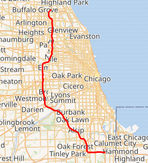
I-294 highlighted in red | ||||
| Route information | ||||
| Auxiliary route of I-94 | ||||
| Maintained by ISTHA | ||||
| Length | 53.45 mi[1] (86.02 km) | |||
| Existed | 1957–present | |||
| History | Completed 1968 | |||
| Major junctions | ||||
| South end | ||||
| ||||
| North end | ||||
| Location | ||||
| Counties | Cook | |||
| Highway system | ||||
| ||||

Route description
I-294 has four of the Tri-State Tollway's six mainline barriers. These are located at:
- 163rd Street
- 82nd Street (southbound) and 83rd Street (northbound)
- Cermak Road
- Irving Park Road (IL 19; southbound) and Touhy Avenue (northbound)
The other two barriers are on I-94.
History
.jpg)
The portion of the Borman Expressway that was completed from Gary westward and the Kingery Expressway were originally designated as I-80, I-90, and I-294 from shortly after the Interstate Highway program was enacted until about 1965, when the connection between the Borman and the Indiana Toll Road was completed, and I-90 was swapped with I-94 west of that junction (and east of where those routes share the same road in Chicago), cutting back I-294 to its current south terminus (eliminating the Indiana part of I-294). Indiana later proposed to extend I-294 east on the current Borman Expressway to Indiana State Route 912, before having it turn north at that point, west at U.S. Route 12, and then back to I-94, most likely somewhere on the Bishop Ford Freeway near 130th Street. The request was denied.
I-294 was built largely before the growth and maturation of the suburbs that run along the corridor. As a result, the vast majority of the interchanges are partial, or were configured to have entrance ramps feeding the toll plazas. Gaps between exit ramps are common, the 6.5-mile (10.5 km) gap between Cicero Avenue (IL 50/IL 83) and 95th Street (US 12/US 20) being one of the more notable ones. Partial interchanges are located at Roosevelt Road (IL 38; northbound exit, southbound entrance), Irving Park Road (IL 19) (southbound exit, northbound entrance), Touhy Avenue (northbound exit, southbound entrance), Dempster Street (US 14; northbound exit, southbound entrance), and Golf Road (IL 58; southbound exit, northbound entrance). Several former partial interchanges have been converted to full interchanges, with automated toll collection facilities on the new ramps, such as at 159th Street (US 6; northbound on and southbound off added) and 95th Street (US 12/US 20; southbound on and northbound off added). The 79th Street exit was moved to 75th Street/Willow Springs Road, and made a complete interchange in the same manner.
From 1992-1993, the central portion of I-294 between Balmoral and 95th Street was widened to eight lanes.[2] Between 2006-2009, the southern and northern portions of I-294 (IL-394 to 95th Street and I-90 to Lake Cook Road respectively) were fully reconstructed and expanded, bringing the entire highway up to eight lanes.
ISTHA and the Illinois Department of Transportation (IDOT) are partnering to construct a new interchange to connect I-294 to I-57. The primary interchange connections between I-294 and I-57 were completed in 2014, while the remaining ramps will be completed in 2022.[3]
The central portion of I-294 between Balmoral Avenue and 95th Street is currently being reconstructed and widened to a five/six lane cross section, with the inside shoulder being a flex lane that can be used during emergencies or heavy congestion. The work also includes reconfiguring the interchange with I-88/290. The entire project is scheduled to be completed in 2026.[4]
Exit list
The entire route is in Cook County.
| Location | mi[1][5] | km | Exit[6] | Destinations | Notes | |
|---|---|---|---|---|---|---|
| Lansing | 0.00 | 0.00 | Southern terminus; southern end of I-80 concurrency; southern end of US 6 concurrency (NB lanes only) | |||
| 161 | Exit number follows I-80; no southbound entrance; northern end of US 6 concurrency (NB lanes only); only free exit northbound | |||||
| Lansing–Thornton Township line | 0 | Southbound exit and northbound entrance; southern terminus of Tri-State Tollway; I-94 exit 74B | ||||
| South Holland | 0.90 | 1.45 | Chicago Southland Lincoln Oasis | |||
| East Hazel Crest | 2.83 | 4.55 | 2 | Signed as exits 2A (north) and 2B (south) | ||
| 4.33 | 6.97 | 4 | Dixie Highway | Southbound exit and northbound entrance | ||
| Hazel Crest | 5.26 | 8.47 | 5 | Northern end of I-80 concurrency; I-80 exit 155 | ||
| 5.81 | 9.35 | 163rd Street Toll Plaza | ||||
| Markham | 6.48 | 10.43 | 6 | Signed as exits 6A (east) and 6B (west) | ||
| Blue Island | 7.75 | 12.47 | 7 | I-Pass only; southbound exit and northbound entrance; full interchange opening 2023–24; I-57 exit 349 | ||
| 8.33 | 13.41 | 8 | I-Pass only; southbound exit and northbound entrance | |||
| Alsip | 12.13 | 19.52 | 12 | Signed as exits 12A (south) and 12B (north) | ||
| Hickory Hills | 17.63 | 28.37 | 17 | Signed as exits 17A (east) and 17B (west) southbound; no northbound signage for 76th Avenue | ||
| 19.37 | 31.17 | 83rd Street Toll Plaza (northbound) | ||||
| 19.78 | 31.83 | 82nd Street Toll Plaza (southbound) | ||||
| Justice | Future interchange | |||||
| 20.45 | 32.91 | — | Southbound entrance only | |||
| Des Plaines River | 21.20– 21.88 | 34.12– 35.21 | Mile-Long Bridge | |||
| Hodgkins | 22.04– 22.28 | 35.47– 35.86 | 22 | 75th Street / Willow Springs Road | ||
| Indian Head Park | 23.20– 24.24 | 37.34– 39.01 | 23 | Signed as Exit 23A (north) and Exit 23B (south) northbound; no exit number southbound; no southbound entrance from I-55 south. (Access from I-55 South to I-294 South is via US 12-20-45 La Grange Rd. and is signed as such on I-55.); I-55 exit 277; southbound exit and northbound entrance provide access from and to Joliet Road | ||
| 23.42 | 37.69 | 23B | Wolf Road | Northbound exit and southbound entrance | ||
| Hinsdale | 25.13 | 40.44 | Hinsdale Oasis | |||
| Western Springs | 27.57 | 44.37 | 27 | Signed as exits 27A (east) and 27B (west) | ||
| Oak Brook | 29.40 | 47.31 | 29 | Northbound exit and southbound entrance; I-88 exit 138 | ||
| 29.63 | 47.68 | 29 | Cermak Road (22nd Street) | Southbound exit and northbound entrance | ||
| 30.00 | 48.28 | Cermak Road Toll Plaza | ||||
| Hillside | 30.64 | 49.31 | 30 | Northbound exit and southbound entrance; signed as exits 30A (east) and 30B (west) | ||
| 31.15 | 50.13 | 31A | Southbound exit and northbound entrance | |||
| Berkeley | 31.74 | 51.08 | 31B | Signed as exit 31 northbound; I-290 exit 15 | ||
| Elmhurst | 33.76 | 54.33 | 33 | Signed as exit 31 northbound; I-290 exit 13A | ||
| Bensenville | Future interchange | |||||
| Schiller Park | 37.96 | 61.09 | O'Hare Oasis (Gas station only) | |||
| 38.41 | 61.81 | 38 | Southbound exit and northbound entrance; signed as exits 38A (east) and 38B (west) | |||
| 38.89 | 62.59 | Irving Park Toll Plaza (southbound) | ||||
| Rosemont | 39.91 | 64.23 | 39 | Balmoral Avenue | I-Pass only on northbound exit ramp; northbound exit and southbound entrance | |
| 40.42 | 65.05 | 40A | Signed as exit 40 northbound; I-190 exits 1C-D; northbound exit to River Road only | |||
| 40.88 | 65.79 | 40B | Signed as exit 40 northbound; I-90 exits 77 and 78 | |||
| Park Ridge | 41.64 | 67.01 | Touhy Avenue Toll Plaza (northbound) | |||
| 42.28 | 68.04 | 42 | Touhy Avenue | Northbound exit and southbound entrance; signed as exits 42A (east) and 42B (west) | ||
| Des Plaines | 44.32 | 71.33 | 44 | Northbound exit and southbound entrance; signed as exits 44A (east) and 42B (west) | ||
| 45.34 | 72.97 | 45 | Southbound exit and northbound entrance | |||
| Glenview | 49.02 | 78.89 | 48 | Willow Road | ||
| Northbrook | 52.75 | 84.89 | 52 | Lake Cook Road | Northbound exit and southbound entrance | |
| — | Northern terminus; northbound exit and southbound entrance; I-94 exit 25B | |||||
1.000 mi = 1.609 km; 1.000 km = 0.621 mi
| ||||||
References
- Illinois Technology Transfer Center (2006). "T2 GIS Data". Retrieved November 8, 2007.
- P. Davis Szymczak (September 27, 1991). "Widening of Tri-State could begin in October". Chicago Tribune. Retrieved April 18, 2010.
- "I-294/I-57 Interchange Project - Phase 2". Retrieved 12 August 2020.
- "Central Tri-State Tollway (I-294) Project". Retrieved 12 August 2020.
- Illinois State Toll Highway Authority. System Map (Map). Downers Grove: Illinois State Toll Highway Authority. Archived from the original on January 24, 2009. Retrieved January 23, 2009.
- "Toll Rates by Plaza (For Years 2009+)" (PDF). Illinois State Toll Highway Authority. Archived from the original (PDF) on January 12, 2009. Retrieved January 23, 2009.
External links
| Wikimedia Commons has media related to Interstate 294. |