Tai To Yan
Tai To Yan (Chinese: 大刀屻) is a mountain that lies in northern Hong Kong near Fanling. It is close to a similarly named peak called Pak Tai To Yan.[1]
| Tai To Yan, Hong Kong | |
|---|---|
| 大刀屻 | |
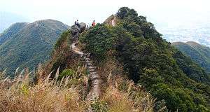 Ridge of Tai To Yan | |
| Highest point | |
| Elevation | 566 m (1,857 ft) Hong Kong Principal Datum |
| Coordinates | 22°27′0.92″N 114°7′5.24″E |
| Geography | |
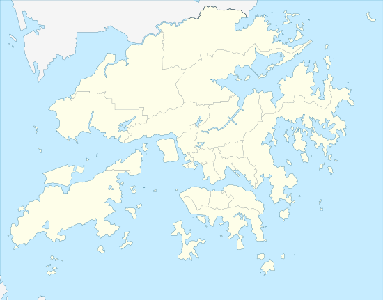 Tai To Yan, Hong Kong Location of Tai To Yan in Hong Kong | |
| Location | |
Geography
Tai To Yan is 566 metres tall and is the tallest mountain in the nearby area.
Access
Tai To Yan is in the Lam Tsuen Country Park in northern Hong Kong. It is hiked as part of the Razors Edge Ridge Hike which brings hikers to both Tai To Yan (566 m) and nearby Pak Tai To Yan (480 m).[2] Hikers can start their hike near Kadoorie Farm and finish a few hours later at Fanling MTR Station.
References
- "Tai To Yan‧Oasistrek". www.oasistrek.com. Retrieved 2019-12-16.
- "WalkOnHill‧Tai To Yan". WalkOnHill. Retrieved 2019-12-16.
| Wikimedia Commons has media related to Tai To Yan. |
| 900 meters or more | |
|---|---|
| 800 to 899 meters | |
| 700 to 799 meters | |
| 600 to 699 meters |
|
| 500 to 599 meters |
|
| 400 to 499 meters (excerpt) |
|
| 300 to 399 meters (excerpt) |
|
| 200 to 299 meters (excerpt) |
|
| 100 to 199 meters (excerpt) |
|
| 99 meters or less (excerpt) |
|
| Collectively |
|
This article is issued from Wikipedia. The text is licensed under Creative Commons - Attribution - Sharealike. Additional terms may apply for the media files.