Strathpine, Queensland
Strathpine is a suburb in the Moreton Bay Region, Queensland, Australia.[2] It is home to the Pine Rivers District offices of the Moreton Bay Region as well as many businesses. The area is home to Strathpine Centre, a medium-sized urban shopping centre.
| Strathpine Moreton Bay Region, Queensland | |||||||||||||||
|---|---|---|---|---|---|---|---|---|---|---|---|---|---|---|---|
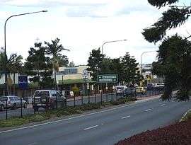 Gympie Road, Strathpine | |||||||||||||||
 Strathpine | |||||||||||||||
| Coordinates | 27°18′06″S 152°59′20″E | ||||||||||||||
| Population | 9,503 (2016 census)[1] | ||||||||||||||
| Established | 1860s | ||||||||||||||
| Postcode(s) | 4500 | ||||||||||||||
| Location | 22 km (14 mi) from Brisbane | ||||||||||||||
| LGA(s) | Moreton Bay Region | ||||||||||||||
| State electorate(s) | Pine Rivers | ||||||||||||||
| Federal Division(s) | Dickson | ||||||||||||||
| |||||||||||||||
History
Strathpine is a Scottish place name, where strath means valley and pine refers to the Pine River.[2]
The area now known as Strathpine was originally developed in the 1860s as an addition to the North Pine settlement during the Gympie gold rush. In the late 19th century, the area was known for sugar and rum production, with several sugar mills and distilleries in the area. The area was first named Strathpine by the Queensland Government Railways in the 1880s.[3]
From 1889 to 2008, Strathpine was the administrative centre of the Pine Rivers Shire Council (formerly known as the Pine Division and the Shire of Pine). Although Pine Rivers Shire was amalgamated in 2008 into the Moreton Bay Regional Council, council offices are still located in the suburb.
The population of the area boomed in the 1940s after the opening of 'Camp Strathpine'[4] a large army camp and airfield which helped both Australian and American forces during World War II. Modern-day Spitfire Avenue occupies the area where one of three airfields constructed in the region during World War II had resided.[5][6] Development slowly increased until the 1960s when Brisbane’s rapidly growing population expanded into the area. Most of the farms were sold off and the area quickly grew into a residential and commercial hub.
Growth continued into the 1980s and Strathpine Centre opened on 22 August 1983, known as Westfield Strathpine until 2015. The Strathpine Library opened in 1990.[7] In recent years, the main road which passes through Strathpine (Gympie Road) has undergone gentrification or urban renewal. Gympie Road is tree-lined with trees of Pine species.
Over recent years, the suburb has been becoming diverse. Households that speak other languages than English has increased, with some of the most common being Samoan, Hindi, Tagalog, Mandarin and Filipino.
Heritage listings
Strathpine has a number of heritage-listed sites, including:
- 238 Gympie Road: former Pine Rivers Shire Hall[8]
Amenities
The Moreton Bay Regional Council operates a public library at 1 Station Road.[9]
Education
The Strathpine area is home to several schools including:
- Strathpine State School
- Strathpine West State School. This school was opened on 27 January 1981.[10]
- Pine Rivers State High School
Transport
Public transport
Strathpine has two railway stations: Strathpine railway station in the south of the suburb and Bray Park railway station in the north of the suburb.[11] They are on the Queensland Rail City network's Caboolture and Redcliffe Peninsula railway lines with frequent services to Brisbane, Caboolture and Redcliffe.
Strathpine Bus Station at Strathpine Centre has many services frequently departing to other surrounding suburbs, Redcliffe, Chermside and Toombul.
Demographics
In the 2011 census, Strathpine recorded a population of 9,278 people, 49.8% female and 50.2% male.[12]
The median age of the Strathpine population was 35 years, 2 years below the national median of 37.[12]
76.7% of people living in Strathpine were born in Australia. The other top responses for country of birth were New Zealand 5.4%, England 3.2%, Philippines 1.1%, Fiji 0.8%, India 0.7%.[12]
87.9% of people spoke only English at home; the next most common languages were 1.1% Samoan, 0.9% Hindi, 0.5% Tagalog, 0.5% Mandarin, 0.3% Filipino.[12]
References
- Australian Bureau of Statistics (27 June 2017). "Strathpine (State Suburb)". 2016 Census QuickStats. Retrieved 18 April 2018.

- "Strathpine (entry 45471)". Queensland Place Names. Queensland Government. Retrieved 14 July 2014.
- Moreton Bay Regional Council. "Strathpine - Brendale". Archived from the original on 6 April 2012. Retrieved 8 December 2011.
- Moreton Bay Regional Council. "Camp Strathpine". Archived from the original on 14 April 2018. Retrieved 3 May 2017.
- Moreton Bay Regional Council. "Our History - Pine Rivers District". Archived from the original on 3 April 2017. Retrieved 3 May 2017.
- "Petrie-Strathpine Airfields Brisbane, Qld During WW2". Australia at War. Archived from the original on 14 April 2017. Retrieved 3 May 2017.
- "Queensland Public Libraries Statistical Bulletin 2016-2017" (PDF). Public Libraries Connect. State Library of Queensland. November 2017. p. 14. Archived (PDF) from the original on 30 January 2018. Retrieved 22 January 2018.
- "Pine Rivers Shire Hall (former) (entry 600768)". Queensland Heritage Register. Queensland Heritage Council. Retrieved 11 July 2013.
- "Strathpine Library". Public Libraries Connect. State Library of Queensland. 5 October 2017. Archived from the original on 23 January 2018. Retrieved 22 January 2018.
- "Opening and closing dates of Queensland Schools". Queensland Government. Retrieved 18 April 2019.
- "Queensland Globe". State of Queensland. Retrieved 10 December 2018.
- Australian Bureau of Statistics (31 October 2012). "Strathpine (SSC)". 2011 Census QuickStats. Retrieved 14 July 2014.