South Creake
South Creake is a village and civil parish in north west Norfolk, England. The village lies 1 1⁄2 miles (2.4 km) south of its twin village of North Creake, and some 5 miles (8 km) north-west of the town of Fakenham.
| South Creake | |
|---|---|
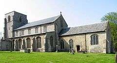 Our Lady St Mary, South Creake | |
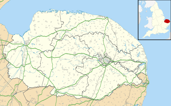 South Creake Location within Norfolk | |
| Area | 20.18 km2 (7.79 sq mi) |
| Population | 516 (2011) |
| • Density | 26/km2 (67/sq mi) |
| OS grid reference | TF861355 |
| Civil parish |
|
| District | |
| Shire county | |
| Region | |
| Country | England |
| Sovereign state | United Kingdom |
| Post town | FAKENHAM |
| Postcode district | NR21 |
| Police | Norfolk |
| Fire | Norfolk |
| Ambulance | East of England |
| UK Parliament | |
South Creake lies on the River Burn, which flows through the centre of the village. On a hill above the village can be found the Bloodgate Hill Iron Age Fort.
The civil parish has an area of 7.79 square miles (20.2 km2) and in the 2001 census had a population of 536 in 245 households, reducing to a population of 516 at the 2011 census.[1] For the purposes of local government, the parish falls within the district of King's Lynn and West Norfolk.[2]
Notable people from South Creake include DJ and Producer Creake & Vibez.
Notes
- "Civil Parish population 2011". Retrieved 29 August 2015.
- Office for National Statistics & Norfolk County Council (2001). Census population and household counts for unparished urban areas and all parishes Archived 11 February 2017 at the Wayback Machine. Retrieved December 2, 2005.
External links
| Wikimedia Commons has media related to South Creake. |
- Map sources for South Creake
- South Creake village signpost
This article is issued from Wikipedia. The text is licensed under Creative Commons - Attribution - Sharealike. Additional terms may apply for the media files.