Shiloh, New Jersey
Shiloh is a borough in Cumberland County, New Jersey, United States. It is part of the Vineland-Millville-Bridgeton Primary Metropolitan Statistical Area for statistical purposes. As of the 2010 United States Census, the borough's population was 516,[9][10][11] reflecting a decline of 18 (-3.4%) from the 534 counted in the 2000 Census, which had in turn increased by 126 (+30.9%) from the 408 counted in the 1990 Census.[20]
Shiloh, New Jersey | |
|---|---|
| Borough of Shiloh | |
 Noyes Service Center in 1992 | |
 Shiloh highlighted in Cumberland County. Inset map: Cumberland County highlighted in the State of New Jersey. | |
 Census Bureau map of Shiloh, New Jersey | |
| Coordinates: 39.462259°N 75.29252°W[1][2] | |
| Country | |
| State | |
| County | Cumberland |
| Incorporated | April 9, 1929 |
| Government | |
| • Type | Borough |
| • Body | Borough Council |
| • Mayor | Brad Campbell (R, term ends December 31, 2020)[4][5] |
| • Municipal clerk | Ronald Campbell Sr.[6] |
| Area | |
| • Total | 1.20 sq mi (3.12 km2) |
| • Land | 1.20 sq mi (3.12 km2) |
| • Water | 0.00 sq mi (0.00 km2) 0.05% |
| Area rank | 485th of 566 in state 14th of 14 in county[1] |
| Elevation | 112 ft (34 m) |
| Population | |
| • Total | 516 |
| • Estimate (2019)[12] | 487 |
| • Rank | 555th of 566 in state 14th of 14 in county[13] |
| • Density | 404.82/sq mi (156.28/km2) |
| • Density rank | 454th of 566 in state 4th of 14 in county[13] |
| Time zone | UTC−05:00 (Eastern (EST)) |
| • Summer (DST) | UTC−04:00 (Eastern (EDT)) |
| ZIP Code | |
| Area code(s) | 856 exchanges: 451, 455[16] |
| FIPS code | 3401167020[1][17][18] |
| GNIS feature ID | 0885393[1][19] |
| Website | www |
Shiloh was incorporated as a borough by an act of the New Jersey Legislature on April 9, 1929, from portions of Hopewell Township and Stow Creek Township, based on the results of a referendum held on May 16, 1929.[21][22] The borough was named for the Civil War Battle of Shiloh.[23]
It is a dry town, where alcohol cannot be sold, though alcohol is available at the winery in the borough.[24][25]
History
The settlement of Shiloh was founded in 1705 by Robert Ayars. He brought over 2,000 Seventh Day Baptists from Rhode Island to be free of religious persecution.[26][27] Known as Cohansey Crossing when a church was formed in the area in 1737, the name Shiloh was adopted in 1771.[28]
When Cumberland County, New Jersey was formed in 1748, the community of Shiloh was divided between Hopewell Township and Stow Creek Township.[29]
As part of a political battle over the site of the county seat for Cumberland County, Columbia Township was formed on March 12, 1844, from portions of Hopewell and Stow Creek Townships; the short-lived municipality included all of present-day Shiloh, in addition to extensive additional land, but all was returned to its original home when Columbia Township was dissolved on March 11, 1845, surviving as an independent municipality for a day short of one year.[21][29]
Geography
According to the United States Census Bureau, the borough had a total area of 1.209 square miles (3.129 km2), including 1.208 square miles (3.128 km2) of land and 0.001 square miles (0.002 km2) of water (0.05%).[1][2]
Shiloh borders Hopewell Township and Stow Creek Township.[30][31]
Demographics
| Historical population | |||
|---|---|---|---|
| Census | Pop. | %± | |
| 1930 | 401 | — | |
| 1940 | 387 | −3.5% | |
| 1950 | 427 | 10.3% | |
| 1960 | 554 | 29.7% | |
| 1970 | 573 | 3.4% | |
| 1980 | 604 | 5.4% | |
| 1990 | 408 | −32.5% | |
| 2000 | 534 | 30.9% | |
| 2010 | 516 | −3.4% | |
| Est. 2019 | 487 | [12] | −5.6% |
| Population sources:1930-2010[32][33] 1930[34] 1930-1990[35] 2000[36][37] 2010[9] | |||
Census 2010
The 2010 United States Census counted 516 people, 198 households, and 138.006 families in the borough. The population density was 427.3 per square mile (165.0/km2). There were 214 housing units at an average density of 177.2 per square mile (68.4/km2). The racial makeup was 93.80% (484) White, 1.74% (9) Black or African American, 2.33% (12) Native American, 0.19% (1) Asian, 0.00% (0) Pacific Islander, 0.58% (3) from other races, and 1.36% (7) from two or more races. Hispanic or Latino of any race were 4.07% (21) of the population.[9]
Of the 198 households, 27.8% had children under the age of 18; 51.0% were married couples living together; 14.1% had a female householder with no husband present and 30.3% were non-families. Of all households, 24.7% were made up of individuals and 12.1% had someone living alone who was 65 years of age or older. The average household size was 2.61 and the average family size was 3.10.[9]
21.1% of the population were under the age of 18, 7.0% from 18 to 24, 26.0% from 25 to 44, 30.4% from 45 to 64, and 15.5% who were 65 years of age or older. The median age was 42.0 years. For every 100 females, the population had 85.6 males. For every 100 females ages 18 and older there were 89.3 males.[9]
As of the 2010 United States Census, the borough's population was 516,[9][10][11] reflecting a decline of 18 (-3.4%) from the 534 counted in the 2000 Census, which had in turn increased by 126 (+30.9%) from the 408 counted in the 1990 Census.[38]
The Census Bureau's 2006-2010 American Community Survey showed that (in 2010 inflation-adjusted dollars) median household income was $61,000 (with a margin of error of +/- $18,454) and the median family income was $63,594 (+/- $11,716). Males had a median income of $44,375 (+/- $18,670) versus $32,105 (+/- $13,923) for females. The per capita income for the borough was $23,003 (+/- $4,509). About 7.0% of families and 8.7% of the population were below the poverty line, including 18.6% of those under age 18 and 10.7% of those age 65 or over.[39]
Census 2000
As of the 2000 United States Census[17] there were 534 people, 194 households, and 152 families residing in the borough. The population density was 446.7 people per square mile (171.8/km2). There were 204 housing units at an average density of 170.6 per square mile (65.6/km2). The racial makeup of the borough was 95.13% White, 2.62% African American, 0.56% Native American, 0.00% from other races, and 1.69% from two or more races. Hispanic or Latino of any race were 3.00% of the population.[36][37]
There were 194 households, out of which 34.5% had children under the age of 18 living with them, 62.9% were married couples living together, 11.9% had a female householder with no husband present, and 21.6% were non-families. 18.0% of all households were made up of individuals, and 7.2% had someone living alone who was 65 years of age or older. The average household size was 2.75 and the average family size was 3.09.[36][37]
In the borough the population was spread out, with 24.5% under the age of 18, 5.8% from 18 to 24, 27.9% from 25 to 44, 26.0% from 45 to 64, and 15.7% who were 65 years of age or older. The median age was 40 years. For every 100 females, there were 88.7 males. For every 100 females age 18 and over, there were 85.7 males.[36][37]
The median income for a household in the borough was $49,191, and the median income for a family was $54,219. Males had a median income of $34,643 versus $20,000 for females. The per capita income for the borough was $16,880. 5.8% of the population and 4.1% of families were below the poverty line. Out of the total people living in poverty, 4.5% are under the age of 18 and 0.0% are 65 or older.[36][37]
Government
Local government
Shiloh is governed under the Borough form of New Jersey municipal government, which is used in 218 of 565 municipalities statewide, making it the most common form of government in New Jersey.[40] The governing body is comprised of a Mayor and a Borough Council, with all positions elected at-large on a partisan basis as part of the November general election. A Mayor is elected directly by the voters to a four-year term of office. The Borough Council is comprised of six members elected to serve three-year terms on a staggered basis, with two seats coming up for election each year in a three-year cycle.[3] The Borough form of government used by Shiloh is a "weak mayor / strong council" government in which council members act as the legislative body with the mayor presiding at meetings and voting only in the event of a tie. The mayor can veto ordinances subject to an override by a two-thirds majority vote of the council. The mayor makes committee and liaison assignments for council members, and most appointments are made by the mayor with the advice and consent of the council.[41][42]
As of 2020, the Mayor of Shiloh is Republican Brad Campbell, whose term of office ends December 31, 2020. Members of the Borough Council are Council President Dallas Bruso (R, 2021), Hillary Barile (R, 2022), Carman Daddario (R, 2022), Jeffrey E. Knerr (R, 2020), Glenn Newkirk (R, 2021) and Medeia D. Willis (R, 2020).[4][43][44][45][46][47][48]
Brad Campbell was appointed to fill the vacant mayoral seat of Harold Davis, following his death in February 2014. The council seat expiring in 2017 held by Carman Daddario became vacant following his being sworn in to serve on the Cumberland County Board of Chosen Freeholders.[49]
Federal, state and county representation
Shiloh is located in the 2nd Congressional District[50] and is part of New Jersey's 1st state legislative district.[10][51][52] Prior to the 2011 reapportionment following the 2010 Census, Shiloh had been in the 3rd state legislative district.[53]
For the 116th United States Congress, New Jersey's Second Congressional District is represented by Jeff Van Drew (R, Dennis Township).[54] New Jersey is represented in the United States Senate by Democrats Cory Booker (Newark, term ends 2021)[55] and Bob Menendez (Paramus, term ends 2025).[56][57]
For the 2020–2021 session (Senate, General Assembly), the 1st Legislative District of the New Jersey Legislature is represented in the State Senate by Mike Testa (R, Vineland) and in the General Assembly by Antwan McClellan (R, Ocean City) and Erik K. Simonsen (R, Lower Township).[58][59]
Cumberland County is governed by a seven-member Board of Chosen Freeholders, who are elected at-large in partisan elections to serve staggered three-year terms in office, with either two or three seats coming up for election each year in a three-year cycle. At an annual reorganization meeting held each January, the freeholders select one member to serve as Freeholder Director and another as Deputy Director.[60] As of 2018, Cumberland County's Freeholders are Freeholder Director Joseph Derella Jr. (D, Millville, term as freeholder and as freeholder director ends December 31, 2018),[61] Deputy Freeholder Director Darlene R. Barber (D, Upper Deerfield Township, term as freeholder ends 2019, term as deputy freeholder director ends 2018),[62] George Castellini (D, Vineland, 2020),[63] Carol Musso (D, Deerfield Township, 2020),[64] James F. Quinn (D, Millville, 2018),[65] Joseph V. Sparacio (R, Deerfield Township, 2019)[66] and Jack Surrency (D, Bridgeton 2020).[67][68][69][70] The county's constitutional officers are Clerk Celeste Riley (D, Bridgeton, 2019),[71][72] Sheriff Robert A. Austino (D, Vineland, 2020)[73][74] and Surrogate Douglas M. Rainear (D, Upper Deerfield Township, 2018).[75][76][69]
Politics
As of March 23, 2011, there were a total of 374 registered voters in Shiloh, of which 80 (21.4%) were registered as Democrats, 117 (31.3%) were registered as Republicans and 176 (47.1%) were registered as Unaffiliated. There was one voter registered to another party.[77]
In the 2012 presidential election, Republican Mitt Romney received 64.1% of the vote (159 cast), ahead of Democrat Barack Obama with 35.5% (88 votes), and other candidates with 0.4% (1 vote), among the 248 ballots cast by the borough's 365 registered voters for a turnout of 67.9%.[78][79] In the 2008 presidential election, Republican John McCain received 57.1% of the vote (160 cast), ahead of Democrat Barack Obama, who received 40.4% (113 votes), with 280 ballots cast among the borough's 371 registered voters, for a turnout of 75.5%.[80] In the 2004 presidential election, Republican George W. Bush received 66.8% of the vote (183 ballots cast), outpolling Democrat John Kerry, who received around 33.6% (92 votes), with 274 ballots cast among the borough's 352 registered voters, for a turnout percentage of 77.8.[81]
In the 2013 gubernatorial election, Republican Chris Christie received 77.8% of the vote (130 cast), ahead of Democrat Barbara Buono with 19.2% (32 votes), and other candidates with 3.0% (5 votes), among the 170 ballots cast by the borough's 342 registered voters (3 ballots were spoiled), for a turnout of 49.7%.[82][83] In the 2009 gubernatorial election, Republican Chris Christie received 56.5% of the vote (109 ballots cast), ahead of both Democrat Jon Corzine with 32.6% (63 votes) and Independent Chris Daggett with 6.7% (13 votes), with 193 ballots cast among the borough's 378 registered voters, yielding a 51.1% turnout.[84]
Education
After Shiloh School was closed following the end of the 2006–07 school year, all public school students in kindergarten through eighth grade now attend Hopewell Crest School as part of a sending/receiving relationship with the Hopewell Township School District.[85][86] As of the 2018–19 school year, the district, comprised of one school, had an enrollment of 507 students and 36.0 classroom teachers (on an FTE basis), for a student–teacher ratio of 14.1:1.[87]
Public school students in ninth through twelfth grades attend Cumberland Regional High School, which also serves students from Deerfield Township, Fairfield Township, Greenwich Township, Hopewell Township, Stow Creek Township and Upper Deerfield Township.[88][89][90] As of the 2018–19 school year, the high school had an enrollment of 1,043 students and 78.5 classroom teachers (on an FTE basis), for a student–teacher ratio of 13.3:1.[91]
Students are also eligible to attend Cumberland County Technology Education Center in Vineland, serving students from the entire county in its full-time technical training programs, which are offered without charge to students who are county residents.[92]
Transportation
_at_Buttonwood_Avenue_in_Shiloh%2C_Cumberland_County%2C_New_Jersey.jpg)
As of May 2010, the borough had a total of 5.84 miles (9.40 km) of roadways, of which 1.54 miles (2.48 km) were maintained by the municipality, 3.17 miles (5.10 km) by Cumberland County and 1.13 miles (1.82 km) by the New Jersey Department of Transportation.[93]
Route 49 (Shiloh Pike) traverses the borough for just over one mile, from north to south, connecting Hopewell Township on one side and Stow Creek Township on the other.[94]
Wineries
References
- 2010 Census Gazetteer Files: New Jersey County Subdivisions, United States Census Bureau. Accessed May 21, 2015.
- US Gazetteer files: 2010, 2000, and 1990, United States Census Bureau. Accessed September 4, 2014.
- 2012 New Jersey Legislative District Data Book, Rutgers University Edward J. Bloustein School of Planning and Public Policy, March 2013, p. 19.
- Mayor and Borough Council, Borough of Shiloh. Accessed November 1, 2019. As of date accessed, term-end dates are incorrect for the entire governing body.
- 2020 New Jersey Mayors Directory, New Jersey Department of Community Affairs. Accessed February 1, 2020.
- Municipal Clerk & Treasurer, Borough of Shiloh. Accessed May 14, 2020.
- "2019 U.S. Gazetteer Files". United States Census Bureau. Retrieved July 26, 2020.
- U.S. Geological Survey Geographic Names Information System: Borough of Shiloh, Geographic Names Information System. Accessed March 14, 2013.
- DP-1 - Profile of General Population and Housing Characteristics: 2010 for Shiloh borough, Cumberland County, New Jersey Archived February 12, 2020, at Archive.today, United States Census Bureau. Accessed October 24, 2012.
- Municipalities Sorted by 2011-2020 Legislative District, New Jersey Department of State. Accessed February 1, 2020.
- Profile of General Demographic Characteristics: 2010 for Shiloh borough Archived July 18, 2014, at the Wayback Machine, New Jersey Department of Labor and Workforce Development. Accessed October 24, 2012.
- "Population and Housing Unit Estimates". United States Census Bureau. May 24, 2020. Retrieved May 27, 2020.
- GCT-PH1 Population, Housing Units, Area, and Density: 2010 - State -- County Subdivision from the 2010 Census Summary File 1 for New Jersey Archived May 26, 2015, at Archive.today, United States Census Bureau. Accessed October 24, 2012.
- Look Up a ZIP Code for Shiloh, NJ, United States Postal Service. Accessed October 24, 2012.
- Zip Codes, State of New Jersey. Accessed August 29, 2013.
- Area Code Lookup - NPA NXX for Shiloh, NJ, Area-Codes.com. Accessed August 29, 2013.
- U.S. Census website , United States Census Bureau. Accessed September 4, 2014.
- Geographic codes for New Jersey, Missouri Census Data Center. Accessed September 1, 2019.
- US Board on Geographic Names, United States Geological Survey. Accessed September 4, 2014.
- Table 7. Population for the Counties and Municipalities in New Jersey: 1990, 2000 and 2010, New Jersey Department of Labor and Workforce Development, February 2011. Accessed July 20, 2013.
- Snyder, John P. The Story of New Jersey's Civil Boundaries: 1606-1968, Bureau of Geology and Topography; Trenton, New Jersey; 1969. p. 121. Accessed October 23, 2012.
- About Shiloh, Borough of Shiloh. Accessed October 2, 2015. "In 1929, finally, the Borough of Shiloh was incorporated as an independent municipality in Cumberland County, recognizing its historical boundaries and village center."
- Hutchinson, Viola L. The Origin of New Jersey Place Names, New Jersey Public Library Commission, May 1945. Accessed October 2, 2015.
- New Jersey Division of Alcoholic Beverage Control. New Jersey ABC list of dry towns (May 1, 2013)
- Giordano, Rita. "More towns catching liquor-license buzz; Moorestown considers ending its dry spell", The Philadelphia Inquirer, June 24, 2007. Accessed February 16, 2014.
- Sources on the Life of Robert Ayars, accessed March 13, 2007
- County's Towns Are What Makes the Region Tick, Cumberland County, New Jersey, United States. Accessed March 13, 2007.
- Shiloh Borough, Cumberland County, New Jersey. Accessed November 1, 2019. "A church was established in 1737 when the community was originally called Cohansey Crossing. The name was changed to Shiloh in 1771."
- About Shiloh, Borough of Shiloh. Accessed November 1, 2019. "Originally known as Cohansey Corners, this village was divided and became part of two townships when the New Jersey General Assembly created Cumberland County in 1748. Half was in Stow Creek and half in Hopewell."
- Map of Cumberland County, New Jersey Department of Transportation. Accessed October 28, 2019.
- New Jersey Municipal Boundaries, New Jersey Department of Transportation. Accessed November 15, 2019.
- Barnett, Bob. Population Data for Cumberland County Municipalities, 1810 - 2010, WestJersey.org. January 6, 2011. Accessed October 24, 2012.
- Cumberland County, NJ Data Book 2016, Cumberland County, New Jersey. Accessed October 31, 2019.
- Fifteenth Census of the United States : 1930 - Population Volume I, United States Census Bureau, p. 715. Accessed October 24, 2012.
- New Jersey Resident Population by Municipality: 1930 - 1990, Workforce New Jersey Public Information Network. Accessed June 28, 2015.
- Census 2000 Profiles of Demographic / Social / Economic / Housing Characteristics for Shiloh borough, New Jersey Archived January 12, 2016, at the Wayback Machine, United States Census Bureau. Accessed October 24, 2012.
- DP-1: Profile of General Demographic Characteristics: 2000 - Census 2000 Summary File 1 (SF 1) 100-Percent Data for Shiloh borough, Cumberland County, New Jersey Archived February 12, 2020, at Archive.today, United States Census Bureau. Accessed October 24, 2012.
- Table 7. Population for the Counties and Municipalities in New Jersey: 1990, 2000 and 2010, New Jersey Department of Labor and Workforce Development, February 2011. Accessed October 24, 2012.
- DP03: Selected Economic Characteristics from the 2006-2010 American Community Survey 5-Year Estimates for Shiloh borough, Cumberland County, New Jersey Archived February 12, 2020, at Archive.today, United States Census Bureau. Accessed October 24, 2012.
- Inventory of Municipal Forms of Government in New Jersey, Rutgers University Center for Government Studies, July 1, 2011. Accessed November 18, 2019.
- Cerra, Michael F. "Forms of Government: Everything You've Always Wanted to Know, But Were Afraid to Ask" Archived 2014-09-24 at the Wayback Machine, New Jersey State League of Municipalities. Accessed November 30, 2014.
- "Forms of Municipal Government in New Jersey", p. 6. Rutgers University Center for Government Studies. Accessed June 3, 2015.
- 2019 Municipal User Friendly Budget for Shiloh Borough, Burlington County, New Jersey Department of Community Affairs. Accessed November 1, 2019.
- 2018 Directory of Cumberland County, New Jersey, Cumberland County, New Jersey. Accessed September 15, 2019.
- General Election Results November 5, 2019, Official Results, Cumberland County, New Jersey, updated November 14, 2019. Accessed January 1, 2020.
- General Election Results November 6, 2018, Official Results, Cumberland County, New Jersey, updated November 19, 2018. Accessed January 1, 2019.
- General Election Results November 7, 2017, Official Results, Cumberland County, New Jersey, updated November 28, 2017. Accessed January 1, 2018.
- General Election Results November 8, 2016, Official Results, Cumberland County, New Jersey, updated November 18, 2016. Accessed January 30, 2017.
- Woods, Don E. "Deerfield Township swears in deployed committeeman over telephone", South Jersey Times, January 14, 2015. Accessed March 8, 2015. "Shiloh Borough: Republicans Medeia Willis and Brad Campbell were sworn in after winning re-election. Campbell serves as mayor but was sworn in last month, replacing Harold Davis — who died last February. Shiloh must also find someone to replace Councilman Carman Daddario, who was elected to the Cumberland County Board of Chosen Freeholders last election."
- Plan Components Report, New Jersey Redistricting Commission, December 23, 2011. Accessed February 1, 2020.
- 2019 New Jersey Citizen's Guide to Government, New Jersey League of Women Voters. Accessed October 30, 2019.
- Districts by Number for 2011-2020, New Jersey Legislature. Accessed January 6, 2013.
- 2011 New Jersey Citizen's Guide to Government Archived June 4, 2013, at the Wayback Machine, p. 64, New Jersey League of Women Voters. Accessed May 22, 2015.
- Directory of Representatives: New Jersey, United States House of Representatives. Accessed January 3, 2019.
- About Cory Booker, United States Senate. Accessed January 26, 2015. "He now owns a home and lives in Newark's Central Ward community."
- Biography of Bob Menendez, United States Senate, January 26, 2015. "He currently lives in Paramus and has two children, Alicia and Robert."
- Senators of the 116th Congress from New Jersey. United States Senate. Accessed April 17, 2019. "Booker, Cory A. - (D - NJ) Class II; Menendez, Robert - (D - NJ) Class I"
- Legislative Roster 2020–2021 Session, New Jersey Legislature. Accessed April 16, 2020.
- District 1 Legislators, New Jersey Legislature. Accessed April 16, 2020.
- About Cumberland County Government, Cumberland County, New Jersey. Accessed June 7, 2018. "By law, Cumberland County is allowed 7 freeholders, who serve staggered, overlapping three year terms. Two are elected in two successive years, three in the third year, elected from the county at-large. A Director of the Board is selected by his colleagues for a one year term."
- Joseph Derella, Cumberland County, New Jersey. Accessed June 7, 2018.
- Darlene Barber, Cumberland County, New Jersey. Accessed June 7, 2018.
- George Castellini, Cumberland County, New Jersey. Accessed June 7, 2018.
- Carol Musso, Cumberland County, New Jersey. Accessed June 7, 2018.
- James F. Quinn, Cumberland County, New Jersey. Accessed June 7, 2018.
- Joseph V. Sparacio, Cumberland County, New Jersey. Accessed June 7, 2018.
- Jack Surrency, Cumberland County, New Jersey. Accessed June 7, 2018.
- The Cumberland County Board of Chosen Freeholders, Cumberland County, New Jersey. Accessed June 7, 2018.
- 2018 Directory of Cumberland County, New Jersey, Cumberland County, New Jersey. Accessed June 7, 2018.
- 2018 County Data Sheet, Cumberland County, New Jersey. Accessed June 7, 2018.
- County Clerk: Celeste M. Riley, Cumberland County Clerk's Office. Accessed June 7, 2018.
- Members List: Clerks, Constitutional Officers Association of New Jersey. Accessed June 7, 2018.
- Sheriff's Office, Cumberland County, New Jersey. Accessed June 7, 2018.
- Members List: Sheriffs, Constitutional Officers Association of New Jersey. Accessed June 7, 2018.
- Cumberland County Surrogate Office, Cumberland County, New Jersey. Accessed June 7, 2018.
- Members List: Surrogates, Constitutional Officers Association of New Jersey. Accessed June 7, 2018.
- Voter Registration Summary - Cumberland, New Jersey Department of State Division of Elections, March 23, 2011. Accessed October 24, 2012.
- "Presidential General Election Results - November 6, 2012 - Cumberland County" (PDF). New Jersey Department of Elections. March 15, 2013. Retrieved December 24, 2014.
- "Number of Registered Voters and Ballots Cast - November 6, 2012 - General Election Results - Cumberland County" (PDF). New Jersey Department of Elections. March 15, 2013. Retrieved December 24, 2014.
- 2008 Presidential General Election Results: Cumberland County, New Jersey Department of State Division of Elections, December 23, 2008. Accessed October 24, 2012.
- 2004 Presidential Election: Cumberland County, New Jersey Department of State Division of Elections, December 13, 2004. Accessed October 24, 2012.
- "Governor - Cumberland County" (PDF). New Jersey Department of Elections. January 29, 2014. Retrieved December 24, 2014.
- "Number of Registered Voters and Ballots Cast - November 5, 2013 - General Election Results - Cumberland County" (PDF). New Jersey Department of Elections. January 29, 2014. Retrieved December 24, 2014.
- 2009 Governor: Cumberland County Archived July 7, 2016, at the Wayback Machine, New Jersey Department of State Division of Elections, December 31, 2009. Accessed October 24, 2012.
- Schools, Borough of Shiloh. Accessed July 1, 2016.
- Walsh, Daniel. "Shiloh School to close for good", Press of Atlantic City, November 30, 2006. Accessed June 8, 2008. "Shiloh's school board voted to send all of the borough's students to Hopewell Township next year as part of a one-year interlocal agreement."
- District information for Hopewell Township School District, National Center for Education Statistics. Accessed April 1, 2020.
- Cumberland Regional School District 2015 Report Card Narrative, New Jersey Department of Education. Accessed June 5, 2016. "The Cumberland Regional School District, located in Western Cumberland County, provides students with a comprehensive learning environment in a nurturing and personalized setting. The district serves students in grades 9-12 who reside in the municipalities of Deerfield, Fairfield, Greenwich & Stow Creek, Hopewell & Shiloh, and Upper Deerfield."
- Shott, Meghan. "Cumberland Regional High School", South Jersey magazine. Accessed June 5, 2016. "Cumberland Regional High School, located in the northwest part of Cumberland County, serves students from Deerfield Township, Fairfield Township, Greenwich Township, Hopewell Township, Shiloh Borough, Stow Creek Township and Upper Deerfield Township."
- Constituent Districts, Cumberland Regional High School. Accessed June 5, 2016.
- School data for Cumberland Regional High School, National Center for Education Statistics. Accessed April 1, 2020.
- Admissions, Cumberland County Technology Education Center. Accessed October 30, 2019. "We specialize in technical education to offer students a chance to explore various careers and assist them in developing the skills they need to be successful. We are a full-time high school in a state of the art facility designed to maximize learning and hands on skills."
- Cumberland County Mileage by Municipality and Jurisdiction, New Jersey Department of Transportation, May 2010. Accessed November 5, 2013.
- Route 49 Straight Line Diagram, New Jersey Department of Transportation, updated May 2017. Accessed October 31, 2019.
External links
| Wikimedia Commons has media related to Shiloh, New Jersey. |
- Borough official website
- Borough of Shiloh, Cumberland Development Corporation.
- Hopewell Crest School
- Hopewell Crest School's 2015–16 School Report Card from the New Jersey Department of Education
- School Data for the Hopewell Crest School, National Center for Education Statistics
- Cumberland Regional High School
Municipalities and communities of Cumberland County, New Jersey, United States | ||
|---|---|---|
| Cities | 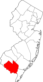 Map of New Jersey highlighting Cumberland County | |
| Borough | ||
| Townships | ||
| CDPs | ||
| Other unincorporated communities | ||