Shediac Parish, New Brunswick
Shediac is a civil parish[lower-alpha 1] in Westmorland County, New Brunswick, Canada.[2]
Shediac Shédiac | |
|---|---|
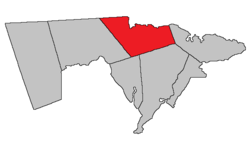 Location within Westmorland County, New Brunswick. | |
| Coordinates: 46.19°N 64.60°W | |
| Country | |
| Province | |
| County | Westmorland County |
| Established | 1827 |
| Area | |
| • Land | 196.71 km2 (75.95 sq mi) |
| Population (2016)[1] | |
| • Total | 4,789 |
| • Density | 24.3/km2 (63/sq mi) |
| • Pop 2011-2016 | |
| • Dwellings | 2,973 |
| Time zone | UTC-4 (AST) |
| • Summer (DST) | UTC-3 (ADT) |
For governance purposes it is divided between the town of Shediac, the village of Cap-Pelé, the incorporated rural community of Beaubassin East;[3], and the local service districts of Grande-Digue, Pointe-du-Chêne, Scoudouc, Scoudouc Road, Shediac Bridge-Shediac River, Shediac Cape, and the parish of Shediac.[4]
History
Shediac Parish was established from Dorchester Parish and Sackville Parish, and a small part of Westmorland Parish in 1827: it was the first parish to be given a name of native origin: the name came from a Mi'kmaq.
Delineation
Shediac Parish is defined in the Territorial Division Act[2] as being bounded:
- East by Botsford Parish, northeasterly by Northumberland Strait and the County line; south by Dorchester and Sackville Parishes, and west by the prolongation of the west line of the grant to Columb Connor on Shediac Road.[lower-alpha 2]
- Notwithstanding anything contained in paragraphs (a) and (f), the dividing line between the Parishes of Botsford and Shediac shall be as follows: Beginning on the line separating the farms of the late Fidele LeBlanc (now called the Jude Boudreau farm) and lands formerly owned by Stephen Burk, where the said line crosses the main post road[lower-alpha 3] at Cap-Pelé, and following said farm line and its prolongations north four degrees and thirty minutes east by the magnet of the year nineteen hundred and three to the shore of Northumberland Strait, and also from said place of beginning south along said farm line and its prolongations four degrees and thirty minutes west to the Cumberland grant line.
Communities
Parish population total does not include incorporated municipalities (in bold).
|
|
|
Demographics
Population
|
LanguageMother tongue (2016)[1]
| |||||||||||||||||||||||||||||||||||||||
Access routes
Highways and numbered routes that run through the parish, including external routes that start or finish at the parish limits:[7]
Notes
- Civil parishes served a variety of government functions until 1966, when the new Municipalities Act stripped them of their responsibilities; they continue to provide convenient boundaries for government uses, especially electoral districts and local service districts. Statistics Canada uses civil parishes as census subdivisions for all parts of the province that are not within municipalities and similar entities.
- Route 134
- Presumably Route 950
References
- "Census Profile, 2016 Census: Shediac, Parish [Census subdivision], New Brunswick". Statistics Canada. Retrieved August 29, 2019.
- "Chapter T-3 Territorial Division Act". Government of New Brunswick. Retrieved 23 July 2020.
- "New Brunswick Regulation 95-36 under the Municipalities Act (O.C. 95-342)". Government of New Brunswick. Retrieved 23 July 2020.
- "New Brunswick Regulation 84-168 under the Municipalities Act (O.C. 84-582)". Government of New Brunswick. Retrieved 23 July 2020.
- Statistics Canada: 2001, 2006 census
- 2011 Statistics Canada Census Profile: Shediac Parish, New Brunswick
- Atlantic Canada Back Road Atlas ISBN 978-1-55368-618-7
External links
- Rural community of Beaubassin East
- Village of Cap-Pelé
- City of Dieppe
- District de services locaux de Grande-Digue
- Town of Shediac
Places adjacent to Shediac Parish, New Brunswick | |
|---|---|
| Subdivisions |
|
|---|---|
| Cities | |
| Counties | |
| |