Dorchester Parish, New Brunswick
Dorchester is a civil parish[lower-alpha 1] in Westmorland County, New Brunswick, Canada.[2]
Dorchester | |
|---|---|
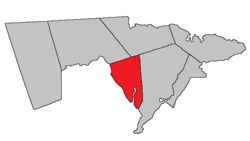 Location within Westmorland County, New Brunswick. | |
| Coordinates: 46.19°N 64.60°W | |
| Country | |
| Province | |
| County | Westmorland County |
| Established | 1787 |
| Area | |
| • Land | 90.13 km2 (34.80 sq mi) |
| Population (2016)[1] | |
| • Total | 429 |
| • Density | 4.8/km2 (12/sq mi) |
| • Change 2011-2016 | |
| • Dwellings | 231 |
| Time zone | UTC-4 (AST) |
| • Summer (DST) | UTC-3 (ADT) |
For governance purposes it is divided between the city of Dieppe;[3] the villages of Dorchester and Memramcook;[3] the Indian reserve of Fort Folly 1; and the local service district of the parish of Dorchester,[4] which further includes the special services area of Calhoun Road.
History
The parish was established in 1787 and named for Sir Guy Carleton, 1st Baron of Dorchester (1724-1808) and the governor-in-chief of British North America: included most of Shediac Parish until 1827.
Delineation
Dorchester Parish is defined in the Territorial Division Act[2] as being bounded:
- West by Petitcodiac River; north by a line running by the magnet of eighteen hundred and ninety-four; south eighty-three degrees and forty-five minutes east from the mouth of Fox Creek; east by the southeast line of lot numbered one (John Sherwood) and the prolongation thereof two hundred and fifty chains from the sea; thence north eleven degrees east by the magnet of the year seventeen hundred and sixty-five.
Communities
Parish population total does not include incorporated municipalities (in bold):
Demographics
Population
|
LanguageMother tongue (2016)[1]
| |||||||||||||||||||||||||||||||||||||||
Access routes
Highways and numbered routes that run through the parish, including external routes that start or finish at the parish limits:[7]
|
|
|
|
See also
Notes
- Civil parishes served a variety of government functions until 1966, when the new Municipalities Act stripped them of their responsibilities; they continue to provide convenient boundaries for government uses, especially electoral districts and local service districts. Statistics Canada uses civil parishes as census subdivisions for all parts of the province that are not within municipalities and similar entities.
References
- "Census Profile, 2016 Census: Dorchester, Parish [Census subdivision], New Brunswick". Statistics Canada. Retrieved October 5, 2019.
- "Chapter T-3 Territorial Division Act". Government of New Brunswick. Retrieved 23 July 2020.
- "New Brunswick Regulation 85-6 under the Municipalities Act (O.C. 85-45)". Government of New Brunswick. Retrieved 23 July 2020.
- "New Brunswick Regulation 84-168 under the Municipalities Act (O.C. 84-582)". Government of New Brunswick. Retrieved 23 July 2020.
- Statistics Canada: 2001, 2006 census
- 2011 Statistics Canada Census Profile: Dorchester Parish, New Brunswick
- Atlantic Canada Back Road Atlas ISBN 978-1-55368-618-7
Places adjacent to Dorchester Parish, New Brunswick | |
|---|---|
| Subdivisions |
|
|---|---|
| Cities | |
| Counties | |
| |