Botsford Parish, New Brunswick
Botsford is a civil parish[lower-alpha 1] in Westmorland County, New Brunswick, Canada.[2]
Botsford | |
|---|---|
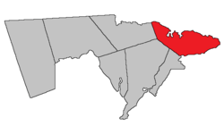 Location within Westmorland County, New Brunswick. | |
| Coordinates: 46.19°N 64.60°W | |
| Country | |
| Province | |
| County | Westmorland County |
| Established | 1805 |
| Area | |
| • Land | 304.16 km2 (117.44 sq mi) |
| Population (2016)[1] | |
| • Total | 1,058 |
| • Density | 3.5/km2 (9/sq mi) |
| • Change 2011-2016 | |
| • Dwellings | 1,045 |
| Time zone | UTC-4 (AST) |
| • Summer (DST) | UTC-3 (ADT) |
For governance purposes it is divided between the villages of Cap-Pelé and Port Elgin;[3] the incorporated rural community of Beaubassin East;[4] and the local service districts of Bayfield, Cape Tormentine, and the parish of Botsford.[5]
History
Botsford Parish erected from Sackville Parish in 1805: named for Amos Botsford (1742-1812), a Loyalist from Connecticut, who settled in Sackville.
Delineation
Botsford Parish is defined in the Territorial Division Act[2] as being bounded:
- Northeast by Northumberland Strait, south by Baie Verte; west by Westmorland County[lower-alpha 2] and a line running magnetic south by the year eighteen hundred and twenty-four to Cumberland grant line, or its northerly prolongation from the northeast angle of a tract of fourteen hundred acres, granted to Thomas Doiron and others, at the mouth of Tedish River.
Communities
Parish population total does not include incorporated municipalities (in bold).
|
|
|
Demographics
| Year | Pop. | ±% |
|---|---|---|
| 1991 | 1,328 | — |
| 1996 | 1,297 | −2.3% |
| 2001 | 1,216 | −6.2% |
| 2006 | 1,203 | −1.1% |
| 2011 | 1,074 | −10.7% |
| 2016 | 1,058 | −1.5% |
| [6][7][1] | ||
Access routes
Highways and numbered routes that run through the parish, including external routes that start or finish at the parish limits:[8]
|
|
|
|
See also
Notes
- Civil parishes served a variety of government functions until 1966, when the new Municipalities Act stripped them of their responsibilities; they continue to provide convenient boundaries for government uses, especially electoral districts and local service districts. Statistics Canada uses civil parishes as census subdivisions for all parts of the province that are not within municipalities and similar entities.
- The word County did not occur in the previous Revised Statutes of New Brunswick. What's meant here is Westmorland Parish; the error occurred when the Revised Statutes of New Brunswick were updated in 1973. The boundary actually runs along a prolongation of the Westmorland Parish line until it strikes the boundary between Shediac Parish and Sackville Parish.
References
- "Census Profile, 2016 Census: Botsford, Parish [Census subdivision], New Brunswick". Statistics Canada. Retrieved October 5, 2019.
- "Chapter T-3 Territorial Division Act". Government of New Brunswick. Retrieved 23 July 2020.
- "New Brunswick Regulation 85-6 under the Municipalities Act (O.C. 85-45)". Government of New Brunswick. Retrieved 23 July 2020.
- "New Brunswick Regulation 95-36 under the Municipalities Act (O.C. 95-342)". Government of New Brunswick. Retrieved 23 July 2020.
- "New Brunswick Regulation 84-168 under the Municipalities Act (O.C. 84-582)". Government of New Brunswick. Retrieved 23 July 2020.
- Statistics Canada: 2001, 2006 census
- 2011 Statistics Canada Census Profile: Botsford Parish, New Brunswick
- Atlantic Canada Back Road Atlas ISBN 978-1-55368-618-7
External links
Places adjacent to Botsford Parish, New Brunswick | |
|---|---|
| Subdivisions |
|
|---|---|
| Cities | |
| Counties | |
| |