San Martín del Rey Aurelio
San Martín del Rey Aurelio (Asturian: Samartín del Rei Aurelio) is a municipality of the Autonomous Community of the Principality of Asturias in northern Spain.
San Martín del Rey Aurelio | |
|---|---|
 Coat of arms | |
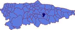 | |
 San Martín del Rey Aurelio Location in Spain | |
| Coordinates: 43°16.4′N 5°36.8′W | |
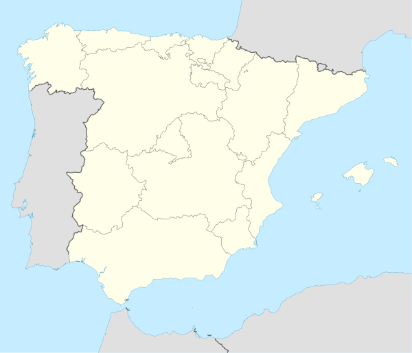
| Country | |
| Autonomous community | |
| Province | Asturias |
| Comarca | Nalón |
| Capital | Sotrondio |
| Government | |
| • Alcalde | Enrique Fernandez Rodriguez (PSOE) |
| Area | |
| • Total | 56.13 km2 (21.67 sq mi) |
| Highest elevation | 1,096 m (3,596 ft) |
| Population (2018)[1] | |
| • Total | 16,283 |
| • Density | 290/km2 (750/sq mi) |
| Time zone | UTC+1 (CET) |
| • Summer (DST) | UTC+2 (CEST) |
| Postal code | 33950 |
There are three main towns in the municipality: Sotrondio, El Entrego, and Blimea, and many villages, such as Santa Bárbara and La Hueria.
It is situated in the central part of Asturias, just below the Sierra de San Mamés, part of the Cantabrian Mountains. The Nalón River, the longest river in Asturias, crosses the municipality.[2] The Redes Natural Park is located nearby.
Historically a mining location, nowadays it is in a re-industrial process with the emigration of many young people (about 30% of under 30). New computer based factories are attempting to establish themselves.
Politics
The current mayor is Enrique Fernández Rodríguez (FSA-PSOE).
| Party/List | 1979 | 1983 | 1987[3] | 1991[3] | 1995[3] | 1999[3] | 2003[3] | 2007[3] | 2011[4] | 2015 |
| PSOE | 11 | 13 | 9 | 11 | 11 | 12 | 11 | 9 | 7 | 7 |
| PCE / IU-BA | 7 | 5 | 6 | 6 | 4 | 4 | 4 | 3 | 4 | 5 |
| Somos | 3 | |||||||||
| CD / AP / PP | 3 | 2 | 3 | 6 | 4 | 6 | 5 | 5 | 2 | |
| FAC | 1 | 0 | ||||||||
| UCD / CDS | 3 | 4 | 1 | |||||||
| URAS / URAS-PAS | 1 | 0 | 0 | |||||||
| Total | 21 | 21 | 21 | 21 | 21 | 21 | 21 | 17 | 17 | 17 |
Gallery
_-_Iglesia_de_San_Andres_00.jpg) Iglesia de San Andrés in El Entrego, Linares
Iglesia de San Andrés in El Entrego, Linares
References
- Municipal Register of Spain 2018. National Statistics Institute.
- Concejo de San Martín del Rey Aurelio
- Dirección General de Política Interior
- Elecciones Locales 2011
External links
![]()
| ||
| Authority control |
|
|---|