Piloña
Piloña (Spanish pronunciation: [piˈloɲa]) is a municipality in the province and autonomous community of Asturias, northwestern Spain. Its capital is the town of Infiesto. Piloña is bounded to the north by Villaviciosa and Colunga, to the east by Parres, to the west by Nava and Cabranes, and to the south by Ponga, Caso, Sobrescobio and Laviana. The area is semi-mountainous with many small, but deep and narrow valleys.
Piloña | |
|---|---|
 | |
 Coat of arms | |
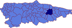 | |
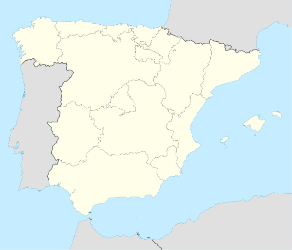 Piloña Location in Spain | |
| Coordinates: 43°21′N 5°21′W | |
| Country | |
| Autonomous community | |
| Province | Asturias |
| Comarca | Oriente |
| Judicial district | Piloña |
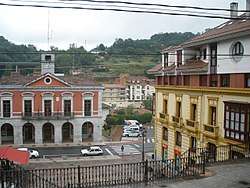
| Capital | Infiesto |
| Government | |
| • Alcalde | Camilo Montes Díaz (PSOE) |
| Area | |
| • Total | 283.89 km2 (109.61 sq mi) |
| Highest elevation | 1,420 m (4,660 ft) |
| Population (2018)[1] | |
| • Total | 7,101 |
| • Density | 25/km2 (65/sq mi) |
| Demonym(s) | piloñeses |
| Time zone | UTC+1 (CET) |
| • Summer (DST) | UTC+2 (CEST) |
| Postal code | 33530 |
| Website | Official website |
History
In prehistoric times Piloña lay along the natural path between Oviedo and Cangas de Onís, in the narrow basin that parallels the coast. Piloña was the largest settlement along that path which connected central Asturias with the Asturian east.
Even earlier there were paleolithic settlements in caves in Piloña such as Aviao (Espinaredo) Cave, Collaréu Cave, and La Peña Ferran (Ferran Rock) which were excavated by the Count de la Vega del Sella in the 1920s. There are several sites with paleolithic rock art and Neanderthal remains, including Sidrón Cave in Borines.
During Roman times Beloncio was occupied, and is identified with the town Paelontium, mentioned by Ptolemy as the capital of the Astur tribe known as Lugones. There is also evidence of Roman occupation at Borines.
Economics
The area is poor, and is depopulating. There were over 20,000 inhabitants in 1930; 8,799 in 2001; and 8,440 in 2005.
The three largest towns are Infiesto (with about 20% of the population) and Villamayor and Sevares. All three are on the Piloña River, a left-hand tributary of the Sella River, and on the main highway, the N-634.
The area is agricultural with cattle raising for both milk and meat, and with some production of forest products.
External links
- Virtual Guide to Piloña, in Spanish
- Piloña page of the Asturian Federation of Municipalities, in Spanish
- Photo Archive of Piloña
| Authority control |
|
|---|
- Municipal Register of Spain 2018. National Statistics Institute.