El Franco
El Franco is a municipality in the Autonomous Community of the Principality of Asturias. It is bordered on the north by the Cantabrian Sea, and to the west by Tapia de Casariego, to the south by Castropol and Boal, and to the east by Coaña. El Franco is part of the Comarca Eo Navia.
El Franco | |
|---|---|
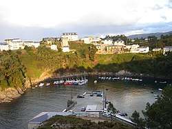 Port of Viavelez | |
 Coat of arms | |
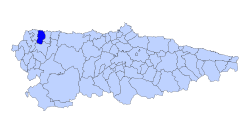 | |
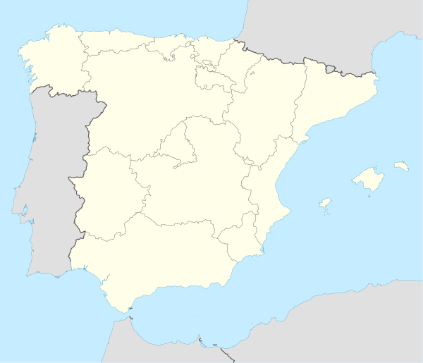 El Franco Location in Spain | |
| Coordinates: 43°33′N 6°52′W | |
| Country | |
| Autonomous community | |
| Province | Asturias |
| Comarca | Eo-Navia |
| Judicial district | Castropol |
| Capital | La Caridad |
| Government | |
| • Alcalde | Cecilia Pérez Sánchez (PSOE) |
| Area | |
| • Total | 78.04 km2 (30.13 sq mi) |
| Highest elevation | 899 m (2,949 ft) |
| Population (2018)[1] | |
| • Total | 3,830 |
| • Density | 49/km2 (130/sq mi) |
| Demonym(s) | franquino/a |
| Time zone | UTC+1 (CET) |
| • Summer (DST) | UTC+2 (CEST) |
| Postal code | 33746 and del 33756 to 33759 |
| Website | www |
The Porcia and Mazo Rivers pass through the municipality.
History
Artifacts from Neolithic Age book an early settlement of the region. Still today rests of Hill forts, in Arancedo as well as in the neighbouring Coaña and Mohias are visible. In the 18th century the old gold mines which are in use until today were found near the embankment castle of Arancedo. During the Middle Ages El Franco was split in the dioceses by Lugo and Oviedo, the administrative capital was in this time, Castropol. In 1852 the administrative seat was laid to El Franco finally in the Parroquia La Caridad where it is still today.
Demographics
| Year | Pop. | ±% |
|---|---|---|
| 1991 | 4,268 | — |
| 1996 | 4,193 | −1.8% |
| 2001 | 4,123 | −1.7% |
| 2004 | 4,112 | −0.3% |
| 2006 | 4,065 | −1.1% |
| 2007 | 4,015 | −1.2% |
Economy
At the top of the employees lies the Livestock and Fishery. The milk industry is provided here still with the highest growth, after in the fishing the preventive measures of the EU started to reach. The tourism industry and administrative companies form the second largest position of the employers and the tourism shows the biggest growth of the region. Smaller, commercial companies and production companies are found predominantly in the small industrial parks of the adjoining municipality.
Points of interest
- La iglesia (Church) de Santa María, built on romanic Basementen finished in the 18th century
- El palacio de Miudes from the 16th century
- El palacio de Fonfría from the 16th century
- El palacio de Jardón
- La torre (Tower) Valdepares
Fiestas and Ferias
- 24. June - San Juan de Prendones in Valdepares.
- 16. July, el Carmen - in Miudes.
- 2. August, Santo Ángel in Viavélez
- from 8. September on: el día de los Remedios
References
- Municipal Register of Spain 2018. National Statistics Institute.
External links
| Wikimedia Commons has media related to El Franco. |
- Federación Asturiana de Concejos (in Spanish)
- Guía del Occidente. El Franco (in Spanish)