Salazie
Salazie is a volcanic caldera and commune (administrative division) in the department and region of Réunion.
Salazie | |
|---|---|
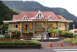 Salazie town hall | |
.svg.png) Coat of arms | |
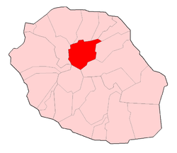 | |
Location of Salazie 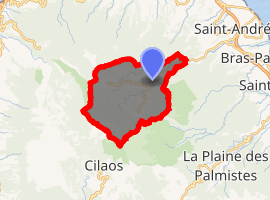
| |
| Coordinates: 21°01′40″S 55°32′21″E | |
| Country | France |
| Overseas region and department | Réunion |
| Arrondissement | Saint-Benoît |
| Canton | Saint-André-3 |
| Intercommunality | Réunion Est |
| Government | |
| • Mayor (2014-2020) | Stéphane Fouassin |
| Area 1 | 103.82 km2 (40.09 sq mi) |
| Population (2017-01-01)[1] | 7,312 |
| • Density | 70/km2 (180/sq mi) |
| Time zone | UTC+04:00 |
| INSEE/Postal code | 97421 /97433 |
| Elevation | 230–3,071 m (755–10,075 ft) (avg. 446 m or 1,463 ft) |
| 1 French Land Register data, which excludes lakes, ponds, glaciers > 1 km2 (0.386 sq mi or 247 acres) and river estuaries. | |

Waterfall of the Trou de fer
The first settlement of the area took place in 1829 after a cyclone had devastated the nearby coast, and the municipality of Salazie was formed in 1889. The name of the commune is potentially derived from the Malagasy word salazy, meaning 'good encampment'.[2]
Geography
Salazie lies in the middle of island, north-east of Piton des Neiges (the highest point on the island), in the Cirque de Salazie (actually a volcanic caldera). The commune is totally landlocked, and borders the communes of Bras-Panon, Cilaos, La Possession, Saint-André, Saint-Benoît, Saint-Denis, Sainte-Marie and Sainte-Suzanne.
Personalities
- Anchaing and Héva: reality or legend of a couple of runaway slaves
See also
- Hell-Bourg, a village, part of the commune of Salazie
- Trou de Fer
- Communes of the Réunion department
- Bridal Veil Falls
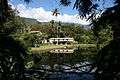 Mare-à-Citrons
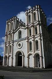 Church of Salazie
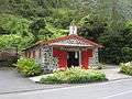
References
- "Populations légales 2017". INSEE. Retrieved 6 January 2020.
- Presentation of Salazie (from Flags of the World (website), with references)
External links
| Wikimedia Commons has media related to Salazie. |
| Authority control |
|
|---|
This article is issued from Wikipedia. The text is licensed under Creative Commons - Attribution - Sharealike. Additional terms may apply for the media files.