Sainte-Rose, Réunion
Sainte-Rose is a commune on the east coast of the French island and department of Réunion.
Sainte-Rose | |
|---|---|
 | |
Location of Sainte-Rose 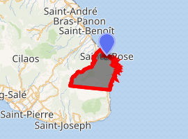
| |
| Coordinates: 21°07′38″S 55°47′32″E | |
| Country | France |
| Overseas region and department | Réunion |
| Arrondissement | Saint-Benoît |
| Canton | Saint-Benoît-2 |
| Intercommunality | Réunion Est |
| Government | |
| • Mayor (2014-2020) | Bruno Mamindy-Pajany |
| Area 1 | 177.60 km2 (68.57 sq mi) |
| Population (2017-01-01)[1] | 6,418 |
| • Density | 36/km2 (94/sq mi) |
| Time zone | UTC+04:00 |
| INSEE/Postal code | 97419 /97439 |
| Elevation | 0–2,623 m (0–8,606 ft) (avg. 29 m or 95 ft) |
| 1 French Land Register data, which excludes lakes, ponds, glaciers > 1 km2 (0.386 sq mi or 247 acres) and river estuaries. | |
Geography
The commune is bordered by the communes of La Plaine-des-Palmistes, Saint-Benoît, Saint-Joseph, Saint-Philippe and Tampon; and by the Rivière de l'Est to the nord. Sainte-Rose is home to the first wind farm on the island, built in 2004.
The "Pointe des Cascades", in the commune, is the easternmost part of the island and also the easternmost part of France and of the European Union.
Climate
Sainte-Rose features a tropical rainforest climate (Köppen Af), with substantial rainfall throughout the course of the year. Its location on the eastern side of Réunion, (windward relative to the trade winds), makes it one of the wettest cities in the world, along with Cherrapunji, Quibdó, and López de Micay.
| Climate data for Sainte-Rose, Réunion | |||||||||||||
|---|---|---|---|---|---|---|---|---|---|---|---|---|---|
| Month | Jan | Feb | Mar | Apr | May | Jun | Jul | Aug | Sep | Oct | Nov | Dec | Year |
| Average high °C (°F) | 29.2 (84.6) |
29.2 (84.6) |
28.7 (83.7) |
27.8 (82.0) |
26.1 (79.0) |
24.5 (76.1) |
23.4 (74.1) |
23.8 (74.8) |
24.7 (76.5) |
25.7 (78.3) |
27.4 (81.3) |
28.6 (83.5) |
26.6 (79.9) |
| Average low °C (°F) | 22.7 (72.9) |
22.8 (73.0) |
22.6 (72.7) |
21.7 (71.1) |
20.3 (68.5) |
18.7 (65.7) |
17.7 (63.9) |
17.7 (63.9) |
18.1 (64.6) |
19.0 (66.2) |
20.7 (69.3) |
21.8 (71.2) |
20.3 (68.6) |
| Average precipitation mm (inches) | 1,076 (42.4) |
1,449 (57.0) |
1,252 (49.3) |
1,104 (43.5) |
919 (36.2) |
765 (30.1) |
903 (35.6) |
740 (29.1) |
677 (26.7) |
622 (24.5) |
580 (22.8) |
842 (33.1) |
10,929 (430.3) |
| Source: Atlas climatique de La Réunion | |||||||||||||
History
The village of Piton Sainte-Rose was partially destroyed by a lava flow in April 1977.
See also
References
- "Populations légales 2017". INSEE. Retrieved 6 January 2020.
- Jumaux, Guillaume (2011). Atlas climatique de La Réunion. Direction interrégionale de La Réunion de Météo France. ISBN 978-2-11-128623-8.
External links
| Wikimedia Commons has media related to Sainte-Rose (Réunion). |
| Authority control |
|
|---|