Saint-Avit-les-Guespières
Saint-Avit-les-Guespières is a commune in the Eure-et-Loir department in northern France.
Saint-Avit-les-Guespières | |
|---|---|
Location of Saint-Avit-les-Guespières 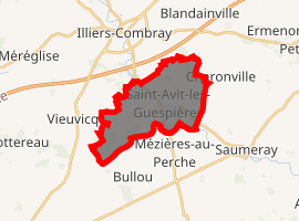
| |
 Saint-Avit-les-Guespières  Saint-Avit-les-Guespières | |
| Coordinates: 48°16′17″N 1°16′19″E | |
| Country | France |
| Region | Centre-Val de Loire |
| Department | Eure-et-Loir |
| Arrondissement | Châteaudun |
| Canton | Illiers-Combray |
| Intercommunality | Pays de Combray |
| Government | |
| • Mayor (2001–2008) | Philippe Gravier |
| Area 1 | 12.64 km2 (4.88 sq mi) |
| Population (2017-01-01)[1] | 362 |
| • Density | 29/km2 (74/sq mi) |
| Time zone | UTC+01:00 (CET) |
| • Summer (DST) | UTC+02:00 (CEST) |
| INSEE/Postal code | 28326 /28120 |
| Elevation | 137–167 m (449–548 ft) (avg. 154 m or 505 ft) |
| 1 French Land Register data, which excludes lakes, ponds, glaciers > 1 km2 (0.386 sq mi or 247 acres) and river estuaries. | |
Population
| Year | Pop. | ±% |
|---|---|---|
| 1793 | 600 | — |
| 1800 | 512 | −14.7% |
| 1806 | 596 | +16.4% |
| 1821 | 515 | −13.6% |
| 1831 | 566 | +9.9% |
| 1836 | 614 | +8.5% |
| 1841 | 612 | −0.3% |
| 1846 | 591 | −3.4% |
| 1851 | 547 | −7.4% |
| 1856 | 567 | +3.7% |
| 1861 | 560 | −1.2% |
| 1866 | 527 | −5.9% |
| 1872 | 529 | +0.4% |
| 1876 | 480 | −9.3% |
| 1881 | 483 | +0.6% |
| 1886 | 469 | −2.9% |
| 1891 | 494 | +5.3% |
| 1896 | 490 | −0.8% |
| 1901 | 489 | −0.2% |
| 1906 | 454 | −7.2% |
| 1911 | 462 | +1.8% |
| 1921 | 406 | −12.1% |
| 1926 | 415 | +2.2% |
| 1931 | 390 | −6.0% |
| 1936 | 360 | −7.7% |
| 1946 | 365 | +1.4% |
| 1954 | 362 | −0.8% |
| 1962 | 314 | −13.3% |
| 1968 | 275 | −12.4% |
| 1975 | 235 | −14.5% |
| 1982 | 276 | +17.4% |
| 1990 | 304 | +10.1% |
| 1999 | 307 | +1.0% |
| 2008 | 322 | +4.9% |
References
- "Populations légales 2017". INSEE. Retrieved 6 January 2020.
| Wikimedia Commons has media related to Saint-Avit-les-Guespières. |
| Authority control |
|
|---|
This article is issued from Wikipedia. The text is licensed under Creative Commons - Attribution - Sharealike. Additional terms may apply for the media files.