Loigny-la-Bataille
Loigny-la-Bataille is a commune in the Eure-et-Loir department in northern France.
Loigny-la-Bataille | |
|---|---|
Location of Loigny-la-Bataille 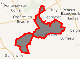
| |
 Loigny-la-Bataille  Loigny-la-Bataille | |
| Coordinates: 48°07′26″N 1°44′02″E | |
| Country | France |
| Region | Centre-Val de Loire |
| Department | Eure-et-Loir |
| Arrondissement | Châteaudun |
| Canton | Voves |
| Intercommunality | Beauce d'Orgères |
| Government | |
| • Mayor (2008–2014) | Hugues Robert |
| Area 1 | 18.05 km2 (6.97 sq mi) |
| Population (2017-01-01)[1] | 206 |
| • Density | 11/km2 (30/sq mi) |
| Time zone | UTC+01:00 (CET) |
| • Summer (DST) | UTC+02:00 (CEST) |
| INSEE/Postal code | 28212 /28140 |
| Elevation | 123–139 m (404–456 ft) (avg. 127 m or 417 ft) |
| 1 French Land Register data, which excludes lakes, ponds, glaciers > 1 km2 (0.386 sq mi or 247 acres) and river estuaries. | |
History
The commune was the site of a major battle Battle of Loigny-Poupry on Friday, December 2, 1870 during the Franco-Prussian War when a French force of about 300 soldiers under General Gaston De Sonis fought a Prussian force of almost 2000. The battle is commemorated by several monuments including a memorial chapel dedicated to the Sacred Heart.
Population
| Year | 1962 | 1968 | 1975 | 1982 | 1990 | 1999 | 2008 |
|---|---|---|---|---|---|---|---|
| Population | 230 | 287 | 238 | 202 | 178 | 174 | 236 |
References
- "Populations légales 2017". INSEE. Retrieved 6 January 2020.
| Wikimedia Commons has media related to Loigny-la-Bataille. |
| Authority control |
|---|
This article is issued from Wikipedia. The text is licensed under Creative Commons - Attribution - Sharealike. Additional terms may apply for the media files.