Romney, West Virginia
Romney is a city in and the county seat of Hampshire County, West Virginia, United States.[5] The population was 1,848 at the 2010 census.
Romney, West Virginia | |
|---|---|
| City of Romney | |
 | |
| Nickname(s): West Virginia's Oldest Town | |
 Location of Romney in Hampshire County, West Virginia. | |
 Romney, West Virginia Location of Romney in Hampshire County, West Virginia.  Romney, West Virginia Romney, West Virginia (Eastern Panhandle of West Virginia)  Romney, West Virginia Romney, West Virginia (West Virginia)  Romney, West Virginia Romney, West Virginia (the United States) | |
| Coordinates: 39°20′42″N 78°45′25″W | |
| Country | United States |
| State | West Virginia |
| County | Hampshire |
| Government | |
| • Mayor | Daniel O. Hileman |
| Area | |
| • Total | 0.96 sq mi (2.49 km2) |
| • Land | 0.96 sq mi (2.49 km2) |
| • Water | 0.00 sq mi (0.00 km2) |
| Elevation | 820 ft (820 m) |
| Population | |
| • Total | 1,848 |
| • Estimate (2019)[3] | 1,695 |
| • Density | 1,763.79/sq mi (681.32/km2) |
| Time zone | UTC-5 (EST) |
| • Summer (DST) | UTC-4 (EDT) |
| ZIP code | 26757 |
| Area code(s) | 304 |
| FIPS code | 54-70084 |
| GNIS feature ID | 1560582[4] |
| Website | City of Romney |
History
Established by consecutive acts of the Virginia House of Burgesses and approved by the governor on December 23, 1762, Romney and Mecklenburg (later renamed Shepherdstown), in Jefferson County, are the oldest towns in West Virginia.[6] The bill containing the Act for establishing the town of Romney, in the county of Hampshire, and for other purposes therein-mentioned, is listed 20th on a list of approved "publick and private bills" and is immediately followed by An Act for establishing the town of Mecklenburg, in the county of Frederick. [7]
Originally settled in 1725 by hunters and traders, Romney was known as Pearsall's Flats and was the site of the French and Indian War stockade Fort Pearsall. Named for the Cinque Ports town of Romney, Kent, England, by Thomas Fairfax, 6th Lord Fairfax of Cameron, the town still bears place names and symbols from its colonial past such as its Marsham Street, named for Robert Marsham, 2nd Baron Romney. It is also home to the West Virginia Schools for the Deaf and Blind and the nation's First Confederate Memorial in Indian Mound Cemetery.
Geography
Romney is located at 39°20′42″N 78°45′25″W (39.344915, -78.756960).[8]
According to the United States Census Bureau, the city has a total area of 0.96 square miles (2.49 km2), all of it land.[9]
Climate
The climate in this area is characterized by hot, humid summers and generally cold winters. According to the Köppen Climate Classification system, Romney has a humid continental climate, abbreviated "Cfa" on climate maps.[10]
Transportation
_at_Bolton_Street_in_Romney%2C_Hampshire_County%2C_West_Virginia.jpg)
Romney is served by two primary highways, the most prominent of them being U.S. Route 50. US 50 heads eastward from Romney towards Winchester and Interstate 81. To the west, US 50 intersects U.S. Route 220, climbs the Allegheny Front, briefly enters Garrett County, Maryland, and then returns to West Virginia, eventually reaching Grafton. The other primary highway serving Romney is West Virginia Route 28, which heads southward towards Moorefield and north towards Cumberland, Maryland and Interstate 68.
Demographics
| Historical population | |||
|---|---|---|---|
| Census | Pop. | %± | |
| 1850 | 456 | — | |
| 1860 | 569 | 24.8% | |
| 1870 | 482 | −15.3% | |
| 1880 | 371 | −23.0% | |
| 1890 | 451 | 21.6% | |
| 1900 | 580 | 28.6% | |
| 1910 | 1,112 | 91.7% | |
| 1920 | 1,028 | −7.6% | |
| 1930 | 1,441 | 40.2% | |
| 1940 | 2,013 | 39.7% | |
| 1950 | 2,059 | 2.3% | |
| 1960 | 2,203 | 7.0% | |
| 1970 | 2,364 | 7.3% | |
| 1980 | 2,094 | −11.4% | |
| 1990 | 1,966 | −6.1% | |
| 2000 | 1,940 | −1.3% | |
| 2010 | 1,848 | −4.7% | |
| Est. 2019 | 1,695 | [3] | −8.3% |
| U.S. Decennial Census[11] 2013 Estimate[12] | |||
2010 census
As of the census[2] of 2010, there were 1,848 people, 843 households, and 410 families living in the city. The population density was 1,925.0 inhabitants per square mile (743.2/km2). There were 967 housing units at an average density of 1,007.3 per square mile (388.9/km2). The racial makeup of the city was 95.8% White, 2.7% African American, 0.2% Native American, 0.1% Asian, 0.1% from other races, and 1.1% from two or more races. Hispanic or Latino of any race were 1.4% of the population.

There were 843 households, of which 23.7% had children under the age of 18 living with them, 31.2% were married couples living together, 13.2% had a female householder with no husband present, 4.3% had a male householder with no wife present, and 51.4% were non-families. 46.5% of all households were made up of individuals, and 26.2% had someone living alone who was 65 years of age or older. The average household size was 2.01 and the average family size was 2.83.
The median age in the city was 41.9 years. 23.6% of residents were under the age of 18; 9.4% were between the ages of 18 and 24; 20.3% were from 25 to 44; 23% were from 45 to 64; and 23.6% were 65 years of age or older. The gender makeup of the city was 44.1% male and 55.9% female.
2000 census
As of the census of 2000, there were 1,940 people, 884 households, and 454 families living in the city. The population density was 2,114.3 people per square mile (814.2/km2). There were 974 housing units at an average density of 1,061.5 per square mile (408.8/km2). The racial makeup of the city was 96.91% White, 1.91% African American, 0.05% Native American, 0.52% Asian, 0.21% from other races, and 0.41% from two or more races. Hispanic or Latino of any race were 0.67% of the population.
There were 884 households, out of which 21.7% had children under the age of 18 living with them, 33.7% were married couples living together, 14.6% had a female householder with no husband present, and 48.6% were non-families. 44.8% of all households were made up of individuals, and 26.8% had someone living alone who was 65 years of age or older. The average household size was 1.97 and the average family size was 2.72.
In the city, the population was spread out, with 25.2% under the age of 18, 7.4% from 18 to 24, 20.1% from 25 to 44, 21.3% from 45 to 64, and 26.1% who were 65 years of age or older. The median age was 42 years. For every 100 females, there were 76.2 males. For every 100 females age 18 and over, there were 68.5 males.
The median income for a household in the city was $22,261, and the median income for a family was $34,271. Males had a median income of $28,667 versus $20,000 for females. The per capita income for the city was $15,765. About 17.2% of families and 24.6% of the population were below the poverty line, including 29.5% of those under age 18 and 18.2% of those age 65 or over.
Parks and recreation

- Hampshire High School Sports Complex, US Route 50 East
- Baseball Field, Cross Country Trails, Running Track, Soccer Field, Softball Field
- Hampshire Park & 4-H Camp, South Branch River Road (CR 8)
- Picnic Pavilions, Baseball Field, Basketball Court, Volleyball Court, Tennis Courts
- Old Romney High School, 111 School Street
- Baseball Field, Basketball Courts, Football Field, Running Track
- Romney Recreation Center, 260 School Street
- Swimming Facilities
- West Virginia Schools for the Deaf and Blind Grounds, East Main Street
- Baseball Field, Basketball Courts, Picnic Pavilions, Running Track, Soccer Field, Swimming Facilities

Notable people
- Stephen Ailes, 8th United States Secretary of the Army
- William Armstrong, U.S. Representative
- John Rinehart Blue, state legislator
- William C. Clayton, state legislator
- Edna Brady Cornwell, First Lady of West Virginia
- John J. Cornwell, 15th Governor of West Virginia
- William B. Cornwell, lawyer and businessman
- John Collins Covell, principal of the West Virginia Schools for the Deaf and Blind
- Samuel Lightfoot Flournoy, state legislator
- Samuel Lightfoot Flournoy, lawyer
- Henry Bell Gilkeson, state legislator and principal of the West Virginia Schools for the Deaf and Blind
- Howard Hille Johnson, founder of the West Virginia Schools for the Deaf and Blind
- James Sloan Kuykendall, state legislator
- Charles S. Lawrence, Institute of Food Technologists Executive Vice President
- Thomas Bryan Martin, colonial-era Virginia politician
- Angus William McDonald, Confederate States Army colonel
- Marshall McDonald, United States Fish Commissioner
- Jerry Mezzatesta, state legislator
- Alexander W. Monroe, Speaker of the West Virginia House of Delegates
- Samuel Mulledy, academic
- Thomas Mulledy, academic
- Ann Pancake, author
- Catherine Pancake, filmmaker
- Sam Pancake, actor
- Isaac Parsons, state legislator
- Isaac Parsons, Confederate military officer and politician
- Lee Hawse Patteson, First Lady of West Virginia
- Randall Terry, pro-life activist
- Christian Streit White, local politician
- John Baker White, local politician
- John Baker White, West Virginia Board of Control member
- Robert White, Attorney General of West Virginia
- Robert White, state legislator
- Charles M. Williams, Harvard Business School professor
- Andrew Wodrow, local politician
- Joshua Soule Zimmerman, state legislator
References
- "2019 U.S. Gazetteer Files". United States Census Bureau. Retrieved August 7, 2020.
- "U.S. Census website". United States Census Bureau. Retrieved 2013-01-24.
- "Population and Housing Unit Estimates". United States Census Bureau. May 24, 2020. Retrieved May 27, 2020.
- "US Board on Geographic Names". United States Geological Survey. 2007-10-25. Retrieved 2008-01-31.
- "Find a County". National Association of Counties. Retrieved 2011-06-07.
- "An Act for establishing the town of Romney, in the county of Hampshire, and for other purposes therein mentioned, Hening's Statutes at Large, Vol. VII, Chapter XII". vagenweb.org. Retrieved 2017-03-05.
- Burgesses, Virginia General Assembly House of (1907-01-01). Journals of the House of Burgesses of Virginia, 1761-1765. Colonial Press, E. Waddey Company. pp. 164–165.
- "US Gazetteer files: 2010, 2000, and 1990". United States Census Bureau. 2011-02-12. Retrieved 2011-04-23.
- "US Gazetteer files 2010". United States Census Bureau. Archived from the original on 2012-07-14. Retrieved 2013-01-24.
- Climate Summary for Romney, West Virginia
- United States Census Bureau. "Census of Population and Housing". Retrieved August 27, 2013.
- "Population Estimates". United States Census Bureau. Retrieved 2014-08-27.
- Ailes, John C. Romney, West Virginia, 1762-1962. Romney, West Virginia, Hampshire Review, 1962.
- Ambler, Charles Henry. "Romney In The Civil War." West Virginia History, Charleston, West Virginia, 1943–44. Arc 1. 4: 5.
- Ansel, William H., Jr. Frontier Forts Along The Potomac And Its Tributaries. Parsons, West Virginia, McClain Publishing Company, reprint 1995.
- Brannon, Selden W. Historic Hampshire. Parsons, West Virginia, McClain Printing Company, 1976.
- Hampshire County 250th Anniversary Committee: Hampshire County, West Virginia, 1754-2004. 2004.
- Maxwell, Hu. History of Hampshire County, West Virginia: From its earliest settlement to the present. Morgantown, West Virginia, A.B. Boughner, 1897.
- Romney Town Council. Historic Romney, 1762-1937. Romney, 1937.
- Sauers, Richard A. The Devastating Hand of War: Romney, West Virginia During the Civil War. Leesburg, Virginia, Gauley Mount Press, 2000.

External links
| Wikimedia Commons has media related to Romney, West Virginia. |
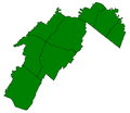
Municipalities and communities of Hampshire County, West Virginia, United States | ||
|---|---|---|
| City | 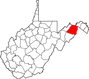 Map of West Virginia highlighting Hampshire County | |
| Town | ||
| CDPs | ||
| Unincorporated communities |
| |
| Authority control |
|
|---|