Rimboval
Rimboval is a commune in the Pas-de-Calais department in the Hauts-de-France region of France.
Rimboval | |
|---|---|
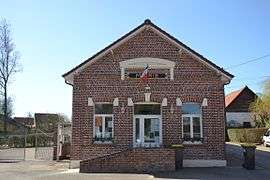 The town hall of Rimboval | |
 Coat of arms | |
Location of Rimboval 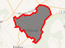
| |
 Rimboval  Rimboval | |
| Coordinates: 50°30′30″N 1°59′12″E | |
| Country | France |
| Region | Hauts-de-France |
| Department | Pas-de-Calais |
| Arrondissement | Montreuil |
| Canton | Fruges |
| Intercommunality | CC Haut Pays du Montreuillois |
| Government | |
| • Mayor | Léonce Lafonte |
| Area 1 | 7.07 km2 (2.73 sq mi) |
| Population (2017-01-01)[1] | 142 |
| • Density | 20/km2 (52/sq mi) |
| Time zone | UTC+01:00 (CET) |
| • Summer (DST) | UTC+02:00 (CEST) |
| INSEE/Postal code | 62710 /62990 |
| Elevation | 87–197 m (285–646 ft) (avg. 100 m or 330 ft) |
| 1 French Land Register data, which excludes lakes, ponds, glaciers > 1 km2 (0.386 sq mi or 247 acres) and river estuaries. | |
Geography
Rimboval is located 10 miles (16 km) northeast of Montreuil-sur-Mer on the D149 road.
Population
| 1962 | 1968 | 1975 | 1982 | 1990 | 1999 | 2006 |
|---|---|---|---|---|---|---|
| 175 | 187 | 151 | 161 | 146 | 124 | 125 |
| Census count starting from 1962: Population without duplicates | ||||||
Places of interest
- The church of St. Omer, dating from the sixteenth century.
- A watermill
External links
| Wikimedia Commons has media related to Rimboval. |
- Rimboval on the Quid website (in French)
| Authority control |
|
|---|
This article is issued from Wikipedia. The text is licensed under Creative Commons - Attribution - Sharealike. Additional terms may apply for the media files.