Pont-de-Roide-Vermondans
Pont-de-Roide-Vermondans (before 2014: Pont-de-Roide)[2] is a commune in the Doubs département in the Bourgogne-Franche-Comté region in eastern France.
Pont-de-Roide-Vermondans | |
|---|---|
 Bridge over the Doubs | |
 Coat of arms | |
Location of Pont-de-Roide-Vermondans 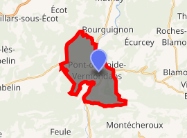
| |
 Pont-de-Roide-Vermondans 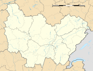 Pont-de-Roide-Vermondans | |
| Coordinates: 47°23′07″N 6°46′15″E | |
| Country | France |
| Region | Bourgogne-Franche-Comté |
| Department | Doubs |
| Arrondissement | Montbéliard |
| Canton | Valentigney |
| Government | |
| • Mayor (2014–2020) | Denis Arnoux |
| Area 1 | 13.58 km2 (5.24 sq mi) |
| Population (2017-01-01)[1] | 4,185 |
| • Density | 310/km2 (800/sq mi) |
| Time zone | UTC+01:00 (CET) |
| • Summer (DST) | UTC+02:00 (CEST) |
| INSEE/Postal code | 25463 /25150 |
| Elevation | 344–817 m (1,129–2,680 ft) |
| 1 French Land Register data, which excludes lakes, ponds, glaciers > 1 km2 (0.386 sq mi or 247 acres) and river estuaries. | |
Geography
The town is at the heart of the Pays de Lomont, 17 km (11 mi) from Montbéliard at the confluence of the Doubs River, the Ranceuse, and the Roide; it is therefore located at the crossroad of different valleys. On the east end of the town are high cliffs known as les Roches, leading to a plateau near the Franco-Swiss border.
History
In 1973, the adjacent village of Vermondans joined the commune of Pont-de-Roide. In 2013 the fusion was made official by the creation of a new commune: Pont-de-Roide - Vermondans.
Population
| Year | Pop. | ±% |
|---|---|---|
| 1962 | 4,626 | — |
| 1968 | 5,261 | +13.7% |
| 1975 | 5,342 | +1.5% |
| 1982 | 4,958 | −7.2% |
| 1990 | 4,983 | +0.5% |
| 1999 | 4,781 | −4.1% |
| 2008 | 4,597 | −3.8% |
| 2012 | 4,309 | −6.3% |
See also
- Communes of the Doubs department
- US Pont-de-Roide
- Armand Machabey (1886–1966), musicologist, born in Pont-de-Roide-Vermondans
References
- "Populations légales 2017". INSEE. Retrieved 6 January 2020.
- Décret n° 2014-1447 3 December 2014 (in French)
External links
| Wikimedia Commons has media related to Pont-de-Roide-Vermondans. |
- Official Web site (in French)
| Authority control |
|
|---|
This article is issued from Wikipedia. The text is licensed under Creative Commons - Attribution - Sharealike. Additional terms may apply for the media files.