Longeville
Longeville is a commune in the Doubs department in the Bourgogne-Franche-Comté region in eastern France.
Longeville | |
|---|---|
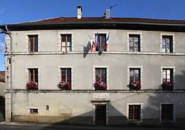 The town hall in Longeville | |
Location of Longeville 
| |
 Longeville 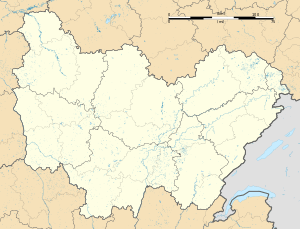 Longeville | |
| Coordinates: 47°01′55″N 6°13′42″E | |
| Country | France |
| Region | Bourgogne-Franche-Comté |
| Department | Doubs |
| Arrondissement | Besançon |
| Canton | Ornans |
| Intercommunality | Canton of Amancey-Loue-Lison |
| Government | |
| • Mayor (2008–2014) | Robert Vouillot |
| Area 1 | 9.46 km2 (3.65 sq mi) |
| Population (2017-01-01)[1] | 173 |
| • Density | 18/km2 (47/sq mi) |
| Time zone | UTC+01:00 (CET) |
| • Summer (DST) | UTC+02:00 (CEST) |
| INSEE/Postal code | 25346 /25330 |
| Elevation | 540–930 m (1,770–3,050 ft) |
| 1 French Land Register data, which excludes lakes, ponds, glaciers > 1 km2 (0.386 sq mi or 247 acres) and river estuaries. | |
Geography
Longeville is a long, narrow village, as its name implies. It is the highest commune in the canton.
The cliffs of the Capucin and Mont Belvoir at 850 m dominate the valley of the Loue River.
Population
| Year | Pop. | ±% |
|---|---|---|
| 1962 | 192 | — |
| 1968 | 195 | +1.6% |
| 1975 | 163 | −16.4% |
| 1982 | 141 | −13.5% |
| 1990 | 145 | +2.8% |
| 1999 | 134 | −7.6% |
| 2008 | 145 | +8.2% |
| 2012 | 158 | +9.0% |
Economy
Cheese production is an important industry, particularly Comté, a hard cheese made of cow's milk similar to Gruyère.
See also
External links
| Wikimedia Commons has media related to Longeville. |
- http://www.routedescommunes.com/departement-25-commune-319.html Longeville on the intercommunal Web site of the department] (in French)
| Authority control |
|
|---|
This article is issued from Wikipedia. The text is licensed under Creative Commons - Attribution - Sharealike. Additional terms may apply for the media files.