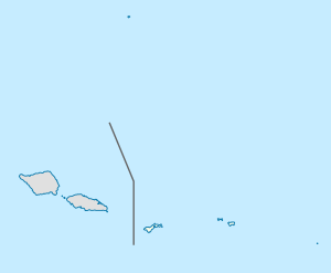
Nu'uuli, American Samoa
Nu'uuli is a village on the central east coast of Tutuila Island, American Samoa. It is located on a peninsula several miles up from Pago Pago International Airport. Nu’uui is located between Pago Pago International Airport and Coconut Point. It is a shopping district which is home to stores such as South Pacific Traders, Nu’uuli Shopping Center, Aiga Supermarket and many more shops.[1]
Nu'uuli | |
|---|---|
Village | |
 Nu'uuli | |
| Coordinates: 14°19′7″S 170°43′25″W | |
| Country | |
| Territory | |
| County | Ituau County |
| Area | |
| • Total | 3.04 sq mi (7.87 km2) |
| Population (2010) | |
| • Total | 3,955 |
| • Density | 1,300/sq mi (500/km2) |
It is the fifth-largest village in land area in American Samoa and the second-largest on Tutuila Island. It straddles the line between the Eastern District and the Western District. This makes it the only village in American Samoa that occupies two districts. It has a total land area of 7.87 km², with 6.23 km² being in the Eastern District and 1.64 km² being in the Western District. Its total population as of the 2010 census was 3,955, with the Eastern District portion containing 2,844 persons and the Western District portion 2,310 persons.
First Lady Lady Bird Johnson dedicated Manulele Tausala Elementary School in Nu'uuli on October 10, 1966. The school is named after the first lady.[2]
Nu’uuli has one of the highest crime rates in American Samoa. The first neighborhood watch type program in the territory was established here by the Department of Public Safety in 2014.[3]
Geography
The best surfing conditions in American Samoa can be found in Faganeanea and neighboring Nu’uuli, however, great surfing can also be found in the 'Āmanave-Poloa area.[4]
Nu'uuli Pala
Nu'uuli Pala is Tutuila Island’s largest mangrove swamp. It borders nearly all of Pala Lagoon’s shoreline. The pala has been designated a special management area in recognition of its size and significance to wildlife and fish habitat. It is the largest and also the most threatened wetland in American Samoa; 33 percent of the mangrove swamp has been converted to dry land since 1961.[5]
The wetland, excluding the open water of the lagoon, covers 123 acres of mangrove forest and swamp. The majority of the swamp is covered with red mangrove and oriental mangrove. Several areas of other freshwater marsh vegetation are interspersed with the mangroves. A small area of saltwater marsh borders the end of Coconut Point. The wetland is an important wildlife and fish habitat, and also provides recreational opportunities as canoeing and fishing. Nu'uuli Pala has been designated a Special Management Area under the American Samoa Coastal Management Act of 1990.[6][7]
Rare species found here include Xylocarpus moluccensis (le’ile’i) and the uncommon shrub Sophora tomentosa, which is also reported on Aunu'u.[8] Nu’uuli Pala is a common feeding site for the Reef Heron (matu’u), a bird species which usually feeds on the coral reefs.[9]
Nu’uuli Falls
Nu’uuli Falls is a 65-feet secluded cascade with a swimming hole beneath. To get here, turn left at Nu’uuli Family Mart when coming from the west. Follow this road veering left at the pig farm. Enter the trailhead and follow the hiking trail for about 15 minutes. Veer left at the first trail juncture, and follow until the trail reaches the stream.[10]
Demographics
Nu’uuli village had the highest number of registered voters as of 2017 with a total of 1,717 registered voters, followed by the villages of Leone, Tafuna, and Pago Pago.[11]
| Population growth[12] | |
|---|---|
| 2010 | 3,955 |
| 2000 | 5,154 |
| 1990 | 3,893 |
| 1980 | 2,585 |
| 1970 | 1,804 |
| 1960 | 1,137 |
Notable people
- Freddie Letuli
- Lonnie Palelei, NFL football player
- Maa Tanuvasa, NFL football player
- Lemanu Peleti Mauga, politician
- Tony Solaita, first American Samoan MLB-player.[13]
- Malaetasi Togafau
References
- Swaney, Deanna (1994). Samoa: Western & American Samoa: a Lonely Planet Travel Survival Kit. Lonely Planet Publications. Page 179. ISBN 9780864422255.
- Shaffer, Robert J. (2000). American Samoa: 100 Years Under the United States Flag. Island Heritage. Page 192. ISBN 9780896103399.
- http://www.radionz.co.nz/international/programmes/datelinepacific/audio/2587818/neighbourhood-watch-type-program-to-begin-in-american-samoa
- Schyma, Rosemarie (2013). Südsee. DuMont Reiseverlag. Page 271. ISBN 9783770176946.
- http://www.botany.hawaii.edu/basch/uhnpscesu/pdfs/sam/Volk1993AS.pdf (Page 3)
- Goldin, Meryl Rose (2002). Field Guide to the Samoan Archipelago: Fish, Wildlife, and Protected Areas. Bess Press. Pages 276-277. ISBN 9781573061117.
- http://www.botany.hawaii.edu/basch/uhnpscesu/pdfs/sam/Volk1993AS.pdf (Page 5)
- https://repository.library.noaa.gov/view/noaa/8414/Share (Pages 33 and 35)
- https://www.nps.gov/npsa/learn/nature/upload/2nded05I.pdf (Page 86)
- http://www.lonelyplanet.com/american-samoa/tutuila/attractions/nuuuli-falls/a/poi-sig/1456064/362248
- http://www.samoanews.com/local-news/election-office-stats-show-registered-female-voters-outnumber-male-voters
- "American Samoa Statistical Yearbook 2016" (PDF). American Samoa Department of Commerce. Archived from the original (PDF) on 2019-02-14. Retrieved 2019-07-25.
- Sunia, Fofo I.F. (2009). A History of American Samoa. Amerika Samoa Humanities Council. Page 339. ISBN 9781573062992.