Asili, American Samoa
Asili is a village on the southwest coast of Tutuila Island, American Samoa. It is located between Leone and 'Amanave. It is located in Lealataua County.
Asili | |
|---|---|
Village | |
 Asili | |
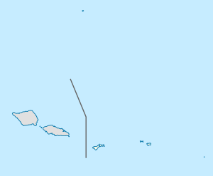
| Coordinates: 14°20′8″S 170°47′44″W | |
| Country | |
| Territory | |
| County | Lealataua |
| Area | |
| • Total | 0.5 sq mi (1.4 km2) |
| Population (2010) | |
| • Total | 224 |
| • Density | 410/sq mi (160/km2) |
Both the Malagateine Stream and Asili Stream flow through Asili before discharging into the sea. A former World War II bunker is located near the shoreline. Several species of Gobie fish, as well as Mountain bass and Freshwater eel, have been recorded in Asili Stream. The Asili Stream originates at 1,190 ft. above sea level. It discharges near the center of the embayment that fronts the village. The main branch of the Malagateine Stream starts around the 520 ft contour along the east side of the Malagatiga Ridge.[1]
Demographics
| Population growth[2] | |
|---|---|
| 2010 | 224 |
| 2000 | 250 |
| 1990 | 203 |
| 1980 | 145 |
| 1970 | 197 |
| 1960 | 104 |
| 1950 | 62 |
| 1940 | 79 |
| 1930 | 64 |
References
- http://www.botany.hawaii.edu/basch/uhnpscesu/pdfs/sam/Pedersen2000vol2AS.pdf (Pages 31-6, 31-8 and 31-10)
- "American Samoa Statistical Yearbook 2016" (PDF). American Samoa Department of Commerce. Archived from the original (PDF) on 2019-02-14. Retrieved 2019-07-25.
| Topics | |||||
|---|---|---|---|---|---|
| Geography | |||||
| Politics |
| ||||
| Economy |
| ||||
| Culture |
| ||||
| Districts |
| ||||
| Islands | |||||
| Villages |
| ||||
This article is issued from Wikipedia. The text is licensed under Creative Commons - Attribution - Sharealike. Additional terms may apply for the media files.