Mount Jukes, Queensland
Mount Jukes is a mountain and surrounding coastal rural locality north of Mackay in the Mackay Region, Queensland, Australia.[2][3] In the 2016 census, Mount Jukes had a population of 394 people.[1]
| Mount Jukes Queensland | |||||||||||||||
|---|---|---|---|---|---|---|---|---|---|---|---|---|---|---|---|
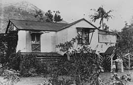 The house "Inglenook" with the mountain in the background, 1909 | |||||||||||||||
 Mount Jukes | |||||||||||||||
| Coordinates | 20.9805°S 148.9716°E | ||||||||||||||
| Population | 394 (2016 census)[1] | ||||||||||||||
| • Density | 5.232/km2 (13.552/sq mi) | ||||||||||||||
| Area | 75.3 km2 (29.1 sq mi) | ||||||||||||||
| Time zone | AEST (UTC+10:00) | ||||||||||||||
| LGA(s) | Mackay Region | ||||||||||||||
| State electorate(s) | Whitsunday | ||||||||||||||
| Federal Division(s) | Dawson | ||||||||||||||
| |||||||||||||||
Geography
The mountain is located in the south-west of the locality (20.9978°S 148.9492°E) within Pioneer Peaks National Park and the Central Mackay Coast IBRA Region.[4] It rises to 547 metres (1,795 ft) above sea level and is composed of igneous rock that has been weathered and eroded.[5] The mountains originated from volcanic activity approximately 32 million years ago.[6]
Mount Jukes has a species of shrubs growing in its trees called the Mount Blackwood holly, a species only found in Mount Blackwood area. The easiest route up the mountain is by gravel road that is locked.
History
Mount Jukes was named by George Elphinstone Dalrymple in 1862 after geologist Joseph Beete Jukes, who served as a naturalist on the explorations of HMS Fly from 1842 to 1846.[2]
See also
References
| Wikimedia Commons has media related to Mount Jukes, Queensland. |
- Australian Bureau of Statistics (27 June 2017). "Mount Jukes (SSC)". 2016 Census QuickStats. Retrieved 20 October 2018.

- "Mount Jukes - mountain in Mackay Region (entry 17422)". Queensland Place Names. Queensland Government. Retrieved 12 November 2019.
- "Mount Jukes - locality in Mackay Region (entry 46810)". Queensland Place Names. Queensland Government. Retrieved 5 November 2019.
- "Pioneer Peaks National Park". WetlandInfo. Department of Environment and Heritage Protection. Retrieved 22 September 2017.
- "Kuttabul". Queensland Places. Centre for the Government of Queensland, University of Queensland. Retrieved 22 September 2017.
- "Cape Hillsborough, Pioneer Peaks, Mount Ossa, Mount Martin and Reliance Creek National Parks and adjoining State Waters Management Plan" (PDF). Queensland Parks and Wildlife Service. 2011. Retrieved 22 September 2017.