Calen, Queensland
Calen is a small town and a coastal locality in the Mackay Region, Queensland, Australia.[2][3] In the 2016 census, Calen had a population of 390 people.[1]
| Calen Queensland | |||||||||||||||
|---|---|---|---|---|---|---|---|---|---|---|---|---|---|---|---|
 Calen | |||||||||||||||
| Coordinates | 20.8975°S 148.7725°E | ||||||||||||||
| Population | 390 (2016 census)[1] | ||||||||||||||
| Postcode(s) | 4798 | ||||||||||||||
| Location |
| ||||||||||||||
| LGA(s) | Mackay Region | ||||||||||||||
| State electorate(s) | Whitsunday | ||||||||||||||
| Federal Division(s) | Dawson | ||||||||||||||
| |||||||||||||||
Geography
The locality of Calen is loosely bounded by One Mile Creek to the south and Blackrock Creek to the north. The land is mostly flat and used for sugar cane farming, apart from some undeveloped mountains across the western boundary of the locality and some small undeveloped hill land in the east which is on the Queensland coast.[4]
The Bruce Highway passes from the south-east to the north-west of the locality. The North Coast railway line runs immediately north and parallel to the highway.[4]
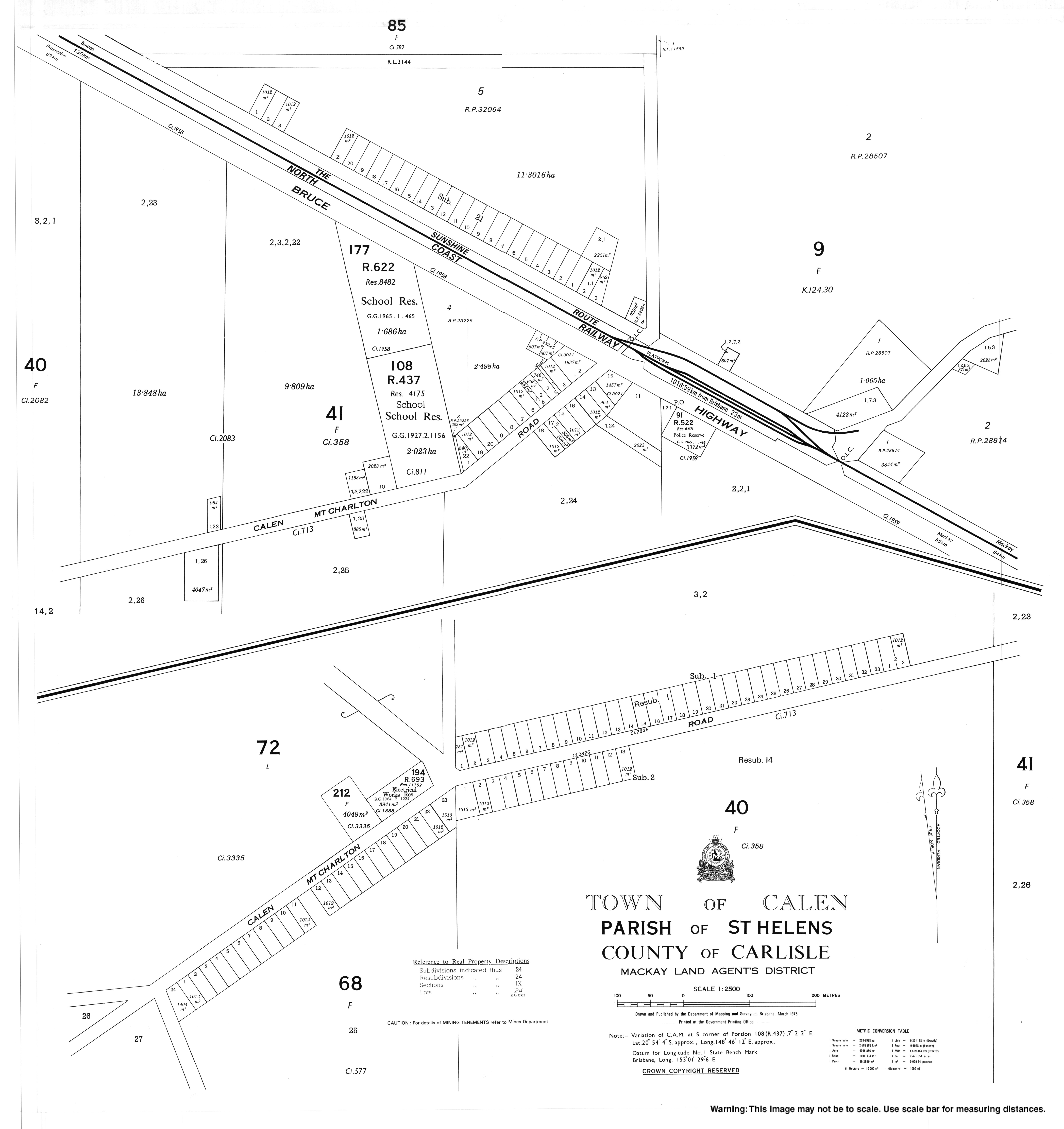
The town of Calen is located in the south-eastern part of the locality with the highway and railway passing through it. The Calen railway station is located in the town.[4][5]
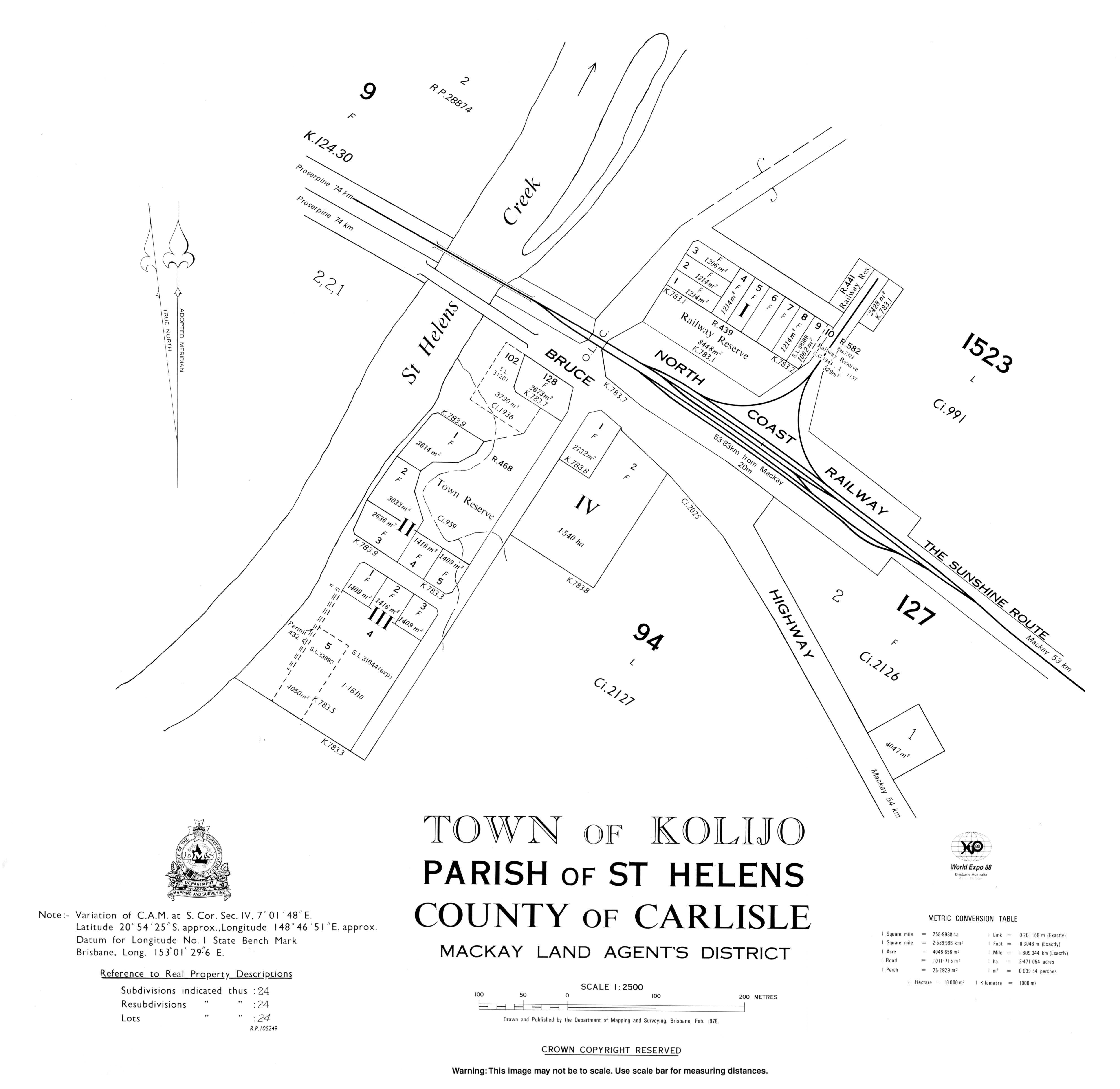
A second town of Kolijo is located on the south-eastern edge of the locality, again with the highway and railway passing through it. Calen and Kolijo are separated by St Helens Creek, which might explain the development of two towns less than 1.5 kilometres (0.93 mi) apart.[4][6]
A neighbourhood called Moondaba exists at the north-western edge of the locality along the highway and railway line. It takes its name from the former Moondaba railway station and is reportedly an Aboriginal word meaning place of snakes.[7] Moondaba is very close to the town of Pindi Pindi to the north, but they are separated by the Blackrock Creek.[4]
The locality of Calen has a network of privately operated tramway lines for transporting sugar cane to the sugar mill.[4]
History
The town of Kolijo takes its name from the former Kolijo railway station which was named on 9 March 1923 by the Queensland Railways Department, reportedly an Aboriginal word meaning possum.
The town of Calen takes its name from the Calen railway station which was named on 8 February 1924 by the Queensland Railway Department, reportedly being an Aboriginal name meaning cloud.[8]
Calen State School opened on 24 February 1925 under head teacher Honoria Mary Doherty. In 1963 it expanded to offering secondary schooling (8-10). In 1991 it further expanded to offer secondary years 11 and 12. On 13 December 2003, it was renamed Calen District State College.[9][10]
Calen Post Office opened by 1933.[11]
At the 2006 census, Calen had a population of 289.[12] By the 2011 census this had grown to 451.[13]
Amenities
The Mackay Regional Council operates a mobile library service on a fortnightly schedule at McIntyre Street near the school.[14][15]
The Calen branch of the Queensland Country Women's Association meets at the QCWA Hall at 120 McIntyre Street.[16]
References
- Australian Bureau of Statistics (27 June 2017). "Calen (SSC)". 2016 Census QuickStats. Retrieved 20 October 2018.

- "Calen - town in Mackay Region (entry 5720)". Queensland Place Names. Queensland Government. Retrieved 25 April 2019.
- "Calen - locality in Mackay Region (entry 46767)". Queensland Place Names. Queensland Government. Retrieved 25 April 2019.
- "Queensland Globe". State of Queensland. Retrieved 1 January 2016.
- "Calen - railway station in Mackay Region (entry 5722)". Queensland Place Names. Queensland Government. Retrieved 28 September 2017.
- "St Helens Creek (entry 32087)". Queensland Place Names. Queensland Government. Retrieved 1 January 2016.
- "Moondaba - neighbourhood (entry 22658)". Queensland Place Names. Queensland Government. Retrieved 1 January 2016.
- "Calen - town (entry 5720)". Queensland Place Names. Queensland Government. Retrieved 1 January 2016.
- "Opening and closing dates of Queensland Schools". Queensland Government. Retrieved 1 January 2016.
- "Agency ID 5055, Calen District State College". Queensland State Archives. Retrieved 1 January 2016.
- Premier Postal History. "Post Office List". Premier Postal Auctions. Retrieved 10 May 2014.
- Australian Bureau of Statistics (25 October 2007). "Calen (L) (Urban Centre/Locality)". 2006 Census QuickStats. Retrieved 27 January 2008.
- Australian Bureau of Statistics (31 October 2012). "Calen". 2011 Census QuickStats. Retrieved 1 January 2016.
- "Libraries: Contact/Opening Hours". Mackay Regional Council. Archived from the original on 1 March 2016. Retrieved 28 April 2017.
- "Mobile Library Timetable 2017" (PDF). Mackay Regional Council. Archived from the original (PDF) on 1 March 2017. Retrieved 8 May 2017.
- "Branch Locations". Queensland Country Women's Association. Archived from the original on 26 December 2018. Retrieved 26 December 2018.
Further reading
- Dunn, Isabel; Dunn, Alan, (author.); Dunn, Joanne, (editor.) (2016), We, Us & Co. : the Pratt family and pioneers of St Helens : an account of the development of Calen, ISBN 978-0-9945720-0-4CS1 maint: multiple names: authors list (link) CS1 maint: extra text: authors list (link)