Mount Hope, Kansas
Mount Hope is a city in Sedgwick County, Kansas, United States. As of the 2010 census, the city population was 813.[6]
Mount Hope, Kansas | |
|---|---|
 Location within Sedgwick County and Kansas | |
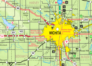 KDOT map of Sedgwick County (legend) | |
| Coordinates: 37°52′9″N 97°39′53″W | |
| Country | United States |
| State | Kansas |
| County | Sedgwick |
| Founded | 1874 |
| Incorporated | 1887 |
| Area | |
| • Total | 1.49 sq mi (3.86 km2) |
| • Land | 1.47 sq mi (3.80 km2) |
| • Water | 0.03 sq mi (0.06 km2) |
| Elevation | 1,440 ft (440 m) |
| Population | |
| • Total | 813 |
| • Estimate (2019)[3] | 801 |
| • Density | 546.01/sq mi (210.79/km2) |
| Time zone | UTC-6 (CST) |
| • Summer (DST) | UTC-5 (CDT) |
| ZIP code | 67108 |
| Area code | 316 |
| FIPS code | 20-48900 [4] |
| GNIS ID | 0473810 [5] |
| Website | mounthopecity.com |
History
Mount Hope was founded in 1874.[7]
Geography
Mount Hope is located at 37°52′9″N 97°39′53″W (37.869198, -97.664663).[8] According to the United States Census Bureau, the city has a total area of 1.48 square miles (3.83 km2), of which, 1.45 square miles (3.76 km2) is land and 0.03 square miles (0.08 km2) is water.[9]
Demographics
| Historical population | |||
|---|---|---|---|
| Census | Pop. | %± | |
| 1890 | 241 | — | |
| 1900 | 327 | 35.7% | |
| 1910 | 519 | 58.7% | |
| 1920 | 513 | −1.2% | |
| 1930 | 466 | −9.2% | |
| 1940 | 442 | −5.2% | |
| 1950 | 473 | 7.0% | |
| 1960 | 539 | 14.0% | |
| 1970 | 665 | 23.4% | |
| 1980 | 791 | 18.9% | |
| 1990 | 805 | 1.8% | |
| 2000 | 830 | 3.1% | |
| 2010 | 813 | −2.0% | |
| Est. 2019 | 801 | [3] | −1.5% |
| U.S. Decennial Census | |||
2010 census
As of the census[2] of 2010, there were 813 people, 313 households, and 206 families living in the city. The population density was 560.7 inhabitants per square mile (216.5/km2). There were 348 housing units at an average density of 240.0 per square mile (92.7/km2). The racial makeup of the city was 94.1% White, 0.4% African American, 1.4% Native American, 0.2% Asian, 2.1% from other races, and 1.8% from two or more races. Hispanic or Latino of any race were 4.7% of the population.
There were 313 households of which 31.3% had children under the age of 18 living with them, 52.4% were married couples living together, 7.7% had a female householder with no husband present, 5.8% had a male householder with no wife present, and 34.2% were non-families. 28.8% of all households were made up of individuals and 15.6% had someone living alone who was 65 years of age or older. The average household size was 2.47 and the average family size was 3.09.
The median age in the city was 43.8 years. 23.4% of residents were under the age of 18; 6.4% were between the ages of 18 and 24; 21.5% were from 25 to 44; 29.1% were from 45 to 64; and 19.6% were 65 years of age or older. The gender makeup of the city was 46.1% male and 53.9% female.
2000 census
As of the census[4] of 2000, there were 830 people, 301 households, and 217 families living in the city. The population density was 810.9 people per square mile (314.2/km2). There were 319 housing units at an average density of 311.7 per square mile (120.8/km2). The racial makeup of the city was 96.27% White, 0.36% African American, 0.48% Native American, 1.08% from other races, and 1.81% from two or more races. Hispanic or Latino of any race were 3.01% of the population.
There were 301 households out of which 37.5% had children under the age of 18 living with them, 61.8% were married couples living together, 7.0% had a female householder with no husband present, and 27.6% were non-families. 26.6% of all households were made up of individuals and 18.3% had someone living alone who was 65 years of age or older. The average household size was 2.60 and the average family size was 3.14.
In the city, the population was spread out with 29.0% under the age of 18, 5.3% from 18 to 24, 27.0% from 25 to 44, 20.4% from 45 to 64, and 18.3% who were 65 years of age or older. The median age was 37 years. For every 100 females, there were 82.0 males. For every 100 females age 18 and over, there were 81.8 males.
The median income for a household in the city was $38,512, and the median income for a family was $45,625. Males had a median income of $36,484 versus $29,375 for females. The per capita income for the city was $19,103. About 5.5% of families and 3.7% of the population were below the poverty line, including 1.7% of those under age 18 and 5.9% of those age 65 or over.
Education
Mount Hope is served by Haven USD 312 school district.
Mount Hope High School was closed through school unification. The Mount Hope Pirates won the Kansas State High School boys class B Track & Field championship in 1939.[10]
References
- "2019 U.S. Gazetteer Files". United States Census Bureau. Retrieved July 24, 2020.
- "U.S. Census website". United States Census Bureau. Retrieved 2012-07-06.
- "Population and Housing Unit Estimates". United States Census Bureau. May 24, 2020. Retrieved May 27, 2020.
- "U.S. Census website". United States Census Bureau. Retrieved 2008-01-31.
- "US Board on Geographic Names". United States Geological Survey. 2007-10-25. Retrieved 2008-01-31.
- "2010 City Population and Housing Occupancy Status". U.S. Census Bureau. Retrieved March 6, 2011.
- Kansas State Historical Society (1916). Biennial Report of the Board of Directors of the Kansas State Historical Society. Kansas State Printing Plant. pp. 285.
- "US Gazetteer files: 2010, 2000, and 1990". United States Census Bureau. 2011-02-12. Retrieved 2011-04-23.
- "US Gazetteer files 2010". United States Census Bureau. Archived from the original on 2012-07-02. Retrieved 2012-07-06.
- "Track & Field". KSHSAA. Retrieved 6 January 2017.
Further reading
External links
| Wikimedia Commons has media related to Mount Hope, Kansas. |
- City
- Maps
- Mount Hope City Map, KDOT
Municipalities and communities of Sedgwick County, Kansas, United States | ||
|---|---|---|
| Cities | 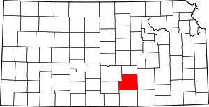 Map of Kansas highlighting Sedgwick County | |
| Unincorporated CDPs | ||
| Unincorporated communities | ||
| Townships | ||
| Footnotes | ‡This populated place also has portions in an adjacent county or counties | |