Clearwater, Kansas
Clearwater is a city in Sedgwick County, Kansas, United States. As of the 2010 census, the city population was 2,481.[6]
Clearwater, Kansas | |
|---|---|
Typical windmill street sign found throughout Clearwater | |
Location within Sedgwick County and Kansas | |
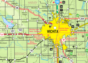 KDOT map of Sedgwick County (legend) | |
| Coordinates: 37°30′20″N 97°30′5″W | |
| Country | United States |
| State | Kansas |
| County | Sedgwick |
| Founded | 1870 |
| Platted | 1872 |
| Incorporated | 1885 |
| Named for | Water |
| Area | |
| • Total | 1.94 sq mi (5.02 km2) |
| • Land | 1.94 sq mi (5.02 km2) |
| • Water | 0.00 sq mi (0.00 km2) |
| Elevation | 1,286 ft (392 m) |
| Population | |
| • Total | 2,481 |
| • Estimate (2019)[3] | 2,552 |
| • Density | 1,317.50/sq mi (508.57/km2) |
| Time zone | UTC-6 (CST) |
| • Summer (DST) | UTC-5 (CDT) |
| ZIP code | 67026 |
| Area code | 620 |
| FIPS code | 20-13925 [4] |
| GNIS ID | 0474315 [5] |
| Website | clearwaterks.org |
History
Clearwater was first settled in 1870, then platted as a city in 1872.[7] It was named from the clear water of the river upon which it is situated.[8] The first post office in Clearwater was established in 1871, and the name of the post office was officially spelled out Clear Water until 1894.[9] The Chisholm Trail ran along the east side of the community from 1867 to 1871.[10]
Geography
Clearwater is located just southwest of Wichita, Kansas at 37°30′20″N 97°30′5″W (37.505646, -97.501516).[11] According to the United States Census Bureau, the city has a total area of 1.87 square miles (4.84 km2), all of it land.[12]
Demographics
| Historical population | |||
|---|---|---|---|
| Census | Pop. | %± | |
| 1890 | 408 | — | |
| 1900 | 368 | −9.8% | |
| 1910 | 569 | 54.6% | |
| 1920 | 647 | 13.7% | |
| 1930 | 669 | 3.4% | |
| 1940 | 591 | −11.7% | |
| 1950 | 647 | 9.5% | |
| 1960 | 1,073 | 65.8% | |
| 1970 | 1,435 | 33.7% | |
| 1980 | 1,684 | 17.4% | |
| 1990 | 1,875 | 11.3% | |
| 2000 | 2,178 | 16.2% | |
| 2010 | 2,481 | 13.9% | |
| Est. 2019 | 2,552 | [3] | 2.9% |
| U.S. Decennial Census | |||
2010 census
As of the census[2] of 2010, there were 2,481 people, 908 households, and 660 families residing in the city. The population density was 1,326.7 inhabitants per square mile (512.2/km2). There were 963 housing units at an average density of 515.0 per square mile (198.8/km2). The racial makeup of the city was 97.2% White, 0.2% African American, 0.3% Native American, 0.3% Asian, 0.3% from other races, and 1.7% from two or more races. Hispanic or Latino of any race were 1.6% of the population.
There were 908 households of which 40.9% had children under the age of 18 living with them, 56.1% were married couples living together, 11.5% had a female householder with no husband present, 5.2% had a male householder with no wife present, and 27.3% were non-families. 25.3% of all households were made up of individuals and 14.2% had someone living alone who was 65 years of age or older. The average household size was 2.65 and the average family size was 3.19.
The median age in the city was 35.8 years. 29.6% of residents were under the age of 18; 7.3% were between the ages of 18 and 24; 24.7% were from 25 to 44; 22% were from 45 to 64; and 16.5% were 65 years of age or older. The gender makeup of the city was 47.1% male and 52.9% female.
2000 census
As of the census of 2000, there were 2,178 people, 773 households, and 609 families residing in the city. The population density was 750.8/km2 (1,942.7/mi2). There were 791 housing units at an average density of 272.7 inhabitants/km2 (705.5 inhabitants/mi2). The racial makeup of the city was 96.42% White, 0.28% African American, 1.24% Native American, 0.41% Asian, 0.05% Pacific Islander, 0.41% from other races, and 1.19% from two or more races. 1.06% of the population were Hispanic or Latino of any race.
There were 773 households out of which 42.8% had children under the age of 18 living with them, 65.1% were married couples living together, 11.1% had a woman whose husband does not live with her, and 21.1% were non-families. 19.4% of all households were made up of individuals and 9.1% had someone living alone who was 65 years of age or older. The average household size was 2.74 and the average family size was 3.15.
In the city, the population was spread out with 31.7% under the age of 18, 6.5% from 18 to 24, 27.4% from 25 to 44, 19.3% from 45 to 64, and 15.1% who were 65 years of age or older. The median age was 35 years. For every 100 females, there were 91.1 males. For every 100 females age 18 and over, there were 85.6 males.
As of 2000 the median income for a household was $50,694, and the median income for a family was $53,816. Males had a median income of $41,306 versus $28,348 for females. The per capita income for the city was $20,286. 4.3% of the population and 3.5% of families were below the poverty line. Out of the total people living in poverty, 5.4% were under the age of 18 and 6.0% were 65 or older.
Education
The community is served by Clearwater USD 264 public school district.
Notable people
- Raymond Goertz, roboticist
- Cara Gorges, 2007 Miss Kansas USA
- Pamela Horton, Playboy Playmate of the Month for October 2012.
- Logan Mize, Country Artist
References
- "2019 U.S. Gazetteer Files". United States Census Bureau. Retrieved July 24, 2020.
- "U.S. Census website". United States Census Bureau. Retrieved 2012-07-06.
- "Population and Housing Unit Estimates". United States Census Bureau. May 24, 2020. Retrieved May 27, 2020.
- "U.S. Census website". United States Census Bureau. Retrieved 2008-01-31.
- "US Board on Geographic Names". United States Geological Survey. 2007-10-25. Retrieved 2008-01-31.
- "2010 City Population and Housing Occupancy Status". U.S. Census Bureau. Retrieved March 6, 2011.
- Kansas: A Cyclopedia of State History; 1912.
- Kansas State Historical Society (1916). Biennial Report of the Board of Directors of the Kansas State Historical Society. Kansas State Printing Plant. pp. 285.
- "Kansas Post Offices, 1828-1961". Kansas Historical Society. Archived from the original on October 9, 2013. Retrieved 10 June 2014.
- Route of the Chisholm cattle trail in Kansas; Kansas Historical Society, 1960s.
- "US Gazetteer files: 2010, 2000, and 1990". United States Census Bureau. 2011-02-12. Retrieved 2011-04-23.
- "US Gazetteer files 2010". United States Census Bureau. Archived from the original on 2012-07-02. Retrieved 2012-07-06.
Further reading
External links
| Wikimedia Commons has media related to Clearwater, Kansas. |
- City
- Historical
- Maps
- Clearwater City Map, KDOT
Municipalities and communities of Sedgwick County, Kansas, United States | ||
|---|---|---|
| Cities | 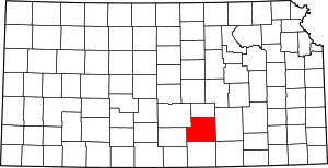 Map of Kansas highlighting Sedgwick County | |
| Unincorporated CDPs | ||
| Unincorporated communities | ||
| Townships | ||
| Footnotes | ‡This populated place also has portions in an adjacent county or counties | |
| Authority control |
|
|---|