Montferrer
Montferrer is a commune in the Pyrénées-Orientales department in southern France.
Montferrer | |
|---|---|
 A general view of Montferrer | |
 Coat of arms | |
Location of Montferrer 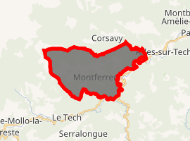
| |
 Montferrer 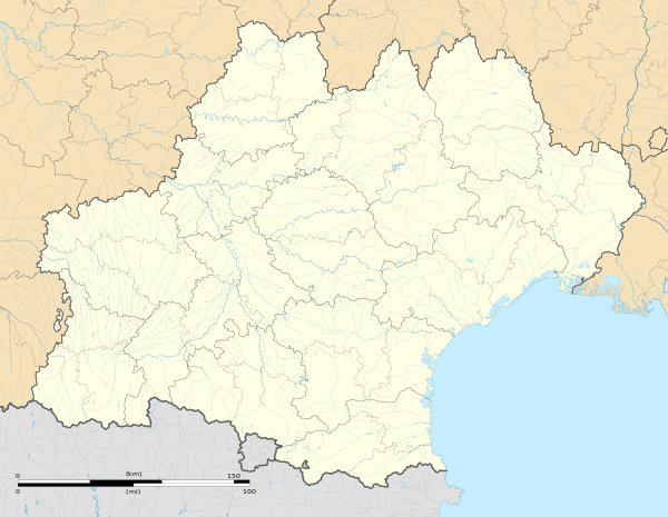 Montferrer | |
| Coordinates: 42°26′20″N 2°34′05″E | |
| Country | France |
| Region | Occitanie |
| Department | Pyrénées-Orientales |
| Arrondissement | Céret |
| Canton | Le Canigou |
| Intercommunality | Haut Vallespir |
| Government | |
| • Mayor (2001–2008) | Dominique Petit[1] |
| Area 1 | 21.95 km2 (8.47 sq mi) |
| Population (2017-01-01)[2] | 188 |
| • Density | 8.6/km2 (22/sq mi) |
| Time zone | UTC+01:00 (CET) |
| • Summer (DST) | UTC+02:00 (CEST) |
| INSEE/Postal code | 66116 /66150 |
| Elevation | 308–1,608 m (1,010–5,276 ft) (avg. 820 m or 2,690 ft) |
| 1 French Land Register data, which excludes lakes, ponds, glaciers > 1 km2 (0.386 sq mi or 247 acres) and river estuaries. | |
Geography
Montferrer is located in the canton of Le Canigou and in the arrondissement of Céret.
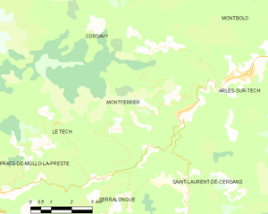
Map of Montferrer and its surrounding communes
Population
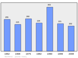
Population 1962-2008
References
- Dominique Petit élu nouveau maire, L'Indépendant
- "Populations légales 2017". INSEE. Retrieved 6 January 2020.
| Wikimedia Commons has media related to Montferrer. |
| Authority control |
|
|---|
This article is issued from Wikipedia. The text is licensed under Creative Commons - Attribution - Sharealike. Additional terms may apply for the media files.