McDowell County, West Virginia
McDowell County is a county in the U.S. state of West Virginia. As of the 2010 census, the population was 22,113.[2] Its county seat is Welch.[3] McDowell county is the southernmost county in the state. It was created in 1858 by the Virginia General Assembly and named for Virginia Governor James McDowell.[4] It became a part of West Virginia in 1863, when several counties seceded from the state of Virginia during the American Civil War.
McDowell County | |
|---|---|
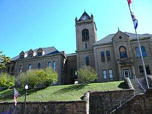 McDowell County Courthouse in Welch | |
 Location within the U.S. state of West Virginia | |
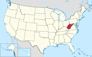 West Virginia's location within the U.S. | |
| Coordinates: 37°22′N 81°39′W | |
| Country | |
| State | |
| Founded | February 28, 1858 |
| Named for | James McDowell[1] |
| Seat | Welch |
| Largest city | Welch |
| Area | |
| • Total | 535 sq mi (1,390 km2) |
| • Land | 533 sq mi (1,380 km2) |
| • Water | 1.4 sq mi (4 km2) 0.3%% |
| Population (2010) | |
| • Total | 22,113 |
| • Estimate (2019) | 17,624 |
| • Density | 41/sq mi (16/km2) |
| Demonym(s) | McDowellian (Colloquial) |
| Time zone | UTC−5 (Eastern) |
| • Summer (DST) | UTC−4 (EDT) |
| Congressional district | 3rd |
| Website | www |
History
On February 20, 1858, McDowell County was formed from the northern portion of Tazewell County.[5] In 1861, as the nation lurched toward civil war, delegates from McDowell County voted in favor of Virginia's secession from the United States.[6] When the northwestern counties voted to secede from Virginia the following year, McDowell, Greenbrier, Logan, Mercer, Monroe, Pocahontas, Webster, and Wyoming Counties refused to participate. The status of these eight counties would be decided by the United States Supreme Court in the case of Virginia v. West Virginia.[7]
McDowell was one of fifty Virginia Counties that were recognized as the state of West Virginia on June 20, 1863. The same year, the residents of McDowell County chose Perryville, now English, then the most populous town, as the new county seat.[4] However, in 1866 the state legislature relocated the county seat to a farm near the mouth of Mill Creek. There it remained until 1874, when it returned to Perryville.[5] The location of the county seat remained in dispute until 1892, when it moved to Welch.[5]
In 1863, West Virginia's counties were divided into civil townships, with the intention of encouraging local government. This proved impractical in the heavily rural state, and in 1872 the townships were converted into magisterial districts.[8] McDowell County was divided into three districts: Big Creek, Elkhorn, and Sandy River. In the 1890s, Browns Creek District was formed from a portion of Elkhorn, and then North Fork District was created from parts of Browns Creek and Elkhorn. A sixth district, Adkin, was created from part of Elkhorn District in the early 1900s. These districts remained stable until the 1980s, when Adkin, Elkhorn, and North Fork were consolidated into the district of North Elkin.[9]
Referring to the unconventional demographics and political state of McDowell County, a local newspaper editor described the county as "the Free State of McDowell", a description that has stuck in the popular imagination.[10]
By the first half of the 20th century, McDowell County's economy was dominated by coal mining. In 1950, it was the "leading coal producing county" in the US. Sixteen percent of the county's population in 1950 was employed in the coal mining sector. However, in the next few decades major breakthroughs in mechanization in the coal industry caused job shortages. Already by 1960 the mining workforce had decreased from around 16,000 to around 7,000.[11]
In May 1963, the increasing rate of poverty in McDowell County led U.S. President John F. Kennedy to remark in a speech given in the city of Welch:
I don't think any American can be satisfied to find in McDowell County, in West Virginia, 20 or 25 percent of the people of that county out of work, not for 6 weeks or 12 weeks, but for a year, 2, 3, or 4 years.[12]
Geography
McDowell County, the southernmost county in West Virginia, is located at 37.37°N 81.65°W. It is bordered by Tazewell County, Virginia, to the south; Buchanan County, Virginia, to the west; Mingo County to the northwest; Wyoming County to the north; and Mercer County to the east. The Appalachian Mountains determine most of the borders of the county.
According to the U.S. Census Bureau, the county has a total area of 535 square miles (1,390 km2), of which 533 square miles (1,380 km2) is land and 1.4 square miles (3.6 km2) (0.3%) is water.[13] The county is roughly in the shape of a semi circle, with the border following the mountains around the county.
Demographics
| Historical population | |||
|---|---|---|---|
| Census | Pop. | %± | |
| 1860 | 1,535 | — | |
| 1870 | 1,952 | 27.2% | |
| 1880 | 3,074 | 57.5% | |
| 1890 | 7,300 | 137.5% | |
| 1900 | 18,747 | 156.8% | |
| 1910 | 47,856 | 155.3% | |
| 1920 | 68,571 | 43.3% | |
| 1930 | 90,479 | 31.9% | |
| 1940 | 94,354 | 4.3% | |
| 1950 | 98,887 | 4.8% | |
| 1960 | 71,359 | −27.8% | |
| 1970 | 50,666 | −29.0% | |
| 1980 | 49,899 | −1.5% | |
| 1990 | 35,233 | −29.4% | |
| 2000 | 27,329 | −22.4% | |
| 2010 | 22,113 | −19.1% | |
| Est. 2019 | 17,624 | [14] | −20.3% |
| U.S. Decennial Census[15] 1790–1960[16] 1900–1990[17] 1990–2000[18] 2010–2018[2] | |||
2010 census
As of the 2010 United States Census, there were 22,113 people, 9,176 households, and 6,196 families residing in the county.[19] The population density was 41.5 inhabitants per square mile (16.0/km2). There were 11,322 housing units at an average density of 21.2 per square mile (8.2/km2).[20] The racial makeup of the county was 89.1% white, 9.5% black or African American, 0.2% American Indian, 0.1% Asian, 0.0% from other races, and 1.1% from two or more races. Those of Hispanic or Latino origin made up 0.4% of the population.[19] The largest ancestry groups were: 13.7% Irish, 12.0% German, 11.5% English, 8.0% American, 2.8% Sub-Saharan African, 2.7% Italian, 2.0% Dutch, 1.1% Scotch-Irish [21]
Of the 9,176 households, 28.7% had children under the age of 18 living with them, 48.1% were married couples living together, 13.9% had a female householder with no husband present, 32.5% were non-families, and 28.8% of all households were made up of individuals. The average household size was 2.36 and the average family size was 2.86. The median age was 43.8 years.[19]
The median income for a household in the county was $22,154 and the median income for a family was $28,413. Males had a median income of $31,229 versus $26,776 for females. The per capita income for the county was $12,955. About 27.5% of families and 32.6% of the population were below the poverty line, including 44.3% of those under age 18 and 20.1% of those age 65 or over.[22]
Life expectancy
Of 3,142 counties in the United States in 2013, McDowell County ranked 3,142 in the life expectancy of both male and female residents. Males in McDowell County lived an average of 63.5 years and females lived an average of 71.5 years compared to the national average for life expectancy of 76.5 for males and 81.2 for females. Moreover, the average life expectancy in McDowell County declined by 3.2 years for males and 4.1 years for females between 1985 and 2013 compared to a national average for the same period of an increased life span of 5.5 years for men and 3.1 years for women. High rates of smoking and obesity and a low level of physical activity appear to be contributing factors to the declining life expectancy for both sexes.[23]
Drug-induced deaths
In 2015, McDowell County had the highest rate of drug-induced deaths of any county in the United States, with 141 deaths per 100,000 people. (The rate for the United States as a whole was 14.7 per 100,000 people.[24]) Neighboring Wyoming County had the second highest rate.[25]
Economy
The county has been classified as a "food desert" by the USDA. In 2017, there were two full-sized grocery stores serving the county's 535 square miles.[26] The county's only Walmart Supercenter, the county's largest employer, closed in 2016.[27]
Politics
The power of industrial and mining political systems turned it strongly towards the Republican Party between 1890 and 1932 – being strongly Republican enough to even support William Howard Taft during the divided 1912 presidential election.[28]
| Year | Republican | Democratic | Third parties |
|---|---|---|---|
| 2016 | 74.1% 4,629 | 23.0% 1,438 | 2.9% 179 |
| 2012 | 64.0% 3,959 | 34.1% 2,109 | 1.9% 120 |
| 2008 | 44.8% 2,882 | 53.3% 3,430 | 1.8% 118 |
| 2004 | 37.8% 2,762 | 61.7% 4,501 | 0.5% 36 |
| 2000 | 32.2% 2,348 | 66.3% 4,845 | 1.5% 110 |
| 1996 | 18.9% 1,550 | 73.0% 5,989 | 8.2% 669 |
| 1992 | 19.8% 1,941 | 71.8% 7,019 | 8.4% 821 |
| 1988 | 25.4% 2,463 | 74.2% 7,204 | 0.5% 47 |
| 1984 | 33.3% 4,284 | 66.3% 8,546 | 0.4% 53 |
| 1980 | 27.7% 3,862 | 70.4% 9,822 | 1.9% 259 |
| 1976 | 28.0% 4,107 | 72.0% 10,557 | |
| 1972 | 56.8% 8,942 | 43.2% 6,811 | |
| 1968 | 21.2% 4,020 | 67.8% 12,842 | 11.0% 2,075 |
| 1964 | 17.0% 3,684 | 83.1% 18,046 | |
| 1960 | 25.2% 6,555 | 74.8% 19,501 | |
| 1956 | 39.8% 11,138 | 60.2% 16,865 | |
| 1952 | 30.2% 10,663 | 69.8% 24,657 | |
| 1948 | 30.8% 9,687 | 68.5% 21,545 | 0.8% 240 |
| 1944 | 36.4% 11,023 | 63.7% 19,300 | |
| 1940 | 36.3% 13,906 | 63.7% 24,449 | |
| 1936 | 28.1% 9,975 | 71.8% 25,471 | 0.1% 35 |
| 1932 | 56.4% 16,069 | 43.4% 12,365 | 0.3% 80 |
| 1928 | 64.0% 14,810 | 35.9% 8,294 | 0.1% 31 |
| 1924 | 63.0% 12,422 | 28.2% 5,561 | 8.9% 1,749 |
| 1920 | 70.6% 12,198 | 29.3% 5,068 | 0.1% 16 |
| 1916 | 65.6% 7,086 | 34.2% 3,692 | 0.2% 20 |
| 1912 | 46.5% 4,341 | 26.8% 2,497 | 26.7% 2,489 |
Government
| Position | Name |
|---|---|
| Commissioner | Cody Estep |
| Commissioner | Cecil Patterson |
| Commissioner, President | Harold McBride |
| Prosecuting Attorney | Ed Kornish |
| Sheriff | Martin West |
| County Assessor | Dennis Altizer |
| County Clerk | Donald Hicks |
| Circuit Clerk | Francine Spencer |
Education
McDowell County Schools operates the county's public K-12 education system of 7 elementary schools, 2 middle schools, and 2 public high schools in McDowell County including Mount View High School, and River View High School. The county also has a private school, Twinbranch Pentecostal Christian Academy which is located in Twinbranch.[30] The current superintendent of schools is Nelson Spencer.
McDowell County Schools were under state control as a 'take-over' county from 2001 to 2013.[31] Some medical services have been brought onsite into schools to reduce student absenteeism among families with only one car, and personal items such as sneakers and backpacks are now made available to students. A mixed use, multistory building in Welch aimed at reducing the housing shortage for teachers is scheduled to open in 2020.[32]
In Popular Culture
Melville Davisson Post used McDowell County as the setting of his short story "Once In Jeopardy". This 1890s tale of the working out of a legal problem is rich in description of the people, customs, politics, and recent history of the area, including the impact of the railroad coming through and the rise of Republican influence.[33]
Author and NASA engineer Homer Hickam grew up in Coalwood, McDowell County. His memoir October Sky, which was adapted into a Hollywood movie, is based on his childhood amateur rocket building experiences in Coalwood.
Transportation
Major highways


The West Virginia Division of Highways is currently trying to construct new highways, such as U.S. Route 121, known as the Coalfields Expressway.[34]
Airport
The county also had one airport, Welch Municipal Airport, which is now closed indefinitely.
Communities
Magisterial districts
- Big Creek
- Browns Creek
- North Elkin
- Sandy River
Census-designated places
Unincorporated communities
- Algoma
- Apple Grove
- Asco
- Ashland
- Atwell
- Avondale
- Beartown
- Big Four
- Bishop (partial)
- Black Wolf
- Bottom Creek
- Canebrake
- Capels
- Caretta
- Carlos
- Carswell
- Coalwood
- Eckman
- Elbert
- Elkhorn
- English
- Ennis
- Erin
- Faraday
- Filbert
- Gilliam
- Havaco
- Hemphill
- Hensley
- Hull
- Isaban (part)
- Jacobs Fork
- Jed
- Jenkinjones
- Johnnycake
- Jolo
- Kyle
- Landgraff
- Leckie
- Lex
- Lila
- Litwar
- Maitland
- McDowell
- Mohawk
- Mohegan
- Monson
- Newhall
- Panther
- Paynesville
- Powhatan
- Premier
- Ream
- Rift
- Rockridge
- Rolfe
- Sandy Huff
- Six
- Skygusty
- Squire
- Superior
- Switchback
- Thorpe
- Twin Branch
- Union City
- Upland
- Vallscreek
- Venus
- Warriormine
- Wilcoe
- Worth
- Yerba
- Yukon
See also
References
- "West Virginia Counties". West Virginia Division of Culture and History. Archived from the original on September 23, 2001. Retrieved July 23, 2013.
- "State & County QuickFacts". United States Census Bureau. Archived from the original on June 6, 2011. Retrieved January 10, 2014.
- "Find a County". National Association of Counties. Archived from the original on May 31, 2011. Retrieved June 7, 2011.
- Lewis, Virgil (1889). History of West Virginia. Philadelphia, PA: Hubbard Brothers, Publishers. p. 728.
- Byrne, George (1915). 1915 Handbook of West Virginia. Charleston, WV: Lovett Printing Company. p. 88.
- "Votes for Secession by County - Virginia Convention of 1861 - Civil War Collections - University of Richmond". secession.richmond.edu. Retrieved April 22, 2019.
- Klement, Frank L.; Curry, Richard Orr (March 1965). "A House Divided: A Study of Statehood Politics and the Copperhead Movement in West Virginia". The Journal of American History. 51 (4): 720. doi:10.2307/1889831. ISSN 0021-8723. JSTOR 1889831.
- Otis K. Rice & Stephen W. Brown, West Virginia: A History, 2nd ed., University Press of Kentucky, Lexington (1993), p. 240.
- United States Census Bureau, U.S. Decennial Census, Tables of Minor Civil Divisions in West Virginia, 1870–2010.
- Deaner, Larry Scott (2004). [Home in the McDowell County Coalfields: The African-American Population of Keystone, West Virginia Home in the McDowell County Coalfields: The African-American Population of Keystone, West Virginia] Check
|url=value (help) (M.S., Geography thesis). Ohio University. Retrieved March 20, 2011. - https://reason.com/2016/12/10/why-dont-people-who-are-stuck-in-depressed-appalachian-towns-just-leave/
- Kennedy, John F. (1964). Public Papers of the Presidents of the United States: John F. Kennedy, 1963. Best Books on, 1964. p. 366. ISBN 9781623769031.
- "2010 Census Gazetteer Files". United States Census Bureau. August 22, 2012. Retrieved July 30, 2015.
- "Population and Housing Unit Estimates". Retrieved March 29, 2020.
- "U.S. Decennial Census". United States Census Bureau. Archived from the original on April 26, 2015. Retrieved January 10, 2014.
- "Historical Census Browser". University of Virginia Library. Retrieved January 10, 2014.
- "Population of Counties by Decennial Census: 1900 to 1990". United States Census Bureau. Retrieved January 10, 2014.
- "Census 2000 PHC-T-4. Ranking Tables for Counties: 1990 and 2000" (PDF). United States Census Bureau. Retrieved January 10, 2014.
- "DP-1 Profile of General Population and Housing Characteristics: 2010 Demographic Profile Data". United States Census Bureau. Archived from the original on February 13, 2020. Retrieved April 3, 2016.
- "Population, Housing Units, Area, and Density: 2010 - County". United States Census Bureau. Archived from the original on February 13, 2020. Retrieved April 3, 2016.
- "DP02 SELECTED SOCIAL CHARACTERISTICS IN THE UNITED STATES – 2006-2010 American Community Survey 5-Year Estimates". United States Census Bureau. Archived from the original on February 13, 2020. Retrieved April 3, 2016.
- "DP03 SELECTED ECONOMIC CHARACTERISTICS – 2006-2010 American Community Survey 5-Year Estimates". United States Census Bureau. Archived from the original on February 13, 2020. Retrieved April 3, 2016.
- "McDowell County, West Virginia", http://www.healthdata.org/sites/default/files/files/county_profiles/US/2015/County_Report_McDowell_County_West_Virginia.pdf, accessed January 12, 2017.
- "Increases in Drug and Opioid Overdose Deaths — United States, 2000–2014". www.cdc.gov. Retrieved March 27, 2018.
- "Underlying Cause of Death, 1999-2015 Results". Centers for Disease Control and Prevention. Retrieved January 11, 2017.
- Coyne, Caity (April 7, 2018). "In McDowell County 'food desert,' concerns about the future". Charleston Gazette-Mail. Retrieved January 19, 2020.
- "What Happened when Walmart Left," The Guardian, , accessed 19 Jan 2020
- Menendez, Albert J.; The Geography of Presidential Elections in the United States, 1868-2004, pp. 334-337 ISBN 0786422173
- Leip, David. "Dave Leip's Atlas of U.S. Presidential Elections". uselectionatlas.org. Retrieved March 27, 2018.
- "Archived copy". Archived from the original on June 21, 2012. Retrieved September 1, 2011.CS1 maint: archived copy as title (link)
- Mays, Mackenzie (May 8, 2013). "McDowell regains school control after 12 years". Charleston Gazette. Retrieved August 17, 2013.
- Balingit, Moriah (October 19, 2019). "Rebuilding the village: A West Virginia school system strives to lift up its children by tackling poverty". Washington Post. Retrieved December 16, 2019.
- . The Man of Last Resort – via Wikisource.
- "Coalfields Expressway". Coalfields Expressway Authority. Retrieved August 31, 2011.
External links
- McDowell County, West Virginia
- McDowell County Board of Education
- McDowell County Commission
- McDowell County Economic Development Authority
- McDowell County Community Calendar
- McDowell County Economic Development Home Page
- McDowell County GenWeb Project
- McDowell Public Library
Places adjacent to McDowell County, West Virginia | ||||||||||
|---|---|---|---|---|---|---|---|---|---|---|
| ||||||||||
Municipalities and communities of McDowell County, West Virginia, United States | ||
|---|---|---|
| Cities | Map of West Virginia highlighting McDowell County | |
| Towns | ||
| CDPs | ||
| Unincorporated communities |
| |
| Ghost town | ||
| Footnotes | ‡This populated place also has portions in an adjacent county or counties | |
| Authority control |
|
|---|