Locust Grove, Georgia
Locust Grove is a city in Henry County, Georgia, United States. The population was 5,402 at the 2010 census,[5] up from 2,322 in 2000. Some unincorporated communities such as Luella and many rural areas surround Locust Grove, and those communities have Locust Grove postal addresses.
Locust Grove, Georgia | |
|---|---|
City | |
 Locust Grove City Hall | |
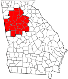
 Location in Henry County and the state of Georgia | |
| Coordinates: 33°20′44″N 84°6′18″W | |
| Country | United States |
| State | Georgia |
| County | Henry |
| Area | |
| • Total | 11.62 sq mi (30.10 km2) |
| • Land | 11.44 sq mi (29.62 km2) |
| • Water | 0.18 sq mi (0.48 km2) |
| Elevation | 837 ft (255 m) |
| Population (2010) | |
| • Total | 5,402 |
| • Estimate (2019)[2] | 8,243 |
| • Density | 720.73/sq mi (278.27/km2) |
| Time zone | UTC-5 (Eastern (EST)) |
| • Summer (DST) | UTC-4 (EDT) |
| ZIP code | 30248 |
| Area code | 770/678/470 |
| FIPS code | 13-47140[3] |
| GNIS feature ID | 0332253[4] |
| Website | www |
Locust Grove has experienced a growth in population and in businesses coming into the area. In 1900 the population of the city was 254 and is now over 5,000.
History
The community was named for a grove of locust trees near the original town site.[6] Georgia General Assembly incorporated Locust Grove in 1893.[7]
Geography

Locust Grove is located in southern Henry County at 33°20′44″N 84°6′18″W (33.345499, -84.104991).[8] U.S. Route 23 passes through the center of town, leading north 7 miles (11 km) to McDonough, the county seat, and southeast 10 miles (16 km) to Jackson. Interstate 75 passes through the western portion of Locust Grove, with access from Exit 212 (Bill Gardner Parkway). I-75 leads northwest 36 miles (58 km) to downtown Atlanta and southeast 49 miles (79 km) to Macon.
According to the United States Census Bureau, the city has a total area of 10.8 square miles (28.1 km2), of which 10.7 square miles (27.6 km2) are land and 0.2 square miles (0.5 km2), or 1.67%, are water.[5]
The unincorporated community of Luella, located 5 miles (8 km) west of the city, uses a "Locust Grove" mailing address.
Major highways


Demographics
| Historical population | |||
|---|---|---|---|
| Census | Pop. | %± | |
| 1890 | 255 | — | |
| 1900 | 254 | −0.4% | |
| 1910 | 716 | 181.9% | |
| 1920 | 529 | −26.1% | |
| 1930 | 428 | −19.1% | |
| 1940 | 349 | −18.5% | |
| 1950 | 405 | 16.0% | |
| 1960 | 369 | −8.9% | |
| 1970 | 642 | 74.0% | |
| 1980 | 1,479 | 130.4% | |
| 1990 | 1,681 | 13.7% | |
| 2000 | 2,322 | 38.1% | |
| 2010 | 5,402 | 132.6% | |
| Est. 2019 | 8,243 | [2] | 52.6% |
| U.S. Decennial Census[9] | |||
As of the census[3] of 2000, there were 2,322 people, 817 households, and 637 families residing in the city. The population density was 1,089.5 people per square mile (420.9/km2). There were 863 housing units at an average density of 404.9 per square mile (156.4/km2). The racial makeup of the city was 82.00% White, 14.38% African American, 0.60% Native American, 0.43% Asian, 0.09% Pacific Islander, 1.08% from other races, and 1.42% from two or more races. Hispanic or Latino of any race were 2.07% of the population.
There were 817 households out of which 41.1% had children under the age of 18 living with them, 55.9% were married couples living together, 15.5% had a female householder with no husband present, and 22.0% were non-families. 18.1% of all households were made up of individuals and 6.4% had someone living alone who was 65 years of age or older. The average household size was 2.84 and the average family size was 3.18.
In the city, the age distribution of the population shows 29.4% under the age of 18, 8.7% from 18 to 24, 35.2% from 25 to 44, 18.4% from 45 to 64, and 8.3% who were 65 years of age or older. The median age was 32 years. For every 100 females, there were 99.3 males. For every 100 females age 18 and over, there were 91.4 males.
The median income for a household in the city was $42,188, and the median income for a family was $46,042. Males had a median income of $32,094 versus $22,845 for females. The per capita income for the city was $16,120. About 5.6% of families and 8.8% of the population were below the poverty line, including 12.3% of those under age 18 and 9.3% of those age 65 or over.
Attractions
Tanger Outlet Center opened for business in the fall of 1994. Since that time many new businesses have made Locust Grove their home. Tanger Outlet Center tenants include Coach, J.Crew, Jones New York, Liz Claiborne, Gap, Banana Republic, Old Navy, Pac Sun, Polo Ralph Lauren, Reebok, Tommy Hilfiger, Nautica, Aeropostale, Jockey, Eddie Bauer, Nike and more.
Locust Grove is also home to Noah's Ark, a non-profit preserve and rehabilitation facility home to more than 1,000 animals. A group home sharing the site was previously licensed by the state of Georgia to provide residential care for up to 24 children but has since closed.
Schools
Public
Elementary
- Locust Grove Elementary School
- Unity Grove Elementary School
- Luella Elementary School
- New Hope Elementary School
- Bethlehem Elementary School
Middle
- Locust Grove Middle School
- Luella Middle School
- Ola Middle School
High
- Locust Grove High School
- Luella High School
- Ola High School
Private
- Strong Rock Christian School
- Heritage Baptist Christian School
References
- "2019 U.S. Gazetteer Files". United States Census Bureau. Retrieved July 9, 2020.
- "Population and Housing Unit Estimates". United States Census Bureau. May 24, 2020. Retrieved May 27, 2020.
- "U.S. Census website". United States Census Bureau. Retrieved 2008-01-31.
- "US Board on Geographic Names". United States Geological Survey. 2007-10-25. Retrieved 2008-01-31.
- "Geographic Identifiers: 2010 Demographic Profile Data (G001): Locust Grove city, Georgia". American Factfinder. U.S. Census Bureau. Retrieved May 18, 2017.
- Krakow, Kenneth K. (1975). Georgia Place-Names: Their History and Origins (PDF). Macon, GA: Winship Press. p. 135. ISBN 0-915430-00-2.
- "Our Town". City of Locust Grove. Retrieved 13 March 2019.
- "US Gazetteer files: 2010, 2000, and 1990". United States Census Bureau. 2011-02-12. Retrieved 2011-04-23.
- "Census of Population and Housing". Census.gov. Retrieved June 4, 2015.
External links
- City of Locust Grove official website
- Locust Grove Institute historical marker
|  | |||||
|
| ||||||
| ||||||
Municipalities and communities of Henry County, Georgia, United States | ||
|---|---|---|
| Cities |  Map of Georgia highlighting Henry County | |
| CDP | ||
| Unincorporated communities | ||
| Ghost towns | ||
| Footnotes | ‡This populated place also has portions in an adjacent county or counties | |
| Authority control |
|
|---|