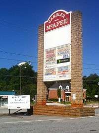
Candler-McAfee, Georgia
Candler-McAfee is a census-designated place in unincorporated DeKalb County, Georgia, United States. It is located east of Atlanta[2] approximately 10 miles (16 km) east of Downtown Atlanta and to the south of Decatur, Georgia[3] The population was 23,025 at the 2010 census.[4]
Candler-McAfee, Atlanta | |
|---|---|
neighborhood of Atlanta | |
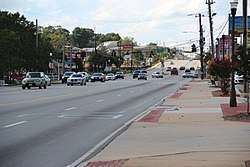 Georgia State Route 155 in Candler-McAfee | |
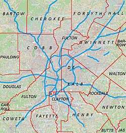
 Location in DeKalb County and the state of Georgia | |
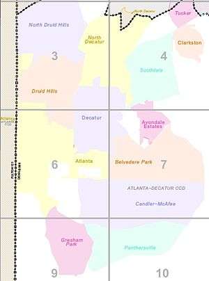
 Candler‑McAfee CDP Location in Atlanta, GA | |
| Coordinates: 33°43′38″N 84°16′29″W | |
| Country | United States |
| State | Georgia |
| County | DeKalb |
| Area | |
| • Total | 7 sq mi (18.1 km2) |
| • Land | 7 sq mi (18.1 km2) |
| • Water | 0 sq mi (0 km2) |
| Population (2010) | |
| • Total | 23,025 |
| • Density | 3,300/sq mi (1,300/km2) |
| Time zone | UTC-5 (Eastern (EST)) |
| • Summer (DST) | UTC-4 (EDT) |
| FIPS code | 13-12834[1] |
Geography
Candler-McAfee is located to the east of the city of Atlanta, Georgia[5] and is bounded by:[6]
- North: Glenwood Avenue
- West: 2nd Avenue
- South: I-20
- East: I-285
The Belvedere Park CDP is to the north and Panthersville CDP is to the south.
According to the United States Census Bureau, the CDP has a total area of 7.0 square miles (18 km2), of which 0.04 square miles (0.10 km2), or 0.29%, is water.
Landmarks
The area is home to DeKalb Fire Station 26 and its water tower. East Lake Golf Club is on the northern boundary of Candler-McAfee
Demographics
| Historical population | |||
|---|---|---|---|
| Census | Pop. | %± | |
| 1980 | 27,306 | — | |
| 1990 | 29,491 | 8.0% | |
| 2000 | 28,294 | −4.1% | |
| 2010 | 23,025 | −18.6% | |
| source:[4][7] | |||
As of the census[1] of 2000, there were 28,294 people, 9,030 households, and 6,926 families residing in the CDP. The population density was 4,054.2 people per square mile (1,565.1/km2). There were 9,415 housing units at an average density of 1,349.0/sq mi (520.8/km2). The racial makeup of the CDP was 3.31% White, 95.17% African American, 0.20% Native American, 0.15% Asian, 0.01% Pacific Islander, 0.41% from other races, and 0.76% from two or more races. Hispanic or Latino of any race were 0.93% of the population.
There were 9,030 households, out of which 32.7% had children under the age of 18 living with them, 36.9% were married couples living together, 33.1% had a female householder with no husband present, and 23.3% were non-families. 18.2% of all households were made up of individuals, and 3.4% had someone living alone who was 65 years of age or older. The average household size was 3.08 and the average family size was 3.46.
In the CDP, the population was spread out, with 28.0% under the age of 18, 10.7% from 18 to 24, 28.2% from 25 to 44, 25.7% from 45 to 64, and 7.5% who were 65 years of age or older. The median age was 33 years. For every 100 females, there were 87.0 males. For every 100 females age 18 and over, there were 81.7 males.
The median income for a household in the CDP was $38,152, and the median income for a family was $40,368. Males had a median income of $30,218 versus $25,887 for females. The per capita income for the CDP was $15,092. About 10.9% of families and 13.6% of the population were below the poverty line, including 17.1% of those under age 18 and 14.9% of those age 65 or over. By 2007 the poverty rate had exploded to 27.5%, one of the highest rates in the country.
Neighborhoods
Neighborhoods in the CDP:
- East Lake Terrace, between Glenwood (N), McAfee (S), Parker (W) and Candler (E)
- Mark Trail Park
- Eastwyck Village
- Glendale Park
- Springwoods
- Spring Valley
Education
It is in the DeKalb County Public Schools.[8] Zoned schools:
- Elementary schools: Columbia, Kelley Lake, Ronald E. McNair, Snapfinger, and Toney (all in the CDP)[9]
- Middle schools: Ronald E. McNair (in the CDP) and Columbia (outside the CDP)[10]
- High schools: Columbia High School (in the CDP) and Ronald E. McNair High School (outside the CDP).[11]
The Roman Catholic Archdiocese of Atlanta operates area Catholic schools. The K-8 school St. Peter Claver Regional School is in Candler-McAfee.[12]
References
| Wikimedia Commons has media related to Candler-McAfee, Georgia. |
- "U.S. Census website". United States Census Bureau. Retrieved January 31, 2008.
- "Atlanta, Georgia :: Boundary Map of Atlanta, Georgia". www.maptechnica.com. Archived from the original on April 24, 2018. Retrieved April 23, 2018.
- "Decatur". Decatur.
- "Race, Hispanic or Latino, Age, and Housing Occupancy: 2010 Census Redistricting Data (Public Law 94-171) Summary File (QT-PL), Candler-McAfee CDP, Georgia". United States Census Bureau. Retrieved October 28, 2011.
- "US Gazetteer files: 2010, 2000, and 1990". United States Census Bureau. February 12, 2011. Retrieved April 23, 2011.
- "Candler-McAfee, Georgia :: Boundary Map of Candler-McAfee, Georgia". www.maptechnica.com. Archived from the original on April 24, 2018. Retrieved April 23, 2018.
- "CENSUS OF POPULATION AND HOUSING (1790–2000)". U.S. Census Bureau. Retrieved July 17, 2010.
- "2010 CENSUS – CENSUS BLOCK MAP: Candler-McAfee CDP, GA" (PDF). U.S. Census Bureau. Retrieved May 7, 2020. – Compare with school addresses and boundary maps.
- "Elementary School Attendance Areas 2016 – 2017 School Year." DeKalb County School System. Retrieved on June 1, 2017.
- "Middle School Attendance Areas 2016 – 2017 School Year." DeKalb County School System. Retrieved on June 1, 2017.
- "High School Attendance Areas 2016 – 2017 School Year." DeKalb County School System. Retrieved on June 1, 2017.
- "Home". St. Peter Claver Regional School. Retrieved May 7, 2020.
2560 Tilson Road Decatur, GA 30032
– Despite the Decatur address it is not in the city limits. Compare with the Candler-McAfee CDP limits map.
| Topics |  | |
|---|---|---|
| Education | ||
| Government |
| |
| Sports | ||
| Related |
| |
| ||
Municipalities and communities of DeKalb County, Georgia, United States | ||
|---|---|---|
| Cities | 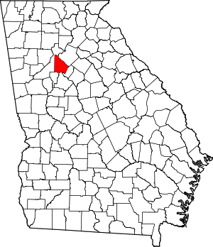 Map of Georgia highlighting DeKalb County | |
| CDPs | ||
| Neighborhoods and unincorporated communities |
| |
| Ghost town | ||
| Footnotes | ‡This populated place also has portions in an adjacent county or counties | |