Mableton, Georgia
Mableton is a town in Cobb County, Georgia, United States. As of the 2010 census, Mableton had a population of 37,115. When Brookhaven became a city in December 2012, Mableton became the largest unincorporated community in Metro Atlanta.
Mableton, Georgia | |
|---|---|
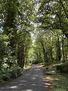
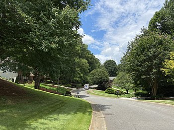  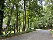  From top to bottom, left to right: residential streets in Mableton; rolling hills and narrow roads are characteristic of the area's piedmont geography, the Atlanta skyline from Mt. Harmony Memorial Gardens in Mableton. | |
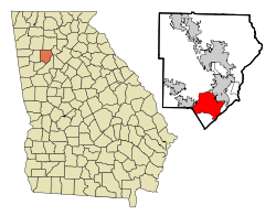 Location in Cobb County and the state of Georgia | |
| Coordinates: 33°48′48″N 84°34′18″W | |
| Country | United States |
| State | Georgia |
| County | Cobb |
| Settled | September 11, 1843 |
| Incorporated (town) | August 19, 1912 - August 17, 1916 |
| Area | |
| • Total | 20.8 sq mi (53.7 km2) |
| • Land | 20.6 sq mi (53.3 km2) |
| • Water | 0.2 sq mi (0.4 km2) |
| Elevation | 978 ft (298 m) |
| Population (2010) | |
| • Total | 37,115 |
| • Density | 1,800/sq mi (690/km2) |
| Time zone | UTC-5 (Eastern (EST)) |
| • Summer (DST) | UTC-4 (EDT) |
| ZIP code | 30126 |
| Area code(s) | 770/678/404 |
| FIPS code | 13-48288[1] |
| GNIS feature ID | 0332295[2] |
| Website | www.mableton.org |
It was named for Robert Mable, who on September 11, 1843, bought 300 acres (approximately 120 hectares or 1.2 km2) of land. The Southern Railway opened a railroad station in Mableton in December 1881, and on June 28, 1882, the post office opened replacing the Bryantville post office about two miles (3.2 km) southeast. On August 19, 1912, Mableton was incorporated as a town but was disincorporated on August 17, 1916.[3] The Robert Mable House and Cemetery, located off U.S. 78 on Floyd Road just north of Clay Road, now includes an amphitheater which hosts public events.[4]
Roy Barnes, governor of Georgia from 1999 to 2003, is from Mableton.
Geography
Mableton is located at 33°48′48″N 84°34′18″W (33.813355, -84.571691).[5] It is approximately 15 miles west-northwest from the city of Atlanta.
According to the United States Census Bureau, the CDP has a total area of 20.8 square miles (54 km2), of which 20.6 square miles (53 km2) is land and 0.2 square miles (0.52 km2), or 0.82%, is water.
Demographics
As of the census of 2010, there were 37,115 people in Mableton.[6]
The 5-year estimates of the 2018 American Community Survey[6] state that 39.2% of the population was White, 48.5% African American, 0.2% Native American/Alaska Native, 2.2% Asian, 0.0% Native Hawaiian/Pacific Islander, 6.2% from some other race alone, and 3.7% from two or more races. Hispanic or Latino of any race were 18.0% of the population. Individuals who identified as White alone, not Hispanic or Latino, were 30.3% of the population.
There were 2,115 identified veterans in the area as of 2018. Foreign born persons (non-U.S. citizens or U.S. nationals at birth) made up 18.1% of the population.
As of 2018, the median income for a household in the CDP was $64,790. Males had a median income of $50,610 versus $46,239 for females. The per capita income for the CDP was $31,474. About 11.9% of the population was below the poverty line.
Among those aged 25 or older in 2018, 87.2% graduated from high school and 36.5% obtained a bachelor's degree or higher.
As of the census[1] of 2000, the population density was 1,444.4 people per square mile (557.6/km2). There were 11,339 housing units at an average density of 550.8/sq mi (212.6/km2). There were 10,894 households, out of which 34.9% had children under the age of 18 living with them, 53.5% were married couples living together, 14.5% had a female householder with no husband present, and 26.9% were non-families. 21.2% of all households were made up of individuals, and 6.7% had someone living alone who was 65 years of age or older. The average household size was 2.72 and the average family size was 3.12.
In that year, the population was spread out, with 26.0% under the age of 18, 8.4% from 18 to 24, 34.4% from 25 to 44, 21.2% from 45 to 64, and 9.9% who were 65 years of age or older. The median age was 35 years. For every 100 females, there were 95.9 males. For every 100 females age 18 and over, there were 93.2 males.
Recreation
The Silver Comet Trail runs through Mableton's northern border with Smyrna.[7]

The Mableton Community Garden is located at 5178 Floyd Road.[8]
Governor Roy Barnes provided a state grant for construction of a 2,500-seat amphitheater shortly after his appointment in 2000, fulfilling residents' desire dating back from the 1970s. The Mable House Barnes Amphitheater is a $7 million state and local investment and attracts numerous high-profile acts.[9]
Education
Cobb County Schools operates public schools.
The Georgia Japanese Language School (GJLS; ジョージア日本語学校 Jōjia Nihongo Gakkō), a part-time supplementary Japanese school, holds its classes at the Lindley 6th Grade Academy in Mableton;[10] Lindley used to be the W. H. Barnes Education Center.[11] The GJLA opened with nine students in 1974 at Oglethorpe University, serving grades 1 through 9. The school moved to W.H. Barnes in 2002.[10]
Whitefield Academy, a Christian preparatory school, is near Mableton and Smyrna.
The SAE Academy is an "independent project-based learning school" for pre-school to 8th grade students located in Mableton.
Primrose Schools, a private school for early preschool children, is in the Providence Pavilion neighborhood of Mableton.
Redevelopment
In the summer of 2010, more than a hundred residents, bureaucrats, politicians, architects, designers and traffic engineers spent a week designing a vision for what downtown Mableton will look like. It was then formalized by Duany Plater-Zyberk into a plan that was unanimously approved by Cobb County's Board of Commissioners.[12]

As of late 2020, Embry Development Company is in talks with the Cobb County Board of Commissioners to begin construction of a 31-acre mixed-use commercial/residential plaza at Mableton Parkway and Old Powder Springs Road.[13] The development calls for 81 town homes, 46 "courtyard cottage" style houses, 21 detached single-family homes, and 13,500 square feet of retail and restaurant space. The particular area, in addition to establishments along Veterans Memorial Highway (U.S. 78), is largely dated and rundown, with some businesses failing to adhere to building codes.[14]
Cityhood
As of 2020, a local initiative known as the South Cobb Alliance is fostering a debate for cityhood.[15] A feasibility study conducted by the Carl Vinson Institute of Government stated that the potential city would generate $11.3 million in operating expenses and $14.6 million in revenue.[16] Alternatively, nearby Smyrna is considering annexing parts of Mableton. This move would make Smyrna the largest city in Cobb County, surpassing the county seat of Marietta, and ultimately disrupt Mableton's cityhood efforts.[17]
Notable people
- Roy Barnes, Governor of Georgia from 1999 to 2002
- Erica Thomas, Georgia State Representative
- Anna Benson, glamour model and ex-wife of baseball player Kris Benson
- Big K.R.I.T., rapper
- AR Fox, pro wrestler
- T.J. Holmes, CNN News Anchor
- Kenny McKinley, former wide receiver for Denver Broncos
- Michael King, television producer/reporter and commentator
- Ne-Yo, R&B singer
- Lil Yachty, rapper who featured on the #1 hit Broccoli (D.R.A.M. song)
- Collin Sexton, basketball player for the Cleveland Cavaliers
- Ronnie DeVoe, Member of New Edition
References
- "U.S. Census website". United States Census Bureau. Retrieved 2008-01-31.
- "US Board on Geographic Names". United States Geological Survey. 2007-10-25. Retrieved 2008-01-31.
- Krakow, Kenneth K. (1975). Georgia Place-Names: Their History and Origins (PDF). Macon, GA: Winship Press. p. 139. ISBN 0-915430-00-2.
- "MABLETON, Cobb County. Incorporated as a town, August 19, 1912 to August 17, 1916. The post office was established June 28, 1882". Archive.is. Archived from the original on 2012-12-05. Retrieved 2019-04-04.
- "US Gazetteer files: 2010, 2000, and 1990". United States Census Bureau. 2011-02-12. Retrieved 2011-04-23.
- "U.S. Census Bureau QuickFacts: Mableton CDP, Georgia". www.census.gov. Retrieved 2020-07-09.
- "Silver Comet Trail, Cobb County Information - Georgia". Silvercometga.com. Retrieved 11 July 2018.
- "Mableton Community Garden". mableton.org. Retrieved 8 June 2020.
- "About Us". mablehouse.org. Retrieved 2020-07-19.
- "13handbook_en09.pdf" (Archive). Georgia Japanese Language Academy. Retrieved on May 11, 2014. "C/O Lindley 6th Grade Academy 1550 Pebblebrook Circle Mableton, GA 30126 U.S.A."
- "03yoran_english.pdf" (). Georgia Japanese Language Academy. Retrieved on May 11, 2014. "C/O W. H. Barnes Education Center 1550-B Pebblebrook Circle Mableton, GA 30126 U.S.A."
- "Mableton Redevelopment District Now Has Master Plan". Patch. Retrieved 2020-01-12.
- agilbert@mdjonline.com, Aleks Gilbert. "Cobb Planning Commission to hear mixed-used, single-family proposals". Northwest Georgia News. Retrieved 2020-08-06.
- Johnson, Larry Felton (2020-08-05). "Cobb Planning Commission holds decision on Mableton Parkway mixed-use development until September". Cobb County Courier. Retrieved 2020-08-06.
- "South Cobb Alliance". sites.google.com. Retrieved 2020-06-10.
- Kristal Dixon, The Atlanta Journal-Constitution. "Study shows proposed city of Mableton is financially feasible". ajc. Retrieved 2020-06-10.
- Kristal Dixon, The Atlanta Journal-Constitution. "Smyrna annexation could make it largest Cobb city, but stymie Mableton". ajc. Retrieved 2020-06-10.
|  | |||||
|
| ||||||
| ||||||
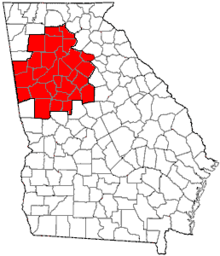
Municipalities and communities of Cobb County, Georgia, United States | ||
|---|---|---|
| Cities | 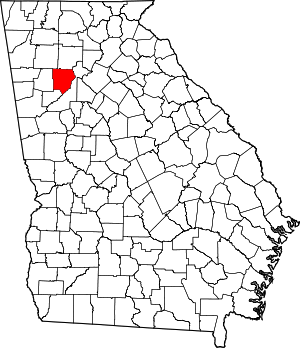 Map of Georgia highlighting Cobb County | |
| CDPs | ||
| Unincorporated communities | ||
| Footnotes | ‡This populated place also has portions in an adjacent county or counties | |
| Authority control |
|
|---|