Lignerolles, Allier
Lignerolles is a commune in the Allier department in central France.
Lignerolles | |
|---|---|
 Coat of arms | |
Location of Lignerolles 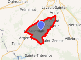
| |
 Lignerolles  Lignerolles | |
| Coordinates: 46°16′51″N 2°34′03″E | |
| Country | France |
| Region | Auvergne-Rhône-Alpes |
| Department | Allier |
| Arrondissement | Montluçon |
| Canton | Montluçon-4 |
| Intercommunality | Montluçon Communauté |
| Government | |
| • Mayor (2014-2020) | Thierry Penthier[1] |
| Area 1 | 11.81 km2 (4.56 sq mi) |
| Population (2017-01-01)[2] | 742 |
| • Density | 63/km2 (160/sq mi) |
| Demonym(s) | Lignerollais, Lignerollaises |
| Time zone | UTC+01:00 (CET) |
| • Summer (DST) | UTC+02:00 (CEST) |
| INSEE/Postal code | 03145 /03410 |
| Elevation | 204–396 m (669–1,299 ft) (avg. 370 m or 1,210 ft) |
| 1 French Land Register data, which excludes lakes, ponds, glaciers > 1 km2 (0.386 sq mi or 247 acres) and river estuaries. | |
Population
| Year | Pop. | ±% |
|---|---|---|
| 2006 | 622 | — |
| 2007 | 621 | −0.2% |
| 2008 | 625 | +0.6% |
| 2009 | 663 | +6.1% |
| 2010 | 697 | +5.1% |
| 2011 | 732 | +5.0% |
| 2012 | 760 | +3.8% |
| 2013 | 768 | +1.1% |
| 2014 | 759 | −1.2% |
| 2015 | 754 | −0.7% |
| 2016 | 748 | −0.8% |
| 2017 | 742 | −0.8% |
Politics
Presidential Elections Second Round:[3]
| Election | Winning Candidate | Party | % | |
|---|---|---|---|---|
| 2017 | Emmanuel Macron | EM | 63.54 | |
| 2012 | François Hollande | PS | 66.03 | |
| 2007 | Ségolène Royal | PS | 60.00 | |
| 2002 | Jacques Chirac | RPR | 87.74 | |
See also
References
- "Liste nominative des communes de l'Allier (avec maire, arrondissement et canton)" [Nominative list of communes of Allier (with mayor, arrondissement and canton)] (PDF). Association of Mayors and Presidents of Communities of Allier (in French). 1 April 2015. Archived from the original (PDF) on 18 May 2015. Retrieved 4 September 2015.
- "Populations légales 2017". INSEE. Retrieved 6 January 2020.
- http://www.lemonde.fr/data/france/presidentielle-2017/
| Wikimedia Commons has media related to Lignerolles. |
This article is issued from Wikipedia. The text is licensed under Creative Commons - Attribution - Sharealike. Additional terms may apply for the media files.