Château-sur-Allier
Château-sur-Allier is a commune in the Allier department in central France.
Château-sur-Allier | |
|---|---|
 The church in Château-sur-Allier | |
 Coat of arms | |
Location of Château-sur-Allier 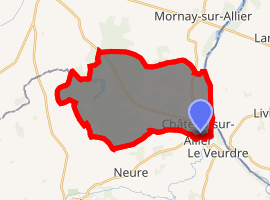
| |
 Château-sur-Allier  Château-sur-Allier | |
| Coordinates: 46°46′00″N 3°01′47″E | |
| Country | France |
| Region | Auvergne-Rhône-Alpes |
| Department | Allier |
| Arrondissement | Moulins |
| Canton | Bourbon-l'Archambault |
| Intercommunality | Pays de Lévis en Bocage Bourbonnais |
| Government | |
| • Mayor (2014–2020) | Jean-Luc Mosnier[1] |
| Area 1 | 27.75 km2 (10.71 sq mi) |
| Population (2017-01-01)[2] | 179 |
| • Density | 6.5/km2 (17/sq mi) |
| Time zone | UTC+01:00 (CET) |
| • Summer (DST) | UTC+02:00 (CEST) |
| INSEE/Postal code | 03064 /03320 |
| Elevation | 180–233 m (591–764 ft) (avg. 187 m or 614 ft) |
| 1 French Land Register data, which excludes lakes, ponds, glaciers > 1 km2 (0.386 sq mi or 247 acres) and river estuaries. | |
Population
| Year | Pop. | ±% |
|---|---|---|
| 1962 | 212 | — |
| 1968 | 251 | +18.4% |
| 1975 | 212 | −15.5% |
| 1982 | 192 | −9.4% |
| 1990 | 208 | +8.3% |
| 1999 | 172 | −17.3% |
| 2008 | 165 | −4.1% |
| 2012 | 178 | +7.9% |
See also
References
- "Liste nominative des communes de l'Allier (avec maire, arrondissement et canton)" [Nominative list of communes of Allier (with mayor, arrondissement and canton)] (PDF). Association of Mayors and Presidents of Communities of Allier. 1 April 2015. Archived from the original (PDF) on 18 May 2015. Retrieved 22 June 2015.
- "Populations légales 2017". INSEE. Retrieved 6 January 2020.
| Wikimedia Commons has media related to Château-sur-Allier. |
| Authority control |
|
|---|
This article is issued from Wikipedia. The text is licensed under Creative Commons - Attribution - Sharealike. Additional terms may apply for the media files.