Le Bouchaud
Le Bouchaud is a commune in the Allier department in central France.
Le Bouchaud | |
|---|---|
Location of Le Bouchaud 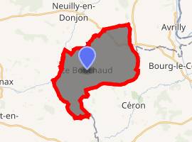
| |
 Le Bouchaud  Le Bouchaud | |
| Coordinates: 46°18′23″N 3°53′56″E | |
| Country | France |
| Region | Auvergne-Rhône-Alpes |
| Department | Allier |
| Arrondissement | Vichy |
| Canton | Dompierre-sur-Besbre |
| Intercommunality | Le Donjon–Val Libre |
| Government | |
| • Mayor (2014–2020) | Louis Meret |
| Area 1 | 22.55 km2 (8.71 sq mi) |
| Population (2017-01-01)[1] | 214 |
| • Density | 9.5/km2 (25/sq mi) |
| Time zone | UTC+01:00 (CET) |
| • Summer (DST) | UTC+02:00 (CEST) |
| INSEE/Postal code | 03035 /03130 |
| Elevation | 269–332 m (883–1,089 ft) (avg. 300 m or 980 ft) |
| 1 French Land Register data, which excludes lakes, ponds, glaciers > 1 km2 (0.386 sq mi or 247 acres) and river estuaries. | |
Population
| Year | Pop. | ±% |
|---|---|---|
| 1962 | 344 | — |
| 1968 | 377 | +9.6% |
| 1975 | 341 | −9.5% |
| 1982 | 277 | −18.8% |
| 1990 | 253 | −8.7% |
| 1999 | 222 | −12.3% |
| 2008 | 213 | −4.1% |
| 2013 | 203 | −4.7% |
| Source: INSEE[2] | ||
See also
References
- "Populations légales 2017". INSEE. Retrieved 6 January 2020.
- "2013 legal populations - Le Bouchaud". INSEE (in French). Retrieved 1 February 2016.
| Wikimedia Commons has media related to Le Bouchaud. |
This article is issued from Wikipedia. The text is licensed under Creative Commons - Attribution - Sharealike. Additional terms may apply for the media files.