Leask, Saskatchewan
Leask (2016 population: 399) is a village in the Canadian province of Saskatchewan within the Rural Municipality of Leask No. 464 and Census Division No. 16. This village is eighty kilometres southwest of the City of Prince Albert. It is the administrative centre of the Mistawasis First Nation band government and the Rural Municipality of Leask No. 464.
Leask | |
|---|---|
| Village of Leask | |
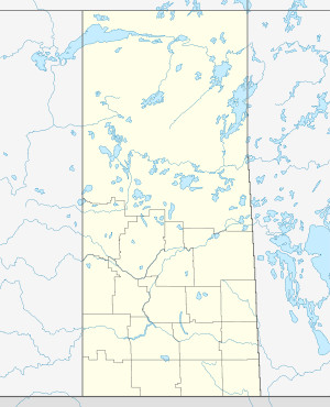 Leask Location of Leask in Saskatchewan  Leask Leask (Canada) | |
| Coordinates: 53.02°N 106.74°W | |
| Country | |
| Province | |
| Region | Central |
| Census division | 16 |
| Rural Municipality | Leask No. 464 |
| Post office founded | 1912 |
| Incorporated (Village) | 1912 |
| Government | |
| • Type | Municipal |
| • Governing body | Leask Village Council[1] |
| • Mayor | Arthur Spriggs |
| • Administrator | Brenda Lockhart |
| Area | |
| • Total | 0.75 km2 (0.29 sq mi) |
| Population (2016) | |
| • Total | 399 |
| • Density | 532.4/km2 (1,379/sq mi) |
| Time zone | UTC-6 (CST) |
| Postal code | S0J 1M0 |
| Area code(s) | 306 |
| Highways | |
| Website | Village of Leask |
| [2][3][4][5] | |
History
Leask incorporated as a village on September 3, 1912.[6]
Demographics
In the 2016 Census of Population conducted by Statistics Canada, the Village of Leask recorded a population of 399 living in 184 of its 211 total private dwellings, a -3.5% change from its 2011 population of 413. With a land area of 0.75 km2 (0.29 sq mi), it had a population density of 532.0/km2 (1,377.9/sq mi) in 2016.[9]
In the 2011 Census of Population, the Village of Leask recorded a population of 413, a -1.2% change from its 2006 population of 418. With a land area of 0.75 km2 (0.29 sq mi), it had a population density of 550.7/km2 (1,426.2/sq mi) in 2011.[10]
See also
- List of communities in Saskatchewan
- Villages of Saskatchewan
References
- Leask Village Council
- National Archives, Archivia Net. "Post Offices and Postmasters". Archived from the original on 2006-10-06. Retrieved 2014-07-12.
- Government of Saskatchewan, MRD Home. "Municipal Directory System". Archived from the original on 2016-01-15. Retrieved 2014-07-12.
- Canadian Textiles Institute. (2005), CTI Determine your provincial constituency, archived from the original on 2007-09-11
- Commissioner of Canada Elections, Chief Electoral Officer of Canada (2005), Elections Canada On-line, archived from the original on 2007-04-21
- "Urban Municipality Incorporations". Saskatchewan Ministry of Government Relations. Archived from the original on October 15, 2014. Retrieved June 1, 2020.
- "Saskatchewan Census Population" (PDF). Saskatchewan Bureau of Statistics. Archived from the original (PDF) on September 24, 2015. Retrieved May 31, 2020.
- "Saskatchewan Census Population". Saskatchewan Bureau of Statistics. Retrieved May 31, 2020.
- "Population and dwelling counts, for Canada, provinces and territories, and census subdivisions (municipalities), 2016 and 2011 censuses – 100% data (Saskatchewan)". Statistics Canada. February 8, 2017. Retrieved May 30, 2020.
- "Population and dwelling counts, for Canada, provinces and territories, and census subdivisions (municipalities), 2011 and 2006 censuses (Saskatchewan)". Statistics Canada. June 3, 2019. Retrieved May 30, 2020.
| Cities | 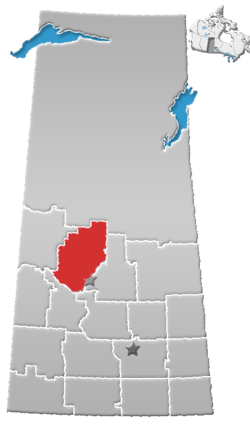 | |
|---|---|---|
| Towns |
| |
| Villages | ||
| Resort villages | ||
| Rural municipalities |
| |
| Crown colonies | ||
| First Nations | ||
| Indian reserves |
| |
| Unorganized areas | ||
| Unincorporated communities | ||